Search the Community
Showing results for tags 'photoreal'.
Found 38 results
-
Dear friends who are all still happy with P3D! Today I just wanted to introduce you to my work of the last few years - yes, years. Some time ago I even created a thread here - somewhere - but I can't find it anymore... 🤐 First of all the following: I'm not the type who likes to advertise his stuff. The reason for the post here is actually that I was told again and again (actually, also more than years now...) that I should do more advertising. For example here, because there are still many P3D fans active here who might be interested... That's why I'm just going to do that now! So, what have I done? Well, what many others have already done - created photosceneries. With autogen, of course! Very briefly, how does one get the idea to create photosceneries? Well, back then, nearly 10 years ago (remember the time back then, that was before ORBX released something like TE Netherlands!), I wanted to enhance the approach area for my home airport EDDM a bit. After a lot of reading, trying, deleting and trying again, I had created an area that covered about 40x20 km around Munich Airport. Everything was created completely manually, every autogen building was placed by hand. Many people were enthusiastic about it at the time and asked if I could create something like that for XYZ airport . And yes, in fact I wanted to do that. Shortly after, I visited Namibia (and that was really great!). But I didn't like the flights in the sim (remember, at that time there was no openLC Africa!). And that's when I had the idea to create a photorealistic Africa. It was a huge project, I never thought I could finish. I have to say the following about this: I was in my geography bachelor studies at the time. And an important part of it is, of course, the use of GIS software. I wanted to combine this so that the creation of the sceneries would be easier. And that's what I did, and created all of Africa photorealistically - in high quality and with accurate autogen. After I had 800 GB of photosceneries for Africa, I thought - why not other regions? In the meantime, a lot has happened here. I now use Sentinel-2 and Landsat-8 OLI data to detect vegetation, which I refine with vector data, including OSM. For buildings, I have chosen an AI approach, so that I can also extract building footprints from the RGB images using a convolutional neural network (with the restriction that it only really works well in Africa, as I have trained the model here). Therefore, in the meantime there are more than 10 Python scripts á 1000-5000 lines of code with which I can create my sceneries - semi-automatically. In the meantime, I have created all of Europe and Africa, and I am working on South America. The server storage space is still a problem. Due to the increased costs, I had to remove Central Africa and all my Asian sceneries from the server - even though I am working on making everything available again. So, a lot of text... It's probably best if I just show pictures - across the world, so to speak. Athens Marrakech El Oued Algiers Cape Town Ouagadougou Somewhere in Ghana Somewhere in Sierra Leone Bulgaria Currently working on Brazil France Frankfurt Serbia Tirana Naples Poland Germany Namibia In the meantime, my sceneries - of course! - also come with comprehensive night lighting. Furthermore - and I think this is not unimportant: How big are the sceneries? Well, I have installed a 4 TB HDD for my sceneries (whole Europe, Africa, half of South America, part of Asia, altogether approx. 60 million km²), on which approx. 2.7 TB are occupied. A lot of information - including a current overview map - can also be found HERE and HERE. For questions regarding the download, please write me a private message (preferably in the FSXForum or at FSDeveloper)! Now, in conclusion, I have no other option but to wish you all a wonderful weekend!
- 56 replies
-
- 25
-

-

-
- photoscenery
- photoreal
- (and 1 more)
-
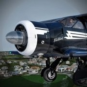
Decided to take my favourite exec turbo twin from La Palma to Lanzarote. Cleared for taxi Off we go Climb condition set on the autopilot Tenerife Gran Canaria Passing over Las Palmas and the port (Global Ships in effect!) Passing Fuerteventura Descending towards Lanzarote Visual approach for 03 Touchdown Shutdown! Thanks for viewing!
-
The Blue Marble Project Meet The Blue Marble, yes we have another marble in our collection Blue Marble is not a new name for Black Marble, It's a Project on its own merits! Not to be confused with Night Environment, Black Marble, or vEarth (Virtual Earth) projects, More detail about Blue Marble Project can be found here http://forums.nightenvironment.com/topic/289-blue-marble/?page=1 The video below showcase the projects from a worldwide prospective (best viewed in full screen at 1080HD!), Freeze frame the first second and you will see the old data visible for one second (including FPS etc.); Right after (in video editing) we blend from the same position only this time from within Blue Marble, Watch closely the following 20 seconds as we time lap through 12 month worldwide seasonal cycle, Before we start spinning the globe to show you Blue Marble in all its glory all around the world, and then right before when you think it’s over… wait for it! Enjoy one more thing… be sure to register as a member of our forums by Christmas to be eligible for our special Christmas gift! with opening our new online shop we will invite all our registered forums members by Christmas to get their Christmas gift! A copy of Blue Marble free of charge The Blue Marble Blue Marble is made out of real worldwide seasonal coordinated high res Photoreal imagery!!! (Blue Marble Seamlessly integrates and is Compatible with all 3rd party add on's like FTX Global and all other regions, UTX etc.)
-
- 2
-
-
- chris bell
- creative design studios
- (and 8 more)
-
Please don´t ask where I got all 100+ hours to create my photoreal Ireland :Big Grin: he he. Here are some shots of the west coast and I must say, Ireland must be one of the most beautiful countries in the world :wub:
-
Using my turbo twin of choice, the Avanti. Leaving Lanzarote. Gran Canaria. Tenerife. Reina Sofia airport off to the left, Mt. Teide off to the right.. Teide in clouds Enjoy.
-
 Hi guys!. Yesterday I was testing some freeware FS9 scenery's on FSX. I came across with 3 airports that work well so far... except for one issue. As you see, the photoreal layer disappears when you are close to the ground. Is there any way to solve this?. The one on the pics is claimed to be FSX compatible... Before you ask, I have zero skills on scenery development, but I'm willing to learn .... Have already installed ADE and the FSX SDK.
 -
Hello everyone! I am working on a photo scenery for Africa for 2.5 years now. Sounds megalomaniac? It is. In the meantime, the project is already well progressed, and many people told me to do some advertising for it. First of all the little story behind the project: After I bought the FSL bus, I noticed how bad the performance of the FSL bus was together with ORBX Germany. So I was searching for a solution, and I found it in Photosceneries. Since I didn't want to fly without autogen, I used my experience from my geography studies and programmed Python scripts based on arcpy. These are able to generate high-precision autogen for the sim based on OSM and Corine data sets, as well as water data, elevation data, population data, etc. and with the help of ScenProc. After Germany was finished, I created Belgium. Although the data for these countries was very good, I started writing Python scripts in parallel, which can also create autogen based on Landsat and Sentinel data, in regions where OSM data is hardly available - like Africa. And so, since Africa is a dark spot in the sim, I started to create african countries about 1 year ago. It took again more than 6 months, until my scripts - and the results - were good enough to post the first pictures. And yes, what can I say, the feedback was excellent! And while I'm still improving my scripts piece by piece, I've been releasing a country every now and then since half a year. At the moment approx. 30 % Africas are covered. Here's a small list of the features I've put a lot of effort on: - Good photo scenery with 2 m/px without strong visible color transitions and without many clouds - Accurate Water- (based on OSM) and Blendmasks - Color adjustments so that desert areas are not overexposed - Accurate autogen vegetation (based on vegetation classifications and land cover data), spatial resolution less than 10 m - Accurate autogen buildings (method introduced with Senegal), placement based on OSM and high resolution land cover data - Small file size (I expect to get whole Africa in less than 700 GB) - No performance impacts But I think I've written enough for now, so some pictures: More Information about my project you can find here: Project Africa - FSDeveloper.com and here: Project Africa - FSXforum.de Have a nice wekend everybody and kind regards! Matthias
-
 Spring time: the best time to visit Paris, the city of love and romance. #Stay@home - you can enjoy the famous places and buildings with your flight sim. Tour Eiffel L'Arc de Triomphe / Place de l'Étoile Place de la Concorde Louvre / Jardin des Tuileries Notre Dame, Panthéon, Palais du Luxembourg / Jardin du Luxembourg Centre Pompidou (Musée National d'Art Moderne) Foire du Trône, Vélodrome, Lac Daumesnil Château Vincennes / Bois de Vincennes Sacré-Coeur, Gare du Nord Musée de l'île-de-France Maintenance SNCF (former marshalling yard) BONUS: Paris at night: Beaver meets Mouse (Mickey): Disneyland Paris NOTE: Sorry, I don't know if it's allowed to post the same pictures in Aerosoft forum and here on AvSim forum. And if allowed, I think it's not a very good idea to post them at the same time. But due to the fact that there is a sale at France VFR only until tomorrow (31.3. / March 31th - many products 30% off http://www.francevfr.com/ ) I hope that it's allowed to make one single exception?
 -
Hi Everyone,I have started a project: Photoreal Scilly for FS9 & FSX. I have created some photoreal tiles in sbuilder and compiled as BGL. When I have put the scenery into FS2004, it's in the correct space but under defualt scenery?Any help much appreciated,
-
FSX plus photoreal scenery (FranceVFR) Link to Wikipedia: https://en.wikipedia.org/wiki/Palace_of_Versailles Official website: https://en.chateauversailles.fr/discover/estate/gardens Always safe landings Torsten
-
I posted this in the design forum and thought, maybe, this belongs here... So, I decided to try some Megascenery Earth. I already own MegaScenery X SoCal and have been very pleased with it. I like the framerates and the realism of the mountains and the view from 4000+ feet. The Megascenery Earth California Upper South is not to the same quality. (I still like it but I have to admit some disappointment in the quality.) The resolution also *seems* to be about half of Megascenery X. The 'Earth' collection seems to be from some dated satellite imagery and the colors are extremely saturated. The hills look blackish. By comparison, the SoCal images look very natural. I uploaded some pics (see the link below) and they're a little out of order so let me take a moment and walk through them. The first few two pictures are from MegaSceneryX Socal...pretty good. Pic 3 is a Google pic of the Socal area that shows both KMRY (Monterey) and LAX..the two areas I'm comparing....pretty close geographically. Pic 4 is the first pic in the set from Mega Earth...sitting on the ground at KMRY. The hill behind looks like it's covered in coal. Pic 5 and 6 are from a few miles north of the airport: 5 is the area as displayed by Google Earth, 6 is from Mega Earth...same area, the Mega Earth pic is chopped off some. 7 is another from Mega Earth at 3000 feet and the last is a high altitude of the area...probably 20,000 feet. You can see them at http://imgur.com/OQO...P,ainwc,6btal#0 Again, sorry about the messed up order but it's enough for you to get an idea of how the area looks. I guess I was thinking that the quality would be roughly the same as MegaX Socal...especially since it's been a few years since they created that one. I *wish* they had chosen a different set of images or done some batch color correction before they packaged it. Like I said, it's still better than FSX scenery but I was certainly hoping for better. Has anyone had any experience with any other photoreal software that has better images? Seems like all the products are raising the bar in terms of quality...PMDG, Orbx, REX...I'd like to get something photoreal that is moving up with those products. I'll certainly replace this when I get the chance. Gregg
-
Hello, So I have just take the plunge into the P3D world. Yes I am/ was a die hard X-Plane fanatic but am looking for deeper systems simulation in the aircraft. So this seems to be the path for now. And as I have found not necessarily a cheap one.However I digress. I have created a massive amount of Photo Scenery for X-Plane all in DDS files. I have found some topics on taking FSX/ P3D scenery to X-Plane but not so much discussion coming the other way. Short story is it would be great to utilize the photo scenery I have in X-Plane for P3D if that is possible in any way to convert. Otherwise I will start looking at creating it for P3D from scratch I suppose. Thanks, and for anyone wondering I am on the fence after using P3D on which is better they both have their pluses and minuses. Not sure I have a clear winner. I think they are two tools for two different things honestly. None the less I am enjoying it and learning a new simulation platform has kept me busy for sure.
-
- 10 replies
-
- 4
-
-
- realistic sky textures
- sky
- (and 2 more)
-
Here's some more pics--I am just enjoying the heck out of FSX these days with this new aircraft and Blue Sky's scenery. There's now contiguous coverage from Phoenix all the way into Northern California, near Mt. Shasta. Enjoy! John
-
The Eye of Paris - watching the planes landing and starting at Orly . . . FSX + photoreal scenery (France VFR)
-
The sun is hiding behind the mountains, it's getting slowly dark, very dark. Can you see the face coming out of the rocks in the darkness of the shadow? Hush! Don't turn around! Somebody in a long black coat is watching you . . . Always safe landings Torsten
-
Hello simfriends Yesterday, was a topic in Avsim, about best photosceneries with photoreal and autogen... the reason of this topic is to show one... is a free! photoreal scenerie of Canaria with some added airports (payware) A few pictures here, to show the great interrest of photosceneries on specifical regions. Stones and volcanic'sands are very detailled... but the same with landclasses (Try yourself in your sim) is very flat...we don't recognise the landscapes, the volcans seem to be only sand-mountains. Specific differences of each island disparate completely with sim-base or global scenery. I uploaded large pictures... Please, enlarge in your browser for better feeling. Good flight
-
-
 It's not the Star of Bethlehem - it's the star of Neufbrisach, Alsace (France): https://drive.google.com/file/d/1i6Y8i1i-WwLGKj5wbT5J004Dk9hT0599/view?usp=sharing
- 2 replies
-
- 3
-
-
-
- VFR
- Neuf-Brisach
- (and 7 more)
-
Hello, I managed to make the EOX Sentinel-2 Cloudless map work for FSEarthTiles 🙂 What you need to do: Step 1: a) Open "FSEarthTiles.ini" b) Copy and paste that under your sources [Service5] ServiceName = Sentinel 2 Cloudless map ServiceCodeing = zyx ServiceUrl = https://a.tiles.maps.eox.at/wmts/1.0.0/s2cloudless-2019_3857/default/GoogleMapsCompatible/%s.jpg Referer = https://a.tiles.maps.eox.at UserAgent = Mozilla/4.0 ServerVariations = a,b,c,d c) Rename your Service Number according to your file For me it's Service5 but for you it may be different so rename it so that it follows your current sources Referer and UserAgent are optional, you can disable them by commenting them using "#". I have noted no difference with or without these lines Step 2: IF YOU DON'T FOLLOW IT IT WON'T WORK a) Open "TileCodeingScript.cs" (in the FSEarthTiles folder) with notepad b) Locate the lines: else if (EarthCommon.StringCompare(iUseCode, "zxy")) { Int64 vServiceZ = EarthMath.cLevel0CodeDeep - iAreaCodeLevel; Int64 vServiceX = iAreaCodeX; Int64 vServiceY = iAreaCodeY; //vResultCode = "&x=" + vServiceX.ToString() + "&y=" + vServiceY.ToString() + "&z=" + vServiceZ.ToString(); vResultCode=vServiceZ.ToString() + "//" + vServiceX.ToString() + "//" + vServiceY.ToString(); } c) Now after these lines copy and paste the following lines : else if (EarthCommon.StringCompare(iUseCode, "zyx")) { Int64 vServiceZ = EarthMath.cLevel0CodeDeep - iAreaCodeLevel; Int64 vServiceX = iAreaCodeY; Int64 vServiceY = iAreaCodeX; //vResultCode = "&x=" + vServiceX.ToString() + "&y=" + vServiceY.ToString() + "&z=" + vServiceZ.ToString(); vResultCode=vServiceZ.ToString() + "//" + vServiceX.ToString() + "//" + vServiceY.ToString(); } Like so : For People who want to know why the second step: -Why do we have to do this? -Because, the source link is like this : https://a.tiles.maps.eox.at/.../ZoomLevel/Latitude/Longitude If you think of a grid you have X = longitude and Y = latitude Now FSEarthtiles must read the link and that's what the ServiceCodeing is for: By putting zxy, FSEarthtiles will read the ZoomLevel, the Longitude and the Latitude in THAT order. You see the problem? FSEarthTiles reads Longitude where the Latitude is in the link so X and Y are inversed. Because there was no "zyx" read mode I had to implement it myself by just copying the "zxy" elif instruction and just inverse X and Y. Maybe there is a smarter way to do it directly in the FSEarthTiles.ini file but I don't know. And that's it ! :) I like the EOX map more than google and bing because even if the max zoom is something like 4m/pixel it gives -a cloudless map -more vivid and beautiful colors than Google and Bing in my opinion
- 7 replies
-
- 2
-
-
- fsearthtiles
- photoreal
- (and 7 more)
-
Photorealistic Corfu Sunset [P3D v3.4]
Drehstuhlpilot posted a topic in The AVSIM Screen Shots Forum
Just a few photorealistic sunset screenshots without HDR and ReShade. I create my own textures based on real skies. :smile: -
Hello, i made some sky textures using Google Earth, Pascal Ad is creating some too and started before me but his work motivated me to do my own :D Here is the link : http://www.mediafire.com/file/e8asozj9lmevs2k/Google+earth+sky+textures+(Lucas).rar And the pictures :
-
Some various screenshots I've taken over some scenery generated with FSEarthTiles. It's an amazing program, it really enriches FS2004 for those with older legacy aircraft they enjoy. John