


Leg 21: Algiers To Batna
Leg 21
Depart: Houari Boumediene Airport, Algiers, Algeria (DAAG)
Arrive: Mostépha Ben Boulaid Airport, Batna, Algeria (DABT)
Aircraft: Douglas DC-3 (Leading Edge Simulations / X-Aviation)
Flight Plan: DAAG ALR BTN DABT
Distance: 163.0 nm
Scenery:
I've been keeping myself on the ground for a few days, waiting to see whether the winds coming off the Mediterranean would calm and hopefully make things a little easier for me. It seems, however, that I'll have no such luck. And as great a city as Algiers is, I'm getting antsy being stuck on one place. Adventure awaits!
Time to press on to Batna, a city to the southeast which lies roughly on the geological border between the Tell Atlas and Aurès mountain ranges. We should be in for some more stunning views of the landscape as we pass over head.

After my engine troubles at Oujda, I've been eager to get the DC-3 back in the air, so we'll be making the one-hundred-sixty-odd mile trip in this lovely plane. The DC-3 is quickly becoming one of my favorite payware planes available for X-Plane: it's a lot of fun to fly and very hands-on, beautifully modeled and textured inside and out, tough, fast, and just exudes that classy, old-school vibe. I highly recommend it to anyone who happens to be a fan of vintage aircraft.
The big radial engines roar to life on the apron. No more problems there, it seems, but I carefully double check all the gauges and levers lest we lose an engine on takeoff this time. I taxi her out to runway 27 and steadily open the throttles. There's a crosswind incoming from the northwest that gives me heck on the takeoff roll (though X-Plane's exaggerated weathervane effect isn't doing me any favors), but I manage to keep the plane on the runway and lift off into the air.
After retracting the gear and picking up some speed, I climb toward the northwest and begin to turn back around toward the airfield. Beneath us pass the city of Algiers, the old citadel, the Bay of Algiers, and the airport again. The engines chug along as we leave Algiers the White beneath the clouds.

We settle into a cruise of 11,000 ft and I take especial care to treat the engines kindly by adjusting the throttle, prop, and mixture handles for an economical flight. Once I've finished squinting at gauges I can sit back and take in the sights. Below us is the stunning Djurdjura Range of the Tell Atlas. Seems like a nice place to do some hiking; evidently there's also skiing in the winter. Snow skiing in Africa--those are two things I'd never put together in my mind before!

From time to time the cloud cover obscures my view of the world below, but wherever there's a break in clouds there's a sweeping panorama of the Tell Atlas to be had.
(The eagle-eyed among you may notice a difference in the clouds and atmospheric effects in these screenshots compared to my previous flights. A few weeks ago, the developers of EFASS introduced UltraWX implementation into their program. UltraWX is a highly configurable real-world weather injector and so in a lot of way a big "first" for X-Plane. Since I mainly use EFASS for planning and monitoring my progress on airline flights, I haven't really touched it in a while, but decided to give it a go to test drive UltraWX.)

Batna sits at about 2,700 feet above sea level so we've got a significantly shorter way to descend than we had to climb. Looks like the airfield is reporting-- wait a minute, that can't be right! 41 kt winds?! (Let's just chalk this up to a bug in UltraWX, shall we?) I consider diverting or even returning to Algiers; however, I notice that the wind doesn't seem to be gusting and that it's coming out of the southwest. Against my better judgement, I decide to attempt a landing on runway 23.

Matters are made worse by the clouds near the ground. Let's play "Spot the Runway"--it's there somewhere!

The runway becomes clear as I get closer. Even though the winds are strong they seem steady, so I decide to go for it. I pass over the threshold in what feels like slow motion and touchdown daintily with the two fore gear. The aircraft rolls forward a short distance, the tailwheel comes down, and we slow to a stop. Success! Welcome to Batna!

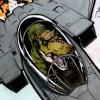
(Here's a close up of the main instrument panel just after the aircraft came to a stop on the runway; just under 40 kts IAS. Wow!)

Next leg: Mostépha Ben Boulaid Airport, Batna, Algeria (DABT) to Cheikh Larbi Tébessa Airport, Tébessa, Algeria (DABS)
2 Comments
Recommended Comments