


machine2035
-
Content Count
608 -
Donations
$0.00 -
Joined
-
Last visited
Posts posted by machine2035
-
-
Hey,
Does anyone yet have a fix which allows the RealityXP GNS430 to actually show the screen of the unit in the VC. Currently the screen just stays back, and the GPS is only useable in the 2D popup.
Cheers!
-
Does anyone who has more knowledge than me in panel.cfg etc know if the following would be possible (having two Reality XP 430W's in the places I marked).
If it is, would someone (Bert??) be kind enough to provide the entry for the panel.cfg to do so

Danke!
-
I understand i was talking about what is seen in this video at 4:07
I guess its a different model radar than what you are modeling? either way im happy
Yes, Air Canada along with some other 777 operators have the Honeywell weather radar (RDR-4000 with Intervue3D), the one that PMDG have decided to model is the Collins WXR2100 (which is more popular compared to the more expensive Honeywell system).
WXR-2100 Control Panel:
RDR-4000 Control Panel:
-
Besides the WXR, I got slightly excited because I thought I saw Radius-To-Fix legs on the ND matching the Abbortsford RNP 07 departure....but then I realised it's the right airport but not the right departure... :lol: B) ...
Me thinks about having latest ARINC format in PMDG buses :Drooling: :Drooling:
-
Realy Thank you on this one, James!
Do you think the -700 will be the same on this on or does It had other internal systems & diffirent item codes in 10. & 18. ?
Realy curious about that one!
I hope someone can help me with this 737-700, but only if it's possible and if it doesn't take to much time!
Should be the same as they run both aircraft on the same flight briefing software. Some FIR's/ANSP's require different things under NAV (such as RNP4 or GPSRNAV etc), so this is something to keep in mind. Just check in the countries AIP for flight planning requirements, however the basic Field 18 layout should be the same. Field 10 equipment changes on aircraft (i.e. newer delivered aircraft might not have ADF installed for example).
-
Dear aviation enthusiasts & dispatchers,
I'm an aviation enthusiast and study at an aviation engineering & operations acadamy near Amsterdam, NL.
I Worked for KL in the past few years. One of My passions are the flight planning all over the world. I worked and searched a lot with the principles
in the EU like CFMU validation, optimal routes, cost index based, and tech & data planning like bass & balance.
At the moment I would like to specialise more on the U.S. Domestic flights from Delta Air Lines, as I'm a big DAL fan.
I was wondering If someone can help me with the following as I was looking behind.
I've been looking for some older ATC plans from mid/end 2013/14 of some Domestic flights. like the 737/738/739 from Delta Air Lines
My question: Is there any possibility the get the FPL- item codes from the 737-700/800/900 fleet on the way how it's filed.
Example:
SDE1FGHIJ1RWXYZ/LB1
PBN/
NAV/
RMK/
RVR/
etc..
I hope someone can help me with those and is able to send me a PM.
Many thanks,
T.Faasse
Hi,
Here is a DL plan from the FAA AISR/NADIN system, from early 2013.
FF KZLAZRZX 060626
KATLDALQ
(FPL-DAL1428-IS
-B738/M-SDE2E3GHIRWXZ/S
-KLAS0715
-N0449F390 DCT BCE J100 EKR DCT BFF J94
OBK DCT LFD DCT CRL J584 ZORBO DCT SLT
J584 FQM DCT LVZ LENDY6
-KJFK0404 KBDL
-PBN/A1B1C1D1O1S1T1 NAV/RNVD1E2A1 REG/N3771K
EET/KZLC0022 KZDV0040 KZMP0142 KZAU0214
KZOB0254 CZYZ0303 KZNY0331 SEL/ABEF RMK/ NRP
-
The 'FMC' is the default GPS in disguise. No navigraph, nothing.
I knew this would be the case....While it is a shame, it certainly doesn't come as a suprise.
-
Comparing yourself to Apple now? Your ever-endearing self-confidence is going super-nova recently isn't it!
Well one thing you didn't see after the initial release of Apple maps was Tim Cook piping up on the Apple forums about how some of his customers had been too spoiled by all the wonderful products Apple had made previously.
Neither did he brush aside legitimate criticisms about the marketing of the product with a 'FFS, all you guys need to do is invest a bit more money / time'.
Nor could Tim Cook be heard saying the critics were just a "######ing and moaning" minority compared to the millions of happy Apple customers, and that he was tiring of their "BS".
No, Tim Cook acknowledged the shortcomings and very publicly apologised, and his product was free:
I lurrrrve this post!
Made the first day of 2014 that much better..
-
When AUTO is selected on the altitude selector outer knob (with the other option being 1000), the behaviour as you explained will occur.
-
I noticed a Frooglesim vid that demonstrates cutting and pasting winds aloft data from another flight planner into a file in the PMDG WX folder.
Can you just do the same thing with the WA info generated by PFPX when you create a flight?
Pretty sure the developers at PFPX are currently working to put one of their wind block formats to match that of PMDG's requirements - I am sure it will be out rather soon.
Most of the other weather client developers are already on board, both AS and Opus are now supported, with FSGRW currently developing theirs (and I anticipate that the build would be released also relatively soon).
-
QUANTAS
Queensland
And
Northern
Territory
Aerial
Services
which gives QANTAS (minus the U)... B)
....Oh if I had a dollar for everytime someone spelt it wrong. :Money Eyes: :Money Eyes:
-
Noticed its Flap 15 only (probably because thats what the PMDG FCOM includes).
PM me if you want some data for other flap settings aswell.
-
Could you not just dial in 1013 in the altimeter and that would result in pressure altitude?? More easy I would think than doing head algorithms.
Yes, that would work to.
I have been usually calculating my TO PERF during flight-planning just for the sakes of saving time. Unless the winds are forecasted to change rapidly in the TAF, the conditions will usually be stable within the 45minutes that I flight planned within.
-
What exactly is Pressure Altitude? Is it just field elevation (above sea level) or is there more about it?
Thanks!
No. Pressure Altitude is what the altimeter would display when you set it to the standard barometric setting (1013hPa/29.92inHg).
To correct your field elevation to pressure altitude;
[a] Obtain current QNH at airport (For this example, we will say 1021hPa and FE = 1000ft).
Find the difference (so 1021-1013 = 8hPa).
[c] 1hPa = 30ft. Since QNH is higher than standard, pressure elevation will be less than field elevation.
[d] Pressure Altitude = Field Elevation - (30ft x hPa differences).
[e] In this example, Pressure Altitude = 1000 - (30x8)
= 976ft.
Most the time the pressure altitude won't be a huge difference to the field elevation and the same table/chart in the manual will be used.
-
Check the manuals :wink:
Standard on the LR.
LOL, yeah I did (posted that while I was at work).
Just thought I remembered seeing it in a powerpoint presentation addressing the differences between the -200 and -300.. Oops! :blink:
-
Thought it was in the 300ER only.
-
Just remember that one of the conditions for auto v-speeds is that the ADIRU is alligned (as someone mentioned above).
Displays dashes when:
• required information not entered
• performance calculations are inhibited
• ADIRU is not aligned -
Pretty sure ADF's are permantely disabled on the -F model. Only available on the pax version.
Would be cool to include an option in the CDU in the future B)
-
From PMDG support;
There are some issues with Panel state loading that were discovered shortly after release that we are working on so I suspect it will not be an issue once the SP1 gets put together.
-
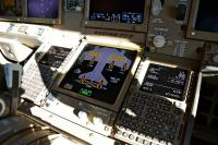
Video of the issue.
Cold and Dark, caution light stuck after overspeed issue due to OpusFSX windshift.
Also submitted to the PMDG support database incase no-one else did.
-
Good work chaps! :im Not Worthy: :Hug: :clapping: :clapping: :clapping:
-
I am seeing slightly better performance than the NGX.
-
Are there any plans for them to add Opus FSX to the list of WX programs it can pull weather from?
-
Please don't tell me they have already ran out of terminal space and are now boarding flights via stand-off bays aswell.
I thought they have a 1.7 million square metre terminal at their hands.


Carenado Turbo Commander Mod v6.0
in 690B TURBO COMMANDER FSX | P3D
Posted
Does anyone have this mod that can share it?