Search the Community
Showing results for tags 'hd mesh v2'.
Found 3 results
-
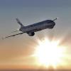
 Name: HD Mesh scenery 2 + SkyMaxx Pro Category: XP Scenery Date Added: 12 December 2013 - 12:23 PM Submitter: sharris Short Description: HD Mesh scenery 2 + SkyMaxx Pro View Video
 -
Did some spontaneous vfr flying near LOWI, really bright day and needless to say, the sunvisor proved very useful B) Ofcourse no other tweaks but bit of sharpen and resizing and as always, comments are welcome :Hug:
-
v1.4 - 2014.12.20 What is OpenStreetMap (OSM)? OSM (http://www.openstreetmap.org) is a freely available map which is updated by users all over the world. It's similar to wikipedia, which is open and allows registered users to make changes and fix issues. Although occasionally some data is imported, e.g. An import was done in Chicago from government data to add buildings, it's mostly a community effort, where people using various sources such as bing maps, GPS devices and country specific sources update and create the maps. What does OSM contain? It contains whatever a specific user decided to map in the area they are editing. Some areas are so well-mapped, that it puts some commercial offerings to shame. Some people map individual trees, street lights, and others map individual buildings and footpaths. There are rules everyone should follow, e.g. how to tag things consistently, but generally the level of detail between different areas can vary considerably. Which areas are best mapped in OSM? Generally, OSM is best in Europe. Countries like France, Czech Republic, Germany and the Netherlands are extremely well mapped, and have very active communities. The US and Australia are somewhat behind, but everyday the database is growing. To see what is being changed and how quickly, have a look at this site http://live.openstreetmap.fr/ which shows live edits being made in the database. There are literally thousands of edits a day all over the world. How/why should I contribute? Since X-Plane, FlightGear and some FSX/P3D commercial products use parts of OSM to generate their scenery, anything you fix or add in OSM will not only appear in updates to X-Plane, but will also benefit OpenStreetMap. e.g. You could add or fix a stream or river in your local area, add a few buildings or a missing forest, or add points of interest such as telephone masts, churches, etc. It's incredibly easy to get started and is also fun and quite addictive. To make simple edits, no special software is required and edits can be made directly from the web browser. For larger edits or more advanced tools, an application called JOSM http://josm.openstreetmap.de/ is used. How is OSM used in X-Plane? As of X-Plane v10, Laminar Research (LR) make use of OSM to build scenery. The default scenery inside the simulator uses OSM (as verified by Andras, author of the HD Mesh) for roads, railroads, coastlines, powerlines, lakes and polygon rivers. Whenever LR updates their scenery, they will attempt to use a more current OSM database. Alpilotx HD mesh v3 -- Andras aka. Alpilotx provides high-definition, updated scenery for X-Plane also based on OSM. The scenery is more up-to-date and uses OSM as LR does for roads, rivers and coastlines etc. The scenery is available here HD-Mesh v3 and is donationware but available for free. Be aware, it's pretty large, so start out with just your local area and go from there. The mesh also includes line rivers which are tagged as "waterway=river". Both the default scenery and HD Mesh do not include individual buildings, forests or wind farms from OSM, however these can be added using World2XPlane/Simheaven (see below). World2XPlane http://www.world2xplane.com is a tool used to add buildings, forests and points of interest to the existing scenery inside X-Plane. It uses a download of the OSM data to generate scenery which is simply dropped into the custom scenery folder. It is customisable, so that users can decide what to generate, how high buildings should be and what models to use for various building and forest types. It can also add street lights along roads, hedges along fields and place 3D objects such as telephone masts, wind farms, etc. Additionally, World2XPlane will add up-to-date roads, powerlines and train lines. Simheaven http://www.simheaven.com is a site offering scenery for X-Plane. The site, as well as offering photo-scenery, uses World2XPlane to generate scenery for entire countries (buildings, forests, roads and POIs). They offer two versions, OSM Only and OSM+Autogen. OSM-only shows OSM objects only, however in areas which haven't been mapped, it can look quite empty. OSM+Autogen uses OSM in areas where the data is good, and the default X-Plane autogen where there is no OSM data. The scenery on this site is updated regularly and is recommended for most users. Which scenery do I need/download? If you are happy with the default roads and vector data inside X-Plane, then you don't need anything, OSM is already included, although it isn't updated regularly. If you prefer an up-to-date, higher detailed mesh and vector data, i.e. roads, rivers and coastlines, then use the HD Mesh v3 from alpilotx. This replaces the default scenery, and is much more accurate and detailed. N.B. At present, not all of the world is available. Buildings and forests from World2XPlane or Simheaven. These are an additional layer on top of the mesh or default data which adds individual buildings or forests from the OSM database. When used in conjunction with photoscenery and the HD Mesh, the effect in well mapped areas is very realistic. Additionally, this data is regularly updated, so any changes or updates you make in OSM will appear in the sim in the next update. Using photoscenery together with OSM and/or HD Mesh Photosceneries are generally available in two different formats: draped polygons, and mesh. Draped polygon photosceneries, as the name implies, don't contain a mesh of their own, but overlay the images on top of existing scenery. Such photosceneries are slow to load and use more memory, as X-Plane needs to load the photoscenery and the original scenery, and overlay the images on top. To use such photosceneries with OSM and HD Mesh, you should place the photoscenery above the mesh and below your airports, OSM scenery and other custom sceneries in the Custom Scenery/scenery_packs.ini file. The utility gmaps (http://members.ferra...cavicchi/GMaps/) creates such scenery using google maps imagery (it can also create basic mesh scenery). Mesh photosceneries contain their own complete mesh, and as such, load quicker and don't require an already existing mesh for the area being loaded. The sceneries on simheaven are complete mesh sceneries. However, because they have their own mesh, they won't work with other meshes. If you have downloaded HD Mesh v2 and you place a mesh photoscenery above the HD Mesh v2 scenery, then the mesh in the photoscenery will be used, and vice versa. Additionally the photo mesh scenery will also take priority over OSM and other scenery, so you need to carefully order them, so that the mesh photoscenery is below your OSM and other scenery such as airports. Presently simheaven is upgrading their photoscenery to use the new HD Mesh v2. However, they also offer patches to upgrade their older photoscenery to use the new mesh. Please see http://www.simheaven.com for details and instructions. A forum user Blacky75 has posted a video and some more information about the scenery and options available for use in the scenery. http://youtu.be/kCnJR5QDyao.