Search the Community
Showing results for tags 'ifr'.
Found 45 results
-
 I had a problem that if I added an approach mid-flight, the airplane would do a 180 and go back to the previous waypoint before starting on the approach. I found a video that explain how you can work around this. Thanks to Clumsy for the video.
 -
Okay so I want to fly and IFR flight plan and I go the way points and set them in my GPS. But ATC gives me headings instead of allowing me to fly my route. Are the headings I get corresponding with my flight plan? Should I just use the headings or just use my flight plan? Help!!!
-
I want to use fsx for ifr procedure training. My computer is rather week so i take all the graphix down to get more fps, but the instruments(ifr cockpit mode) sometimes 'jump', and is there a way to gette better resolution in the cockpit but not use to many recourses on outside graphix? How do i best set up the weather so that i get the wind gradient and the right turning the first 2-3000' ? if i just pick actual weather does it include that? Hope you can help me out making the last ajustments, really nice using it to learn the procedures in instrument approaches
-
Hello everyone, I am trying to "simulate" air taxi service between tropical islands. This is short and great way to flight However, i would like to make a proper and well-planned flight, since i am going to do it online on IVAO. My preferred A/C is DHC-6 Twin Otter. My departure is FSIA Mahe Island and arrival is FSPP Praslin. Well dep/arr is vicinity of Seychelles. There are many islands with small airports and airfields. My questions are below (i know there are too many!) 1- Should i go for IFR or VFR? Weather is almost always clear, wind is calm and visibility is good near Seychelles. How to decide? 2- How to select a cruising altitude for VFR? I read AIP/AIS of Seychelles, seems like its provide all information needed. Is that right way to start planning? 3- Is that possible to use ILS approach on VFR flight plan? Is this a VFR -> IFR or VFR -> VFR flight? 4- I am going to do same flight with Cessna 172. It does have all necessary equipment for IFR as far i know, so i can go for IFR, right? 5- I am little bit confused about terms IFR, VFR and Visual. Does Visual approach changes flightplan to VFR? As far i know, Visual Approach is a part of IFR. So flightplan should be stay same, right? Why and when Visual Approach needed? Is this possible to do Visual Approach on ILS runway? (Ignoring ILS and doing whole thing visually) So is this possible to do Visual Approach in VFR flight? What's the equivalent of Visual Approach in VFR? Or am i getting this completely wrong? As i understand, Viisual Approach is the VFR's itself. Because whole thing visual. So how about opposite scenerio? Can i use ILS approach on VFR? And does it changes flightplan to VFR->IFR? Any help and idea would be great. Thank you all.
-
Hi guys, yesterday I landed my Leonardo MD80 in EDDL via RNAV 05R approach in FSX Stem Edition. This is the approach plate: https://fly.rocketroute.com/plates/adminview/EDDL_3-1-5_GPS___FMS_RNAV_Arrival_Chart_Transition_to_Final_Approach_%28Overlay_to_Radar_Vector_Pattern%29_RWY_05L_05R.pdf?cmd=pdf&docid=400000000096018&icao=EDDL Starting from DOMUX at FL140 down till to FAF NATOS to 3000' The strange thing is this: when I do the final right turn base to align with 05R (always following lateral navigation with FMC NAV TRK) the aircraft was completely misaligned with runway 05R (I arrive parallel to 05R and not aligned to) so I can't capture the LOC and was unable to capture G/S beacause I'm also too high, but I'm correctly at 3000' as indicated in the approach plate and confirmed in the altimeter. In your opinion is there a problem with default scenery EDDL in FSX? I suppose is not an aircraft issue. Has anyone tried this approach? Thank so much for your help, Riccardo
-

From the album: Real world Beech Bonanza
-
From the album: Real world Beech Bonanza
-
From the album: Real world Beech Bonanza
-
From the album: Carenado V35 San Luis Obispo
-
From the album: Carenado V35 San Luis Obispo
-
From the album: Carenado V35 San Luis Obispo
-
Hi people! I recently made a flight in Alaska Anchorage (AK24 to PAZK). I followed ANC (Anchorage) VOR/DME to get the location of PAZK. Is this IFR? Is this VFR? I (think I ) know what are both, and their differences, but this just seemed to be a hybrid of them both (does it exists?) Weather was 20NM visibility, few clouds at, say, 5000ft. strong crosswinds (~20nm)... so no visibility or icing problems. Any input from a RW pilot or somebody knowledgeable is appreciated. Cheers and happy flying! Nicolás
-
Hello Guys. I am a pilot based out of a Commercial US airport. I have made friends with one of the tower controllers. He is a super nice guy and when I am in town, he texts me when any interesting or high profile flights come through. (USAF F15 Flight of 4: touch and go and approach practices last week!) Anyway, for those of you who are unfamiliar with flight ops, in the US and most other countries, there is something called a Flight Progress Strip. This is sent to a special printer in the tower or enroute facility. There are strips for arrivals, departures, and enroute aircraft that pass through a certain facility. It contains information like AC Type, Routing, ALT, DEP & ARR Airports, etc. On a couple occasions he has given me flight strips for a flight that I was operating. I see no problem with this because the info is publicly available online of you just look on somewhere like flightaware to track an aircraft that I am operating. Well, he gave me a neat gift of an AF1 flight strip. The flight was already completed by the time he gave me the strip so it isn't like a had private information...at least i don't think. I would love to show this off to other pilots or on a forum like this. However, I don't want the controller to get in trouble and I don't want to get in trouble myself, especially since there is no malice intended. It is just very cool. This strip was given to me a couple years ago, at the time, the day after AF1 passed through the airport. What do you think? I might post an edited picture on here so that you can see what it looks like without giving away any information.
-
By 'hard IFR' I mean, maybe 400 ft ceiling, maybe light rain, in the clouds for a couple of hours. I, sometimes, look at my ol' C182 and wonder what the conventional wisdom out there is. Gregg
-
How should I make my flight plan accessible to the FSX ATC?I have tried to load my IFR plan from FSX "load flightplan" in addition to loading and activating it in the fmc of my PMDG md-11.But:After I get my departure IFR permissions from FSX ATC I never get any ATC messages that is in accordance with my filed flight plan.Is it possible to file such a plan and actually follow it without "upsetting" the FSX ATC?RegardsKai
-
Hi all, I am considering purchasing the RealAir SF260 for use in instrument training, primarily because of its smooth gauges. However, there is no POH available. While this is not a deal-breaker, it's certainly nice. Can anyone recommend a spot where I can download a POH that can be used with the Realair SF260? Further, can anyone recommend any other available aircraft (FSX) or add-ons that feature smooth gauges? I am looking into the RealityXP gauges (I currently use their 430) but am not quite sure how I'd get them into other aircraft I'm using. Any help is greatly appreciated!Thanks,Andrew
-
 So here it is: my first ever flight sim tutorial released on Youtube. Let me know what you think. I tried to make it as professional as possible, both piloting and video wise.
 -
 So I am having a problem. FSX ATC is trying to take me to vectors to ILS at a runway, but I want to use the one I have on my FMC instead. Is there a way to make the ATC follow my route, or can I figure out which STAR it is trying to take me to so that way I can put it in my FMC?
 -
 de belles images et un vol avec des explications (pour débutant ou autres 😉 )Bon visionnage.CLIQUEZ ICIBons vols à tous.Eric
 -
From the album: Carenado V35 San Luis Obispo
-
From the album: Carenado V35 San Luis Obispo
-
From the album: Carenado V35 San Luis Obispo
-
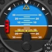
Our desktop flight simulators, for all their shortcomings, are quite good platforms for picking up and practicing the basics of instrument flight and navigation. In this short series of articles we will look at the basics of the instrument scan, flying basic manoeuvres on instruments, radio navigation procedures, instrument departures and approaches, and en-route IFR operations. The Instrument Panel The full panel is made up of the 'basic six' flight instruments. These in turn can be divided in to two categories -- the pressure-operated instruments, connected to the aircraft's pitot-static system, and the gyroscopic instruments -- which take their information, as the name suggests, from spinning gyroscopes. The 'full panel' is said to consist of the 'basic six' flight instruments, illustrated above. In modern Western aircraft these are typically laid out in the so-called 'basic T' layout highlighted above. The airspeed indicator (ASI), altimeter and vertical speed indicator (VSI) are the pressure-operated instruments and provide information about airspeed, height and rate of climb or descent. The remaining gyroscopic instruments -- the artificial horizon (or attitude indicator), turn indicator and heading indicator -- provide information about aircraft attitude, rate of turn and aircraft heading. Although modern airliners are equipped with a great deal of sophisticated electronic equipment, the basic six flight instruments and the proper techniques for their use have changed remarkably little since the first 'blind flying' experiments in the 1920s. As an instrument pilot you must learn to trust above all else what you see on the instruments, and become proficient in flying on both the full panel and the limited (or partial) panel. The B747-400 Primary Flight Display retains fundamentally the same 'Basic T' layout as a traditional analogue instrument panel. Photo credit: Markus Vitzethum For a given aeroplane weight and configuration, a particular attitude combined with a particular power setting will always result in a similar flightpath, be that level, climbing, descending or turning. Any change of power and/or attitude results in a change of flightpath and/or airspeed. For this reason, the attitude indicator (AI) and the engine power gauges (RPM, manifold pressure, N1 etc) are known as the control instruments. The remaining instruments are the performance instruments, as they show how the aeroplane is performing as a result of the selected power and attitude. Scanning The first step to becoming a proficient instrument pilot is to develop a good instrument scan. A pilot with a good scan is always looking at meaningful information: simply attempting to scan all the instruments all the time does not achieve this objective! Because power + attitude = performance, the attitude indicator is arguably the most important instrument we have available to us. As long as we have the correct power set on the engine gauges, and are holding the correct attitude on the AI, the performance of the aeroplane will be very close to what we want. Once set it is unusual for the power to change very much, and therefore only occasional glances at the engine gauges are required for confirmation. The attitude, however, will change dynamically and for this reason the instrument scan always starts and ends with the attitude indicator. The most common type of scan is known as the selective radial scan. Why? It is selective because only the instruments most important for the manoeuvre are selected and prioritised. It is radial because the scan is centred on the attitude indicator and moves radially out to another instrument, before moving back to the attitude indicator In straight and level flight, for instance, the most important instruments are: The AI (which indicates that the wings are level and the correct pitch attitude for straight and level is set) The altimeter (which confirms that the height is constant) The heading indicator (which confirms that heading is constant -- further, if the wings are also level it follows that the aircraft must also be substantially in balance) A simple scan for straight and level flight, therefore, could be AI - altimeter - AI - heading indicator - AI, and so on. Of course, it is prudent to also periodically scan the other instruments, but only perhaps every fifth or tenth cycle, for instance. A typical scan for straight and level flight. Note the emphasis placed on the AI, altimeter and heading indicator. What about a level turn? Again, the AI remains of prime importance to set the bank and pitch attitude, and the altimeter remains important to ensure height is being maintained. The turn and slip indicator is also important in order to maintain balance and rate of turn. However, if we are changing heading significantly, it is probably not necessary to scan the heading indicator at a high rate initially. For instance, in a standard rate turn of 3° per second, a 180° turn will take one minute: so initially we might only scan the heading indicator occasionally. However, as the target heading is approached we would want to scan the heading indicator increasingly frequently in order to ensure we roll out accurately. Remember, the proficient instrument pilot is always looking at relevant information. Typical scan for maintaining a level turn at constant bank angle. Note that the heading indicator will also need to be scanned increasingly frequently as the target heading is approached. Other useful scans include the vertical scan - used, for example, when referencing an enroute chart or other document - or the more relaxed circular scan, which may be used to monitor the aircraft’s performance in cruising flight, perhaps with the autopilot engaged. The vertical scan (left) and circular scan (right) may be used enroute when navigating, or in the case of the circular scan, to monitor the aircraft's performance when the autopilot is engaged Another type of scan is the inverted V scan. This scan - covering the AI, turn and slip indicator and VSI - may be used if an instrument failure is suspected, as the three instruments scanned are typically driven by independent systems. In many aircraft the AI gyro is vacuum-driven, whilst the gyro for the turn indicator is electrically driven. The VSI, meanwhile, uses the static system. As a result, a failure of any one of these systems would result in two out of the three instruments agreeing whilst the instrument driven by the failed system would show a discrepancy. The 'inverted V scan' is useful for determining if an instrument has failed Scanning Mistakes Apart from trying to look at too much at once, perhaps the most common error in scanning is fixation. For instance, the pilot may stare at the heading indicator, wondering how the heading has drifted ten degrees away from the target, missing that the aircraft has entered a climb. It is important to keep your eyes moving and keep seeking relevant information for the manoeuvre you are flying. Building an effective instrument scan is rather like reading a book, or this article -- rather than reading each individual letter, you are instead scanning and interpreting the words and sentences as a whole. In the same way the proficient instrument pilot will read the panel as a whole, rather than each individual instrument in isolation. In the next article in this series, we’ll look at putting the instrument scan in to practice with some basic flight manoeuvres and techniques.
-
From the album: Real world Beech Bonanza
-
From the album: Real world Beech Bonanza