Jump to content
Sign in to follow this  
  • entries
    56
  • comments
    7
  • views
    33,961

About this blog

Random flight simulator musings, review addendums and flight logs

Entries in this blog

Gaiiden

Fixed Wing and Rotor Wing

So today I decided not to wait for good weather to fly and just go out in whatever conditions presented. Turned out that things were a bit crummy around where I was flying, but not horribly so. I began at Martha's Vinyard (KMVY), where I last flew this past weekend. Such a beautiful place - will definitely be back someday. I always meant for KMVY to be a stop-over in the flight to Boston, so I decided to continue on to Logan International (KBOS). Ultimately, I wanted to fly a Jet Ranger around the city. Upon researching though, I found here are no helicopter operations out of KBOS, so I then hunted down a regional airport in the area and found Norwood Memorial (KOWD), which is about 13nm south west of Boston.


<object width="500" height="375" classid="clsid:d27cdb6e-ae6d-11cf-96b8-444553540000" codebase="http://download.macromedia.com/pub/shockwave/cabs/flash/swflash.cab#version=6,0,40,0"><param name="flashvars" value="offsite=true&lang=en-us&page_show_url=%2Fphotos%2Fgaiiden%2Fsets%2F72157624831674315%2Fshow%2F&page_show_back_url=%2Fphotos%2Fgaiiden%2Fsets%2F72157624831674315%2F&set_id=72157624831674315&jump_to=" /><param name="allowFullScreen" value="true" /><param name="src" value="http://www.flickr.com/apps/slideshow/show.swf?v=104087" /><param name="allowfullscreen" value="true" /><embed width="500" height="375" type="application/x-shockwave-flash" src="http://www.flickr.com/apps/slideshow/show.swf?v=104087" flashvars="offsite=true&lang=en-us&page_show_url=%2Fphotos%2Fgaiiden%2Fsets%2F72157624831674315%2Fshow%2F&page_show_back_url=%2Fphotos%2Fgaiiden%2Fsets%2F72157624831674315%2F&set_id=72157624831674315&jump_to=" allowFullScreen="true" allowfullscreen="true" /></object>


I filed an IFR flight plan with Providence Departure so I wouldn't have to worry about conditions when I got there. Departure instructed me to climb out at runway heading and make for 4,000 feet. According to the weather report I was reading from the airport weather station, that would put me right in the clouds. Sweet! I've always been under the puffy whiteness, and now I get to go through it. Getting clearance from Vinyard tower, I took off on Runway 24 and Departure guided me out then handed me over to Providence Approach, which then handed me to Cape Approach which then handed me to Boston Approach. Along the way I was up and through the clouds, relying more on instruments than I have so far, but I never neglected my instrument study while flying VFR all this time so I had no troubles staying on course. Descending through the clouds to approach Norwood the ride got bumpy, and I came out under the clouds to rainy overcast, but things managed to clear up several miles later when I hit the airport and I was able to make a visual approach to Runway 10.


I immediately hopped into the Bell Jet Ranger after I had parked and secured the Cessna, marveling at the wonderful view I had from the cockpit. Seriously, the floor viewports made a huge difference even when taking off. After flying the nimble Robinson around, the heavier Jet Ranger felt relatively slow, but it was still a very responsive craft. I could twitch the joystick and see it lean or dip. Also, it required more of a hand on the stick to maintain forward flight. With the Robinson I could tilt it over to start moving forward, and then centering the stick it would stay like that - with the Jet Ranger though centering the stick immediately causes the nose to come back up - and even over if you're not careful. Everything else about flying the Jet Ranger was the same as the Robinson though, so it didn't take me long to get into stable flight maintaining an altitude.


Looking at the Boston Heli Chart, I decided to loop around Boston using Route Quarry (QUARE) and then returning along Route Fenway (FENWA). Traveling up Quarry was no trouble at all, as Interstate 93 was a prominent road feature on the ground. Approaching the city I buzzed downtown and then turned west to look for Fenway, which was a rail road line heading south. I found what I thought was the railroad and banked over hard left to follow... and didn't realize something very important - I can't fly this craft exactly like a Robinson. The key difference between the two is that the Robinson's engine is located low and to the rear of the craft, whereas the Jet Ranger has a huge turbine engine high up amidship. The top-heavyness means if you bank too far you can flip the chopper easily. And that's what I did - right into the Charles River.


I restarted the flight back at Norwood and this time completed the loop as I originally planned, following the railroad tracks after passing Fenway Park to get back to the airport. Landing, I put her down on the first try. Seriously, I love the floor windows soooo much. I hopped right back into the Cessna and after checking conditions along the route home decided to stay VFR, although I plotted my course VOR to VOR so I would be navigating by instruments. As I was completing my pre flight and setting all my radios, I heard an engine noise. Since my engine was still off I figured a plane was taxiing by. Turning to look, I see a Piper Cub come trundling past... right into the tail of my plane. *sigh* So I had to reset and tune my radios all over again, then when I moved to taxi out I realized I had forgotten to ask for clearance from Ground. So I stopped, radioed Ground to get taxi clearance, but when I started up again I crashed into another plane that the AI traffic had injected into my vacant parking spot! ARRRGH!!


I finally made it in the air on the third try, although I set the sim to Slew mode while I prepped so that any aircraft passing by me would also pass through me and thus leave me in peace. To mix things up a bit I decided to climb to 10,000 feet to be above the clouds again. It took about an hour for me to reach 10,000 feet, mainly because I had to zig and zag a bit to avoid the clouds and climb through the clear patches. I finally leveled off at 10,000 feet (brrrrr it was like 27 degrees Fahrenheit up there!!) and realized I was at full throttle going about 80 knots. #####? Then I realized I needed to alter the pitch of my propeller blades to bite more air because it was thinner up here. So I reached for the prop pitch control and... wait... where is it?


I didn't have one :sad:


So, with a fixed propeller it was pretty useless cruising at an altitude that kept me at 80 knots, so I descended down, going all the way to 2,500 to stay under some scattered clouds at 3,000 feet. There I was able to cruise around 115 knots. Much better! Besides getting knocked around a bit by some pretty hefty wind gusts along the way from Massachusetts to New Jersey, the trip was largely uneventful, although it was good practice for my radio navigation skills, which I hadn't used in a while. The weather stayed great all the way into KBLM, where I landed on Runway 32 and taxied to the ramp to shut down for the day.


I must say flying the Cessna 172 has been fun, but I'm ready for something new. Not too new or too fast, I still like poking along slow so I can have extra time to do things - until I get used to procedures a lot more I will continue to fly things that don't go very fast. So to upgrade I'm sticking with the Cessna but going with a newer model - a C182 Skylane II RG. Unless something better comes along between now and tomorrow.

Gaiiden

I got bored of lounging at the beach so decided to check the FBO over at the airport to see if there were any charter flights available. Turns out a family of three that just arrived in port on a cruise ship were looking to meet up with some friends aboard a private yacht arriving at Key West this afternoon. But the yacht wasn't looking to put into port and it had a helipad so the family decided to just charter a helicopter to pick them up from the pad on the cruise ship and ferry them out to the yacht. Man, must be nice to have the dough to splurge on that! Well, at least I get a cut. So I hopped in the Bell 206 sitting on the tarmac and fired her up, took off and skimmed the south side of the key, around Fort Zachary Taylor and landed on the bow of the cruise ship where the family was waiting. My landing was straight in, no wobbles, no futzing - a smooth approach and the softest touchdown I've ever done ever. Which was good cause I had an audience and they were sitting right on the pad!


After I landed I pulled the throttle back but in messing around with Shift+# keys to find a window that would help me open up the doors I accidentally shut off the engine. Oh well, probably safer for the family to board that way anyhow! I finally remembered just opening the co-pilot door up front opens all the doors except mine, so the mom, dad and daughter could finally stow their day-trip luggage and climb aboard. This time I remembered to go into the Fuel and Payload menu to add weight for my three passengers and their baggage. I gave the dad 175lbs, the mom 115lbs and the daughter was 75lbs. Their baggage was only 35lbs. We took off from the ship and circled north around the key to find the yacht. The captain was nice enough to stop for us but apparently ignored my suggestion to turn into the wind. It was a 10kt breeze so even though I approached slightly crosswind it didn't push me around too much and wasn't a real issue. What I did find surprising however was that coming in to land I was having a much more difficult time keeping the helicopter stable on my approach. It wanted to oscillate back and forth a lot, since the center of gravity had shifted further to the rear with my passengers and baggage. Still, after a bit of hovering and nudging around I finally found the edge of the pad and then scraped my skids along to the center to let people out.

Once my passengers were offloaded I went and removed their weight from the Fuel and Payload screen, took off an made the short hop back to the airport, completing a nice circle around the key. Coming in to land at the airport was exactly like landing on the cruise ship - back to the loadout of just me the helicopter was really stable and I made a smooth approach and landing with no need to hover and futz around. I'm really annoyed now I didn't remember to change the loadout the other two times I simulated passengers, the difference is very noticeable! I've always read about how important it is to properly load an aircraft but I've never really experienced it like this before. I'll have to make sure to always remember from now on - I will actually make it a checklist item for pre-flight and takeoff in the helicopters and pre-flight in the aircraft.

trail.png

Gaiiden

Mountain Hop

Time to complete the trip I began on my last flight when I was forced to divert due to weather.


The plan was simple - just depart north out of K09, tune into the Glens Falls VOR and gradually head east until I intercepted the 190 radial which would take me in for a direct approach on Runway 19 at KGFL. Thankfully unlike most simple plans that actually turn out to be not so simple, this one did indeed work out as planned. There was no wind throughout the flight so I was able to takeoff north and land south with no issue. I had to ascend and descend through a scattered cloud layer around 4300 feet but worked to keep my VFR cloud separation as best as possible. I realized today that I've been forgetting to activate the NAV radios and confirm the beacon signal - probably because I've flown the last two flights without a fully prepared flight plan in which I usually note the beacon codes and seeing them reminds me to tune in and listen. I really don't have to since the DME indicators on my radio stack with RadioHD on my iPad show the name of the VOR I'm tuned to, but I think it's still a good habit to stick to. My landing at KGFL was almost perfect - timed my descent well enough that I didn't need to dive or climb excessively to establish my glide path but just as I entered the touchdown zone I flared too much and ending up floating about 100 yards or so before finally settling down. I still have to get used to knowing how high I am from the runway.


track.jpg

I've already planned out my next flight. Was considering Montreal or Toronto but couldn't find enough decent scenery to make it worth my while - plus my vector data is only highly accurate for the US. So I'll be heading back to Niagara and then from there on to Cleveland, Detroit and Chicago before starting a long haul west into Orbx territory (Central Rocky Mountains)

Gaiiden

Military Maneuvers

It was always my plan, once I reached McGuire AFB (KWRI), to hop into the cockpit of the F/A-18 for a joyride, however the other weekend PC Aviator had a 24-hour sale that dropped the price of one of their store items way down - it was the Virtavia MV-22 Osprey, the military version of the Bell tilt rotor aircraft.


<object width="500" height="375" classid="clsid:d27cdb6e-ae6d-11cf-96b8-444553540000" codebase="http://download.macromedia.com/pub/shockwave/cabs/flash/swflash.cab#version=6,0,40,0"><param name="flashvars" value="offsite=true&lang=en-us&page_show_url=%2Fphotos%2Fgaiiden%2Fsets%2F72157625021166572%2Fshow%2F&page_show_back_url=%2Fphotos%2Fgaiiden%2Fsets%2F72157625021166572%2F&set_id=72157625021166572&jump_to=" /><param name="allowFullScreen" value="true" /><param name="src" value="http://www.flickr.com/apps/slideshow/show.swf?v=104087" /><param name="allowfullscreen" value="true" /><embed width="500" height="375" type="application/x-shockwave-flash" src="http://www.flickr.com/apps/slideshow/show.swf?v=104087" flashvars="offsite=true&lang=en-us&page_show_url=%2Fphotos%2Fgaiiden%2Fsets%2F72157625021166572%2Fshow%2F&page_show_back_url=%2Fphotos%2Fgaiiden%2Fsets%2F72157625021166572%2F&set_id=72157625021166572&jump_to=" allowFullScreen="true" allowfullscreen="true" /></object>


But first I still wanted to take out the F/A-18. I had to do a bit of reconfiguring on my joystick/throttle to enable controls for things like landing gear, elevator trim, flaps and speed brakes, but after that I was all set to go. I took a few minutes to peer closely around the cockpit and figure out as much of it as I could - I'm sill used to gauges, which aren't a prominent feature of a digital cockpit like this. The MFDs (Multi-Function Displays) were the real gauges, allowing you to flip between views that showed you various aircraft status screens and navigational views. But you can't rely on screens, so there are also analogue versions of all the vital stuff. With everything located (that I needed) I took off and headed out over the ocean to play around without having to worry about pesky residents complaining about the noise of my afterburner. I pulled a couple of G's and almost blacked out a few times, and climbed all the way up to 40,000 feet. Barrel rolls were obviously performed multiple times. My love for the afterburner however cut things rather short, since that thing gulps fuel. I had no idea how to navigate with the craft, so I dead-reckoned my way back to the area of McGuire and had the tower guide me in. On approach, not knowing the necessary landing speed or anything, I went full flaps and throttle way back, but when I touched down  - I must have been on only one rear wheel or something because I practically flipped over. Or at least I would have if FSX modeled damage. As it was my right wing just buried itself in the ground and the sim registered a crash.


Second flight was in the V-22 Osprey. Very cool plane. I actually lowered the blades to full forward while on the ground, not realizing that you can't do that cause they're so big they cut into the ground. It's surprisingly responsive on the throttle too - I pushed forward to taxi and ended up at 20 knots before I realized what was happening. You can't actually fly this craft like a helicopter when the blades are raised full up, the airplane is capable of VSTOL, or Very Short Take Offs and Landings. The smaller civilian version can probably do VTOL (Vertical Take Offs and Landings), but not this baby. You only need about 100' of runway though. Once airborne, the transition to full-forward flight is done slowly to let you build up speed - the manual says you want 100 knots before lowering the blades all the way horizontal. I flew something similar to a traffic pattern (first flight, gimme a break) and came back around to land. I treated the descent like a normal approach, but as I got closer I went to tilt the blades up a notch to begin transition to a slow hover. Woah!! Bringing up the blades just one notch dropped me from like 120 knots to 80 knots in about 6 seconds. I can wait to do this much closer to the runway than I thought. I gradually brought the blades vertical and used the throttle to lower myself down (you go about 30 knots with the blades full up). I ended up coming down way too fast - I thought for sure another crash was imminent. Instead when I touched down I just heard this huge SCCCRRRAAAAPPPPEEEEEE and kinda spun sideways a bit.


I had forgotten to lower my landing gear.


Of course, in my defense I'm not used to having retractable landing gear, and I did remember to lower them in the F/A-18. But still. *Facepalm* The sim didn't really register it as a crash per se, but my engines completely died :P


I think I'll save the F/A-18, while fun, for a time when I have an aircraft carrier close by to travel to. In the meantime next flight I'm going to get used to the MV-22 some more as well as take out the AgustaWestland AW101 chopper.

Gaiiden

I decided to take one more flight around Manhattan (for now) - the only problem was that my plans to do so during sunset were ruined when I got called in to coach at the gym, and by the time I was able to fly it was just past midnight. Obviously there are sound abatement rules in effect past a certain hour for aircraft flying over the city. But you know what? I exercised my virtual power and canceled them for tonight. Tough ######, virtual residents of Manhattan.
 

<object width="500" height="375" classid="clsid:d27cdb6e-ae6d-11cf-96b8-444553540000" codebase="http://download.macromedia.com/pub/shockwave/cabs/flash/swflash.cab#version=6,0,40,0"><param name="flashvars" value="offsite=true&lang=en-us&page_show_url=%2Fphotos%2Fgaiiden%2Fsets%2F72157624929630826%2Fshow%2F&page_show_back_url=%2Fphotos%2Fgaiiden%2Fsets%2F72157624929630826%2F&set_id=72157624929630826&jump_to=" /><param name="allowFullScreen" value="true" /><param name="src" value="http://www.flickr.com/apps/slideshow/show.swf?v=104087" /><param name="allowfullscreen" value="true" /><embed width="500" height="375" type="application/x-shockwave-flash" src="http://www.flickr.com/apps/slideshow/show.swf?v=104087" flashvars="offsite=true&lang=en-us&page_show_url=%2Fphotos%2Fgaiiden%2Fsets%2F72157624929630826%2Fshow%2F&page_show_back_url=%2Fphotos%2Fgaiiden%2Fsets%2F72157624929630826%2F&set_id=72157624929630826&jump_to=" allowFullScreen="true" allowfullscreen="true" /></object>


I logged on to VATSIM, hoping again that La Guardia tower would become active at some point in the night, but despite the weekend things were pretty dead in NYC airspace. Still, to practice I set up all my comms and did my best to type out my location on the appropriate frequency whenever I was over a well-known landmark. Did a much better job of it this time - to bad no one was really around to notice.

Basically I flew from KJRA on West 30th St north to Central Park along then doubled back south to Midtown and beyond to Ground Zero - given that it is Sep 11th today, I figured I should pay my respects. After swooping past Ground Zero I headed north over the East River until I came abreast of Midtown, where I crossed over and searched out a rooftop helipad I had noticed earlier. It took me 3 go-arounds, 2 near crashes and much stress but I managed to set the helicopter down on the edge of the pad - and not the edge of the building.

After the rooftop landing I flew north along the Hudson to cross over at the George Washington Bridge and head east to KTEB... except I never spotted the GWB. I was passing over the mouth of the Harlem River before I realized how far north I had gone. #####? I turned around and headed south and spotted Route 80 leading to the GWB... but no GWB. I thought maybe the bridge was just not lit so I looked closer and it was simply gone. Quick!! Somebody call Carmen Sandiego!

After getting my bearings back I headed west to land at KTEB, all the while tuning to the proper comm frequencies and broadcasting my location and intent. Again, just good practice. Though my approach to the airport was better, I still managed to enter into a hover about 75 yards short of the pad. What I like to do to land is descend like a plane until I'm over the helipad at a hover at about 50 feet, then descend vertically. Generally how copters approach and land in real life. The problem is this helicopter has no floor windows, so even when I'm close to the ground, it's hard to tell exactly how close - and no I do not trust my altimeter for this. After three go arounds I finally gave up and just let her settle down on the apron wherever the hell she wanted.

I think this is my last flight in the Robinson R22. Nice small spry little craft but not being able to see down while landing just sucks. Next helicopter trip I'm going to hop into the Bell 206 Jet Ranger. Dunno when that'll be since I plan to hop back into a fixed wing craft for some more cross-country VFR next. Where to where I haven't decided yet, or when. Could be tomorrow, could be next week!

But it'll probably be tomorrow.

Gaiiden

This morning I was up early again and had some time to kill before the day's planned activities, so I decided to hop into the Cessna 172 to fly up north to an airport that could give me a chopper to take over Manhattan later on in the day. Consulting Sky Vector, I found that Teterboro (KTEB) has a helipad, which was my first choice to begin with even before I checked. So yey!
 

<object width="500" height="375" classid="clsid:d27cdb6e-ae6d-11cf-96b8-444553540000" codebase="http://download.macromedia.com/pub/shockwave/cabs/flash/swflash.cab#version=6,0,40,0"><param name="flashvars" value="offsite=true&lang=en-us&page_show_url=%2Fphotos%2Fgaiiden%2Fsets%2F72157624837415564%2Fshow%2F&page_show_back_url=%2Fphotos%2Fgaiiden%2Fsets%2F72157624837415564%2F&set_id=72157624837415564&jump_to=" /><param name="allowFullScreen" value="true" /><param name="src" value="http://www.flickr.com/apps/slideshow/show.swf?v=104087" /><param name="allowfullscreen" value="true" /><embed width="500" height="375" type="application/x-shockwave-flash" src="http://www.flickr.com/apps/slideshow/show.swf?v=104087" flashvars="offsite=true&lang=en-us&page_show_url=%2Fphotos%2Fgaiiden%2Fsets%2F72157624837415564%2Fshow%2F&page_show_back_url=%2Fphotos%2Fgaiiden%2Fsets%2F72157624837415564%2F&set_id=72157624837415564&jump_to=" allowFullScreen="true" allowfullscreen="true" /></object>

KBLM to KTEB

Before loading up the flight though, I rustled through my scenery library and pulled out some KTEB custom scenery I had downloaded to install first. Well... that didn't go so well. I still don't know what I was doing wrong but I couldn't get FSX to recognize the scenery files at all. I will need to look more into that. For this flight I just shrugged and went with the generic but passable default airport scenery (just like at KBLM).

I filed an IFR flight plan just to get some practice with ATC guiding me through the Class B airspace to the airport. Departure from KBLM was a little rough - my left rudder pedal brake got jammed on and I kinda swerved off the runway during my take off roll. Erm. Ooops. Luckily while there were other aircraft at the airport, none of them were taxiing at the time. So I technically took off from the grass but then climbed and headed out no problem. I guess I could have aborted the take off since it was early in my roll but... oh what the hell I didn't crash did I?? Okay then. Any take off that leaves the ground is a good take off, dammit.

So ATC guided me up north, telling me to stick to 2500' and 340° heading, blah blah blah. They gave me a couple of seemingly random direction changes and then when they instructed me to change frequency, the ATC window wouldn't give me any options to respond. After 4 tries to contact me and getting no response, they canceled my flight plan and told me to get the hell off their frequency and back to general. So I thought my radio had broke - until I contacted Teterboro tower to request landing clearance. They came back fine and told me to make straight in for Runway 6 visual approach.

Errrr... okay. I was all ready to intercept an ILS glide slope, not make a visual approach. I was just passing KEWR so I hastily consulted the sectional chart on my laptop (aka "flight computer" eh? eh?) for visual navigation aids and found that following a river running just north of KEWR would let me intercept the Runway 6 glide path at a nice 45 deegree(ish) angle. ATC radioed in to tell me I was cleared to land, so I continued to follow the river until I had the airport in sight, then took her in for a landing. I came way short - barely crossed the runway threshold before setting her down - and I think I might have buckled the landing gear a bit too... but, any landing you can walk away from is a good landing, dammit.

Of course then I got completely lost trying to taxi to my parking spot despite having an APD open and ready. Maybe the taxiways in the game weren't the same as in the real-life APD? I might have to fix that. It didn't help the taxiways were only labeled at the runway intersections either. Finally I just turned on the progressive taxi (the game's equivalent of asking ATC to guide you like a little kid) to make it to my parking spot so I could shut down. Stressful flight!

Back to ground school

Later in the day I sat down for about an hour or two of ground school to get myself back up to speed on helicopters. If you don't know, helicopters are pretty insane flying machines. They are inherently unstable beasts that require more attention than an airplane - we're talking constant control adjustments to pitch, yaw, roll and throttle. So after going over some great resource material at Hover Control, I sat down to actually plot out my Manhattan flight. Remember - I'm working hard to keep things real and actually learn more about flying than just how to handle an aircraft. Therefore, my next task was to figure out how the hell to understand this helicopter chart.

Like any aeronautical chart, it's layered with what appears to be more information than is possible to process at once. It really is amazing that people in actual cockpits can reference these things - but I suppose it comes with practice just like anything else. While I tried finding instructional material on the internet without much success, I remembered that - duh! - the Manhattan scenery came with a user guide, which gave me all the info I needed, coupled with the chart's Legend, to figure it out.

In the process, I learned that in my earlier flight along Manhattan, I broke quite a few laws, although I did get some things right, like staying to the right side of the East River as I flew by Manhattan instead of the left (think of the rivers as streets for aircraft. South-bound stays to the west side, north-bound to the east side). Mainly the laws I broke were height related, along with failure to properly announce my location and contact certain airports when entering their airspace. Luckily for me, the FAA is pretty lenient in this world. (And by "pretty lenient" I of course mean nonexistent).

Anywhoo, if you'll reference the chart you can see the route I planned to follow, which was a departure from KTEB along the Echo Route to the GWB, catching the Hudson River route south to The Lady (Statue of Liberty), then hopping over to the north-bound Hudson River route, cutting across Central Park and then south-bound along the East River route to the Downtown Manhattan/Wall Street heliport (KJRB).

Manhattan tour

By the time I finished ground schooling, planned my route, and dusted off and set up my HOTAS, the sun had already dipped below the horizon and full night was just beginning. I had hoped to fly around in the day and land at dusk, but... oh well. Sitting on the pad I contacted the Teterboro tower to request takeoff clearance - and they told me to taxi to Runway 19. Well, so much for bothering to simulate ATC on this flight! (technically, you can "ground taxi" by flying low and slow along the ground. I dunno if the game's ATC knew I was in a heli and wanted me to ground taxi, or was just giving me plane flight directions. I decided the latter). Still not ready to deal with VATSIM though.

Upon take off I tried to practice a little bit of hovering - and of course nearly spun into the ground flying backwards. Screw that. I pushed up the throttle to transition into proper flight and decided I can practice hovering later. I kind of steered the heli in the general direction I was suppose to be going, all the while giving people on the ground the impression that some drunk guy who didn't know how to fly had stolen a helicopter. But I managed to find what I figured had to be Route80 snaking it's way east and following it I soon came to the George Washington Bridge. Checking to make sure I was below 1,100' like I was supposed to be, I hung a hard right and started down the Hudson. Luckily this little heli can't go anywhere near the maximum 140kts airspeed in this area, so I didn't have to worry about that.

I did, however have to worry about crashing into the ground, as I fought to attain stable flight. About halfway down the Hudson I finally achieved a sense of equilibrium before I ended up a mess of spare parts (both human and mechanical) strewn upon the earth. Had I been still simulating ATC, I would have by now also tuned to the Hudson River general frequency and reported myself passing noticeable landmarks like the Holland Tunnel ventilator towers. Again tho - trying not to crash.

I approached The Lady and managed to descend and stay under the 500' ceiling mandated in the area. I did a close fly by as I banked back north past Governer's Island towards downtown to begin my loop around Manhattan. Just after I passed Ground Zero (I could see the construction cranes working on the Freedom Tower), I noticed a lack of RPMs. This is bad. I opened up the throttle all the way and staved of descent for a few seconds, but then I began to autorotate as I fell towards the Hudson.

SPLASH!!!!

Luckily rescue crews were quick to respond to my little disaster. I'm sure it will be on the news tomorrow.

"DRUNK MAN STEALS HELICOPTER, CRASHES IT IN HUDSON RIVER - STORY AT ELEVEN!!!!!"

Hover practice

I decided afterwards to go back to Teterboro and practice some hovering, and spent about 15 minutes just trying to keep the damn helicopter in one spot. By the end, I was able to at least keep it over the helipad, if not perfectly stationary (and I will also admit the helipad is actually pretty damn big). I even practiced a few small loops around the airport and landing again - although one of my landings was so hard that after I bounced back down to the ground, my engine completely died. And I was just thinking after surviving that landing how tough they had built this thing...

Heli crashed, computer didn't!

One good thing was that I didn't experience any issues with my PC locking up due to heat, most likely since I took measures to ensure better airflow through my case. Although I tried my best to tweak my graphics settings, I couldn't bump the framerate any higher than 10FPS - which, actually didn't seem to be so bad flying around with. I'll continue to experiment to see if I can squeeze out some more frames. Hopefully my next flight over the city will end better. I suppose crashing into a heliport instead of the Hudson could be considered better... somehow...

Gaiiden

Medical Emergency

Having not flown since January, it was high time I got some stick time on something, and I figured the best way to do that would be to role play a bit with a scenario that didn't require a ton of pre-flight planning (other than designing the small bit of extra scenery needed) and where I could just hop in the sim and go without doing engine startups and talking to ATC and all that jazz. I've been sitting on the US Cities X - Niagara/Buffalo scenery for nearly just as long now and decided it was high time I got some use out of that as well. A while ago I found a sweet yellow/black medical livery for the Cerasim Bell 222B and the Niagara/Buffalo scenery has a hospital helipad so I decided to have an emergency airlift. But from where? Looking around the scenery I spotted the bridge linking the US and Canada and once I confirmed it was a hard surface I could land on I opened my scenery toolbox and got to work adding cars, a median barrier and light poles. The scenario is that traffic is backed up all to hell and someone is having a heart attack or whatever and first responders on the scene can't wait for an ambulance to fight its way through the logjam. So in comes the helicopter to the rescue!


<object width="500" height="375" classid="clsid:d27cdb6e-ae6d-11cf-96b8-444553540000" codebase="

http://download.macromedia.com/pub/shockwave/cabs/flash/swflash.cab#version=6,0,40,0"><param name="flashvars" value="offsite=true&lang=en-us&page_show_url=%2Fphotos%2Fgaiiden%2Fsets%2F72157633501313348%2Fshow%2F&page_show_back_url=%2Fphotos%2Fgaiiden%2Fsets%2F72157633501313348%2F&set_id=72157633501313348&jump_to=" /><param name="allowFullScreen" value="true" /><param name="src" value="http://www.flickr.com/apps/slideshow/show.swf?v=124984" /><param name="allowfullscreen" value="true" /><embed width="500" height="375" type="application/x-shockwave-flash" src="http://www.flickr.com/apps/slideshow/show.swf?v=124984" flashvars="offsite=true&lang=en-us&page_show_url=%2Fphotos%2Fgaiiden%2Fsets%2F72157633501313348%2Fshow%2F&page_show_back_url=%2Fphotos%2Fgaiiden%2Fsets%2F72157633501313348%2F&set_id=72157633501313348&jump_to=" allowFullScreen="true" allowfullscreen="true" /></object>


Before I could get going though I decided to update my ATI drivers, which I still had running 11.12 because versions later than that had changed the 3D gaming settings interface and I was too lazy to figure out how to get good looks out of the sim similar to the old settings I had. Then this post came up on the FTX forums and I decided to give it a whirl. It does a good job nixing the jaggies - I get a little shimmer on my 3D instrument needles but that's it. The graphics quality is definitely a lot "crisper" than my previous settings without being so crisp you get jagged edges everywhere. I also had to update a few external programs given the time that had passed since I last flew.


Finally I could boot up the sim and hop straight onto the pad at the Women and Children's Hospital of Buffalo with the engine running. I took off and headed north, flying over the water so I could stay low (1,500 feet) and go 130kts without bothering the residents too much. Soon I was passing over American Falls and the bridge was in sight as I continued to decelerate and work out my approach. I ended up swinging over the Canadian side to come at the bridge from the side at a 45° angle. However there was a feisty 9kt wind to go with the low cloud cover (thankfully the rain that was intermittent throughout the area held off) and down near the bridge the canyon funneled it and not only did you hear it but you certainly felt its effects. I think I did at least two complete 360° rotations trying to line up my landing. I'm sure my patient wasn't feeling any better watching me try to land. Finally though I was able to stabilize and edge over the bridge and thump her down. Anything over 4 ft per second could cause damage to my landing gear - I landed at 3.9 ft/s. That was close! Oh and I also almost rolled into a cop car because I forgot I had wheels not skids after touching down.


We got the patient loaded up in good order - she was in stable condition. Once we were buttoned back up I took her up and out, minding the tall light posts to either side. We flew back over Horseshoe Falls, giving our passenger a chance to sight-see, then it was back to the deck and 130kts racing for Buffalo. The winds were starting to buffet at bit, so the ride wasn't as smooth as I'm sure our patient would have liked but her condition didn't worsen. Once back over the city I had to circle once to spot the hospital, then it was a straight approach, minor futzing over the pad and a nice gentle 1.8 ft/s landing to ensure the continued good health of our passenger. Of course, this time on landing I forgot that the door to egress the patient was on the other side, so I had to taxi through a K-turn so the patient could be offloaded without falling off the side of the helipad. That would be bad.


Well, thankfully my first foray as a medical evac pilot came out okay. I just checked in with the doctors and it looks like our patient will be making a full recovery. Hurrah!


If you'd like the scenery I used to test your own skill, you can download it here.


Next time I hope to hop in the Bonanza V-tail for a nice long flight up to Buffalo and then some heli tours of the falls...

Gaiiden

Long Island Loop

Wow, awesome flight today! It happened in two parts. First part was lifting off from KMMU to fly into the city. I got lost leaving the airport and couldn't find Route 10 to take me to Route 280 (Heli chart for reference) so I had to turn around, go back to the airport and upon flying over re-oriented myself properly. After that the flight into the city went without a problem. I hit the Hudson and turned upriver to touch down on the pad at KJRA with no problems on the first approach. Pleased, I lifted off and headed back downriver to The Lady and flew past Governer's Island to land at KJRB. Once again I smoothly decelerated and although I hit a hover early, I kept her straight and nudged her in for a landing on the pad. Next was to continue up the East River and land at 6N5, using the proper approach of coming in over the water. Well, I almost ended up in the drink but I managed to increase the throttle enough to keep me dry, then slowly crept in for a landing - this time with my entire tail boom over the tarmac! Still, I put her down hard on the skids because I felt I was drifting into the terminal again. Finally from 6N5 I flew a new route, which was Throgs to Republic - leading me to Republic Airport (KFRG) where I touched down on the tarmac since it had no helipad (but does service helicopters in real life).


<object width="500" height="375" classid="clsid:d27cdb6e-ae6d-11cf-96b8-444553540000" codebase="http://download.macromedia.com/pub/shockwave/cabs/flash/swflash.cab#version=6,0,40,0"><param name="flashvars" value="offsite=true&lang=en-us&page_show_url=%2Fphotos%2Fgaiiden%2Fsets%2F72157624992629544%2Fshow%2F&page_show_back_url=%2Fphotos%2Fgaiiden%2Fsets%2F72157624992629544%2F&set_id=72157624992629544&jump_to=" /><param name="allowFullScreen" value="true" /><param name="src" value="http://www.flickr.com/apps/slideshow/show.swf?v=104087" /><param name="allowfullscreen" value="true" /><embed width="500" height="375" type="application/x-shockwave-flash" src="http://www.flickr.com/apps/slideshow/show.swf?v=104087" flashvars="offsite=true&lang=en-us&page_show_url=%2Fphotos%2Fgaiiden%2Fsets%2F72157624992629544%2Fshow%2F&page_show_back_url=%2Fphotos%2Fgaiiden%2Fsets%2F72157624992629544%2F&set_id=72157624992629544&jump_to=" allowFullScreen="true" allowfullscreen="true" /></object>
 

After that I had to shut down and go run open workout at the gym. When I got home again I was back in the sim at KFRG. Refueled and ready to go, I decided to fly out to the tip of Long Island. Studying the heli chart for Long Island I saw my only option was to fly along the shoreline, no doubt to reduce noise over the residential areas which make up the majority of the island. So I took routes Republic and Meadowbrook to South Shore and plodded along the coast at around 110 knots cruise, low at 1500 feet since I planned to make landings at two airports along the way. The first was Brookhaven (KHWV), and although the airport in FSX didn't have a helipad (I'll have to fix that) the satellite ground textures did! So I put her down on the pad, or where one was supposed to be. From there it was back to South Shore and my next stop, which was Gabreski (KFOK) not too far away. Again, no helipads in the sim so I set her down on the tarmac and hover taxied to a parking spot. A hover taxi is moving around the airport just a few feet above the ground. Managed it pretty good. I climbed out of KFOK to 2500 feet since I didn't plan to set down again, but as I flew I continued to study the heli chart and noticed that one of the many heliports listed wasn't marked Pvt (Private). This was pretty much the only one so I decided to check it out since it was right along the shore. Turns out Southampton (87N) isn't in the sim but as with KHWV, I could see the pad in the ground textures so I set her down there. Then it was back to 2500 feet, around the tip of Long Island just as the sun was hitting the horizon, and back along Route North Shore. A few minutes into my return leg a plane flew no less than 500 feet under me - very close in aviation terms. So I tuned into NY Approach for flight following so they could notify me whenever traffic got close. I continued on without mishap until I spotted my landmark to turn over land and make for Long Island Mac Arthur (KISP). So used to not finding a helipad, I almost missed the one KISP had! But I approached slow and almost, almost descended straight onto the pad without having to futz around in a hover to orient myself over it properly. But I did have to do that - bright side is when my skids finally kissed the Earth I was dead center of the pad oriented along the H. Win!


A couple of technical notes about this flight.


First, long flights in a helicopter are tough without an autopilot. I mentioned previously how much attention you need to give the controls since there is no trim to hold it level, and I mean it. You can look away for a second and find yourself 200 feet higher or lower than you were previously. While I can keep my hand off the throttle, my right hand has to remain on the stick at all times, constantly adjusting pressure to keep the helicopter level. Really the single most important gauge on your control panel is the Vertical Speed Indicator, as it will tell you if you are flying level or not. You can't use your Artificial Horizon, as the helicopter's pitch adjustments are too minute to be able to tell by looking at it whether you're in level flight. The VSI needle goes up, a touch more pressure on the stick. The VSI needs sags down, ease up slightly on the stick. It's a constant adjustment.


Second, turning still needs work. I can keep the turn coordinated by "stepping on the ball" properly using the rudder pedals and the turn coordinator, but it's interesting how the helicopter wants to climb so much when you bank into a turn. So I need to get better at anticipating this increase in vertical speed and dip the nose further as I roll into a turn. And it's not even that easy, because at some point in the turn I will start to lose altitude, so I need to pitch forward into the turn, but then start to level back out before the VSI needle begins to drop. Still, the entire flight I was able to stay +/- 200 feet of my target altitude like 98% of the time.


Speaking of the turn slip indicator, I noticed for the first time how even in level flight with no bank you need to step on the right rudder pedal and hold it ever so slightly to counter the torque of the main rotor - and the slip indicator tells you this. Centering up the ball really makes the chopper fly straight. Luckily my rudder pedals stick very well and so I don't have to maintain constant pressure on them once I get them into position - I just have to exert pressure to move them. As you can imagine, when I vary the throttle, the slip indicator is affected as well since the amount of torque from the main rotor changes. I'm learning to better anticipate this.


Finally, my throttle and pitch control are insanely better, which is the main reason I was able to make every single landing today on the first approach. Yes, when I got down to within 50 feet of the ground I usually futzed around in a hover for a good minute or so before finally setting her down, but I was able to keep the chopper slow and in control so even if I came down short of the pad I was able to increase throttle just enough to maintain altitude and work the pitch to nudge me over the pad before setting down, and in most cases setting down without bouncing back up or bumping or sliding along the ground on my skids. I can also transition to and from a hover much smoothly and better control how fast I want to move over the ground.


Things'll get more interesting next time. I'm going to mix it up a lot...

Gaiiden

VFR Long Haul

I can't believe it's been an entire year since I last flew the V35B. What the hell. Where has the time gone? This really puts things in perspective and makes me want to try to get back to spending some more time flying in the sim, especially since I recently upgraded my graphics card from an HD5870 to a much newer HD7970 - it's been 4 years since I upgraded my graphics card, and most likely another 4 before I do it again. There's been more too - FTX Global has been released, NYC 2013 X has been released, and before that I had installed Buffalo airport and Buffalo city/Niagara Falls scenery. All this together has made for an awesome flight, though not without its issues. I actually had to try three times (over three separate days) to get through this flight!


The first problem came when flying past Manhattan. The scenery by Drzewiecki Design is fabulous, don't get me wrong but it was unfortunately made for FSX systems with DX10 Preview enabled. It's frustrating that developers are building products that rely heavily on code Microsoft never finalized for the FSX platform, but there it is. My biggest complaint was that the company never made it known that DX10 Preview was (for all intents and purposes) required to run this add-on although you can run lesser-resolution textures and sim graphical settings to not get Out Of Memory (OOM) errors under DX9. Last ever day-one purchase I will make from that developer, that's for sure! I'm not satisfied at all with DX10 Preview and so while I thought I had the sim tweaked properly to use the scenery under DX9 the sim start giving me warning chimes flying past the city - but didn't crash. I muted the system volume in the mixer so the warning chimes wouldn't bug me and flew on - but 3/4 of the way to Albany my entire computer hard locked.

The second problem came from an add-on I've had installed for a while, A2A's Accu-Feel. It's never given me any problems and has lent a lot of added ambiance and realism to my sim, but on my second attempt of this flight it screwed me over bad. I was about halfway up the Jersey shore and the weather was beautiful - light winds, little clouds. The aircraft was trimmed out perfect at 1,500 feet and I only had one hand on the yoke. Suddenly I started to get a bit of chop that escalated in another two seconds to severe turbulence. Just as I grabbed the throttle lever to yank it down FSX reported that my aircraft had been overstressed and destroyed! I deduced this was Accu-Feel's "clear air turbulence" at work, which can sometimes bump you around with pockets of turbulent air in otherwise calm conditions.

The third try, I did my best to ensure nothing would go wrong. I had done a few test flights around Manhattan with some new scenery textures and settings. I had toned down the turbulence levels in Accu-Feel. I even stuck a fan next to my case to help blow off hot air exiting the back just in case that hard lock the first flight had actually been my computer overheating. And I crossed my fingers!!
Because I did three flights, I used pictures captured from all three in my album above - the weather and flight paths were essentially the same.

You can get the flight plan and the breadcrumb file from here.
 

Posted Image


The flight kicked off okay. I taxied out to Runway 35 under the direction of ATC and departed, turning south and picking up the Delaware river to follow to the Delaware Bay and along the southern coast of NJ. This being the third time doing it I was trimmed out and cruising easily. Clouds were scattered up around 2,000 so I stayed at 1,500 and close to the shore in case I had engine trouble. On the previous flight attempts I would take a 12nm DME arc around Atlantic City bravo airspace but decided I really didn't want to ditch in the ocean if my single engine decided to quit on me so I stuck near the shore and requested clearance through the airspace. The skies cleared up around the Barnegat Inlet so I decided to climb up to 5,000 feet (FL050) for some better views, but that just meant I had to descend again shortly thereafter to slip under the NYC bravo airspace and prepare to enter the NYC SFRA.

No airframe-rending turbulence so far, and now I had to try and make it past Manhattan without tripping an OOM. But even though I knew better I wanted some good pictures and while panning around to get angles I started hearing the warning chimes. I muted the system volume, kept my eyes forward and just flew on. A few dozen miles up the Hudson and I began to relax since the sim was still running smoothly and wasn't giving me hassles with taking screen captures, something that tends to fail when things are unstable. Still, I was worried the whole rest of the flight given that I had triggered the warning chimes.

Following the Hudson River was easy, although I did zone out a bit and not realize I was low enough to be passing through some Class D airspace along the way - I had planned to be flying higher but the weather had other ideas. Pretty sure I was through and out of the airspace by the time I realized it but FSX still gave me the option to request a transition so I did, then reported clear like a minute later. Oh well. Speaking of the weather, it was crummy as I approached Albany and for the rest of the flight. It's unfortunate given that my first two attempts had great weather along the entire route. I was hesitant of even trying the flight but careful study if the METARs and TAFs as well as referencing weather.com led me to believe the weather would remain within VFR minimums and I would not have to divert along the way. I was right (*phew*).

Posted Image

Reaching Albany I made my first navigational blunder. I was supposed to follow I-89 to I-90 but instead ended up along I-88 for a short while before realizing that I was heading too much due west. I should have really just been looking out for the Mohawk River running along I-90 rather than trying to pick out the road itself! Light rain had started by now and visibility was down to 7-8 miles - I wish I could have climbed higher to get a better view of the roads but the clouds were just too low. Regardless once I picked up the river following I-90 all the way out to Utica wasn't a problem. Of course once I there I once again failed to properly navigate via roads and decided instead to follow a boat canal towards Oneida Lake - ironically it turns out I was indeed following the road I was supposed to be following (Rt 69/13) before I turned off to follow the canal!

Posted Image

But whatever, I made it up to the shore of Lake Ontario and from there it was pretty much smooth sailing navigation-wise. I was able to identify the towns of Oswego and Rochester as I flew by them, and picked up the Robert Moses Parkway that led from the shore of the lake inland towards Buffalo. The sun was approaching the horizon and lights were coming on - which makes things a lot more confusing if you are not familiar with the area. All the lights make it hard to pick out roadways - and airports. The default FSX airports are very easy to see since their runways stick out from the surrounding terrain. The KBUF scenery was part of the terrain textures and didn't have the "hard edges" other airports do that make them more visible. Also, the lighting of KBUF at this time of day was very dim compared to the rest of the scenery. I was too low to really see the darker patch of land very well, and had to practically fly over the airport to recognize it. Not too different from real life really - have you ever looked out a plane window and tried to find the airport when you know you should be able to see it? Harder than you think! I had expected to guide myself in along I-290 but once again my road navigation messed me up. I was cleared right pattern to runway 23 and marked it with my heading bug on my compass, but still got completely disoriented approaching the airport.

Posted Image

I managed to make the right pattern entry to runway 23 - I actually ended up pretty well lined up - but in the process I completely lost sight of the airport again!! So I thouht I had taken too long to turn base and final and the airport was off to my right, so I turned that way. Then I saw it out to my left and turned back to line up, not realizing I had looped around. Trying to pay attention to my compass and find the airport at the same time was just too much - I spotted a runway and went for it! Of course I made things even worse by floating over pretty much the entire 7161 feet of runway before finally landing and braking hard to come to a stop just before the start of the opposite end threshold. Fortunately I didn't have to suffer any rebukes from ATC for landing on runway 14 instead of runway 32 and they gave me taxi directions to the general aviation stalls on the other side of the airport. So after a while taxiing I finally pulled into a stall and shut down.

Geeeezz

Learned some interesting things on this flight. Better to trust rivers than roads, and do some better planning for visual approaches to new airports. Overall I'd say the flight went well - I mean I did (finally) make it in one piece! The entire trip took a little over 4 hours, which makes it both my longest and farthest continuous flight that I have logged here in this journal. I plan to spend some time choppering and flying around the Niagara/Buffalo area as well as upstate NY - then I've decided to move on to Chicago... hopefully before next year!!!

Oh and as a bonus, I had time this evening to take a quick hop in a new Bell 206 livery.

Gaiiden

Sunrise jaunt

It's been quite a while since I've logged any time flying. Mainly because I've been playing other games, also because after upgrading from XP to W7 late last year I never got around to fully getting FSX set back up and running. But now everything is back in working order again, finally - so I decided to hop in the Cessna for an early-morning flight.
 

<object width="500" height="375" classid="clsid:d27cdb6e-ae6d-11cf-96b8-444553540000" codebase="http://download.macromedia.com/pub/shockwave/cabs/flash/swflash.cab#version=6,0,40,0"><param name="flashvars" value="offsite=true&lang=en-us&page_show_url=%2Fphotos%2Fgaiiden%2Fsets%2F72157624824453838%2Fshow%2F&page_show_back_url=%2Fphotos%2Fgaiiden%2Fsets%2F72157624824453838%2F&set_id=72157624824453838&jump_to=" /><param name="allowFullScreen" value="true" /><param name="src" value="http://www.flickr.com/apps/slideshow/show.swf?v=104087" /><param name="allowfullscreen" value="true" /><embed width="500" height="375" type="application/x-shockwave-flash" src="http://www.flickr.com/apps/slideshow/show.swf?v=104087" flashvars="offsite=true&lang=en-us&page_show_url=%2Fphotos%2Fgaiiden%2Fsets%2F72157624824453838%2Fshow%2F&page_show_back_url=%2Fphotos%2Fgaiiden%2Fsets%2F72157624824453838%2F&set_id=72157624824453838&jump_to=" allowFullScreen="true" allowfullscreen="true" /></object>

Since the last time I've flown, I've upgraded my graphics card to a Radeon HD5870 and installed several commercial add-ons to boost the experience. They are:

As with last time, I'm still using MegaScenery Earth for my ground textures, except that I now have the entire New York/New Jersey/Long Island area around me. Also, I realized just the other day that since I now have two audio outputs thanks to the HDMI in the HD5800, I can set the ATC voice traffic to come through the HDMI into a set of headphones, while keeping all the environment sounds like the plane's engine coming out of my PC speakers. Even more realistic!

Today was my first flight with all these products installed and running together, and things worked very well. Since I'm still at KBLM from my last flight, I started off at one of the parking areas and taxied out to the nearest runway, 21. I took off straight out and then lazily banked eastwards towards the shore and the sun just starting to peek over the horizon. I followed the shoreline northwards out past Sandy Hook and then continued on straight towards Manhattan, which popped up in all its glory... and slowed my machine down to 5FPS! :P But it was tolerable for simply flying over the city, which I did over the East River. I will be exploring Manhattan more in a helicopter at some later date.

After cruising over Manhattan with no problems, I decided to bank east over Long Island just as I was passing the George Washington Bridge. By now the sun was almost all the way over the horizon and I continued eastwards until New York Approach handed me off to the general frequency, at which point I decided to head back in towards KBLM. So, heading southwest over Long Island I did a pass straight over KJFK to check out the early morning air traffic at the terminals. There were several planes still boarding (it was only 6:30am) but the NY Approach channel was a lot busier now as I flew back over the bay towards Sandy Hook.

At this point my computer decided to go into heat lock :sad: It seems that I have it working a bit too hard and it doesn't seem to be doing a good job cooling itself. I probably have some pretty clogged fans and maybe even a few that just aren't working anymore. I will need to disassemble the rig and make sure I have proper airflow so I can actually finish a flight that lasts longer than 1-2 hours :/

So, a bittersweet return to flying. Everything seems to be operating just fine - so as soon as I fix this heat issue I'll be able to resume my flights around my local area. I still plan to slowly work my way outwards as I earn more flight time and get bored with the immediate area, but I do have several thousand square miles to play around in, so I should be happy for a while!

Gaiiden

KWRI to KFMH

I decided to go for it and plot a flight up to Massachusetts in the MV-22, there's a Coast Guard base up there on the Cape that I could justify a military flight to. While it's listed on the sectional as Cape Cod Coast Guard Air Station (KFMH), it actually services Otis Air National Guard base, so in the simulator it's called Otis ANG. I plotted a simple VOR to VOR route that took me out along Long Island before turning northeast to vector in to KFMH. Studying the weather along the route I decided that a 15,000 foot cruise altitude would be best.


<object width="500" height="375" classid="clsid:d27cdb6e-ae6d-11cf-96b8-444553540000" codebase="http://download.macromedia.com/pub/shockwave/cabs/flash/swflash.cab#version=6,0,40,0"><param name="flashvars" value="offsite=true&lang=en-us&page_show_url=%2Fphotos%2Fgaiiden%2Fsets%2F72157624916478017%2Fshow%2F&page_show_back_url=%2Fphotos%2Fgaiiden%2Fsets%2F72157624916478017%2F&set_id=72157624916478017&jump_to=" /><param name="allowFullScreen" value="true" /><param name="src" value="http://www.flickr.com/apps/slideshow/show.swf?v=104087" /><param name="allowfullscreen" value="true" /><embed width="500" height="375" type="application/x-shockwave-flash" src="http://www.flickr.com/apps/slideshow/show.swf?v=104087" flashvars="offsite=true&lang=en-us&page_show_url=%2Fphotos%2Fgaiiden%2Fsets%2F72157624916478017%2Fshow%2F&page_show_back_url=%2Fphotos%2Fgaiiden%2Fsets%2F72157624916478017%2F&set_id=72157624916478017&jump_to=" allowFullScreen="true" allowfullscreen="true" /></object>


As I pre-flighted and set my Nav radios, I contacted McGuire Departure to get clearance through to Otis. They cleared me to 13,000 feet along runway heading. I then tuned to Ground for my taxi instructions and held short of Runway 6. Tower cleared me for take off and I was on my way. When I switched to external spot view to take a picture I realized I had forgotten to raise my landing gear. You can tell how good I am at using a simple thing like a "checklist". Okay, guilty as charged. Then, as I passed through 10,000 feet, I noticed my airspeed indicator read 0, which meant ice had gotten into my pitot tube - so I turned the heater on and that fixed it. Switch the carb heat on too for good measure. Enroute over Sandy Hook, NJ I started flying straight into some clouds so I radioed NY Approach for permission to take it up to 17,000. They told me to go to 15,000, expecting 17,000 (which meant that my request would eventually be fully approved). So I skimmed the clouds for a bit before climbing all the way up to 17,000 - which put me right below a layer of Cirrus, but in clear air. At one point I let my attention drift and climbed to 18,000, but corrected back to 17,000 before ATC took note of it. The MV-22 cruises very nice, I didn't feel any need to use the autopilot after getting it trimmed out. The winds were gusty, which made for constant course corrections, but I don't mind being hands on so much. ATC vectored me a few times but for the most part left me alone to my own navigation. Passing over the end of Long Island they dropped me down to 5,000 feet and informed me to expect a Runway 5 visual approach. Three vectors later and I was lined up with the runway 5 miles out at 2,100 feet, which put me into a pretty steep glide slope. I aimed short of the threshold (trees made me lengthen the approach a little) and started tilting up the rotors at around 500 feet, which ballooned me up to 700 but I was ready for it and reduced throttle to keep me in a descent after the initial "bounce". Final approach brought me almost halfway down the runway but I managed to set her down intact - although I may have loosened a few bolts in the process!


I have two new complaints about the MV-22 after this flight. First, the radio tuning sucks. I can select the radio stack on the MFD but my normal selector buttons on the joystick don't highlight any of the frequencies for me to change. Having to use the mouse, the +/- hotspots are stacked vertically, not horizontally. So to change a frequency I have to have the mouse cursor slightly higher or lower than the number to do so. Problem is the COM 1/2 and NAV 1/2 frequencies are stacked so close it feels like a pixel between them. So it's very difficult to decrease the frequency without instead increasing the frequency below it. Even worse when you're maneuvering and the relative head motion effect moves the panel under your cursor. So basically if you're at 110.15 and have to go to 114.05, the easiest way is just to advance .15 up through .95 and around again to .05 instead of just down a few short changes.


Secondly, it appears you can't modify the payload of the aircraft. No options show up in the menu and the payload field of the loadout screen only shows 0lbs.


As neat as the MV-22 is, it's really no fun unless you can put its VSTOL capabilities to good use. It's more unfortunate that it's not truly VTOL capable like a helicopter. The real thing is, so that's another thing wrong with this aircraft. We'll see if I like it any better after a flight back to McGuire.


Once I taxied and parked at Otis, I hopped into a USCG Agusta helicopter to cruise around the shore of Cape Cod Bay for a while until dusk fully set in and close out VFR operations. As with my prior flight in the Agusta, the horrible resolution of the main flight display makes it annoying to fly since you can barely read the altimeter and airspeed, and your heading is only displayed on the lower flight screen's ADF dial. That's hard to read too, and you need to be looking down to see it. Otherwise still a sweet ride - put her right down on the threshold of the runway returning to Otis light as a feather - so responsive for such a large helicopter.


So I also forgot to save my flight after switching off all the Agusta systems. It's a new habit I have to get into that I should have gotten into from the beginning - saving my flight at the end so I can quickly restart from my last position. I also need to get better at using checklists - it's just hard when the checklist for your aircraft is more like notes than items to follow, another small failing of the MV-22 product.

Gaiiden

KBLM to KMMU

Such beautiful weather this evening, couldn't resist seeing the sun setting from the air. I also wanted to take the Jet Ranger into Manhattan tomorrow, so I had to get back to an airport that gave me access to helicopter services. I originally planned to head back to Teterboro (KTEB) but I realized that another airport in the area, Morristown Municipal (KMMU) also offered heli services. I also wanted to get in some more traffic pattern practice so I plotted my route to KMMU along two small airstrips - Old Bridge (3N6) and Central Jersey Regional (47N).


<object width="500" height="375" classid="clsid:d27cdb6e-ae6d-11cf-96b8-444553540000" codebase="http://download.macromedia.com/pub/shockwave/cabs/flash/swflash.cab#version=6,0,40,0"><param name="flashvars" value="offsite=true&lang=en-us&page_show_url=%2Fphotos%2Fgaiiden%2Fsets%2F72157624965269336%2Fshow%2F&page_show_back_url=%2Fphotos%2Fgaiiden%2Fsets%2F72157624965269336%2F&set_id=72157624965269336&jump_to=" /><param name="allowFullScreen" value="true" /><param name="src" value="http://www.flickr.com/apps/slideshow/show.swf?v=104087" /><param name="allowfullscreen" value="true" /><embed width="500" height="375" type="application/x-shockwave-flash" src="http://www.flickr.com/apps/slideshow/show.swf?v=104087" flashvars="offsite=true&lang=en-us&page_show_url=%2Fphotos%2Fgaiiden%2Fsets%2F72157624965269336%2Fshow%2F&page_show_back_url=%2Fphotos%2Fgaiiden%2Fsets%2F72157624965269336%2F&set_id=72157624965269336&jump_to=" allowFullScreen="true" allowfullscreen="true" /></object>


I know I said I was going to buy a new plane - and I did do a lot of looking around the market. I researched the Cessna 182 a bit more and realized it was more of a step back than a step forward in terms of aircraft capabilities. I would really like a plane that challenges me in new ways. I almost bought the Beech Bonanza instead, but then I caught sight of the V-tail version in the "coming soon" section of Carenado's site. Given that it was next in line to be released (at least, that's how it appeared since all entries below it were released in chronological order leading up to those images) I decided to hold off and wait - hopefully it's an HD version of the craft as well.


So it was back in the good ol' trusty Cessna 172S for this flight - no complaints. No troubles running through preflight and departing from KBLM straight out from Runway 32. From there I intercepted Route 18 and followed it to the north until I spotted the beacon for Old Bridge, then set myself up to enter upwind at a 45° angle and fly the left pattern down to Runway 06. I ended up turning short on final and below the glide path, but overall a decent pattern. I landed and came to a full stop, taxiing off the runway since Old Bridge does not allow touch and gos. Whether they allow transient craft to just land, taxi around and take off again I dunno, but I didn't do a touch and go. So there.


So I departed along the same runway I came in on after taxiing back down its length. Next stop was Central Jersey Regional, which I found by flying north out of Old Bridge to the Raritan River and then followed it until I spotted the beacon for 47N. Then, as I was setting up to enter the pattern, I lost sight of the airport and thought it was a beacon way off to my rear port side - so I banked to the runway downwind heading of 25 and found myself lined up with 47N! Turns out I had seen the beacon for Princetown (39N) - I knew it was too far away yet after losing sight of 47N that was all I had seen. So I quick banked back to the right for the crosswing leg to Runway 07 and flew a pretty perfect left pattern - downwind and then base and then final, without having to make a big sweeping turn from downwind to final to line up with the runway and skip base. 47N did allow touch and gos so I set her down and pushed the throttle back open to take her out again.


As soon as I was climbing back out I tuned to Morristown ATIS to get the latest weather info and then Morristown Tower to request landing clearance. They directed me to enter downwind for Runway 23. I climbed to 2,000 feet to make sure I got a good view of the area because I had no visible landmarks to follow to the airport besides a heading once I left 47N. KMMU is a bigger airport than the single strips I was using for pattern practice though, so I spotted it with no problem and descended to enter the pattern. Everything was going fine until I made another visual error - mistaking the threshold of Runway31 as Runway 23, due to the skewed perspective of being up in the air and the way the night lighting plays tricks on your eyes. So I turned towards it for final but realized my error and S-curved back into the proper pattern. I then turned base and then final on the proper runway. As with 47N, I kept my approach high  to avoid any unseen obstacles in the darkness. Still, I managed to bring her down steep enough to still hit the touchdown marks and not break my undercarriage.


Taxiing to the ramp was a bit of an issue though - I had some custom scenery installed for the airport and for some reason all the taxi signs were gone! I had the airport diagram open so I knew the taxi path I needed to take, but with no signs pointing out where the paths intersected it was very hard to see in the dark. Yes there was lighting but unless you're traveling on that taxiway you can't tell what lights belong to what. I'll need to fix that, but in the meantime I made it to my parking area, found a tie down spot and shut down.


Tomorrow (or sometime later this week) I'll be taking the Jet Ranger into NYC.

Gaiiden

4N1 to KBLM

Today's flight was completing the loop I started two weeks ago when I took off from KBLM and traveled south down the New Jersey coast to Cape May for an arrival at KWWD. Now that I'm way up in north Jersey right by the New York border, I needed to get back to KBLM but had to make full use of my available VFR scenery, which extended out east onto Long Island.
 

<object width="500" height="375" classid="clsid:d27cdb6e-ae6d-11cf-96b8-444553540000" codebase="http://download.macromedia.com/pub/shockwave/cabs/flash/swflash.cab#version=6,0,40,0"><param name="flashvars" value="offsite=true&lang=en-us&page_show_url=%2Fphotos%2Fgaiiden%2Fsets%2F72157624785046052%2Fshow%2F&page_show_back_url=%2Fphotos%2Fgaiiden%2Fsets%2F72157624785046052%2F&set_id=72157624785046052&jump_to=" /><param name="allowFullScreen" value="true" /><param name="src" value="http://www.flickr.com/apps/slideshow/show.swf?v=104087" /><param name="allowfullscreen" value="true" /><embed width="500" height="375" type="application/x-shockwave-flash" src="http://www.flickr.com/apps/slideshow/show.swf?v=104087" flashvars="offsite=true&lang=en-us&page_show_url=%2Fphotos%2Fgaiiden%2Fsets%2F72157624785046052%2Fshow%2F&page_show_back_url=%2Fphotos%2Fgaiiden%2Fsets%2F72157624785046052%2F&set_id=72157624785046052&jump_to=" allowFullScreen="true" allowfullscreen="true" /></object>


So the plan called for a departure from 4N1 on Runway 6, turning SSE to intercept the Hudson River, following that south until I hit the tip of Manhattan. From there I would catch the 270° radial inbound to the Deer Park VOR, which would take me straight between KLGA and KJFK and out to KFRG, which is at the far east of my current VFR scenery. After a touch and go at KFRG, I would turn south to the Long Island coast and then track that back east until I picked up the 30° radial inbound to the Colts Neck VOR. After crossing over Colts Neck I would track outbound on the 190° radial to set me up for a direct approach to Runway 14 at KBLM.

I was back in the Cessna 172 for this flight. The Mooney Bravo was fun but had too much speed for VFR flight - I just wanted to cruise nice and slow this time out. I'm also way more comfortable in the Cessna having logged the most hours in it. Once I start taking on farther flights, the Mooney and other aircraft will become more suitable.

The flight was largely uneventful. I hit a couple of bumps transitioning from land to water in several areas, but I was able to stay within +/- 200 feet of my cruise altitude of 2500 feet despite some nasty updrafts. Approaching KFRG for my touch and go, the controller cleared me for a right traffic entry to the pattern for Runway 1 - but I had already unconsciously set myself up for left traffic since that's all I've flown so far. Checking the airport information on my laptop I saw that Runway 1 is indeed a right traffic runway, so I had to circle out of the left pattern I was in to re-enter in a right pattern and then land and go.

For both airports this time I checked the traffic pattern altitude and descended to that prior to entering the pattern as well.

The next flight won't happen for a while as I return to the classroom to work on my Instrument Rating. After that I'll most likely chart a long flight up north to one of my favorite places - Martha's Vineyard.

Gaiiden

FedEx Delivery

Was looking for more things to do around the Buffalo/Niagara areas and realized that one of the airports that was done for the photoscenery was actually owned by the Eurocopter company (CNJ3). I had the Nemeth Designs Eurocopter AS-355 Ecureuil II in my library from a sale on PCAviator that I had only used for my HeliTraffic NYC flights. Looking on OZx for repaints for the chopper I came across a fictional FedEx paint. I checked for flights out of KBUF and sure enough there were FedEx cargo planes. So I created the fictional story of FedEx wanting delivery of a chopper to their KBUF hub so they could handle last-minute deliveries to the airport or make fast deliveries from the airport.


I spent some time last week getting familiar with the systems and procedures for the AS-355 and already had a flight saved with the helicopter shut down. But when I loaded up the flight all the controls were reset to their "on" positions and I had to turn everything off again to go through the engine start checklist properly. Only problem was that I couldn't get the engines to actually start. So I ended up having to reload the flight to turn everything back on (except the engines) slew up a few hundred feet and disable slew so FSX would make the engines run, then slew back to the ground. With the engines running and the collective as low as it went the helicopter still wanted to rotate on the pad. After I lifted off and started flying around I found that the thing was extremely sensitive - being used to a more docile Bell I was having a hard time not over-correcting for just about everything. The chopper has an autopilot and trim controls for all pitch axis but I couldn't find a good way to use them without the mouse on the 3D panel. Also during the flight I had this weird issue of the cockpit not rendering the outside world and just showing me black all around. It cleared up after a few minutes but I'd never seen this before.

2013-10-24_15-49-42-775.jpg

Coming in to land at KBUF I made the initial approach from spot view because my cockpit view was still nonfunctional. When I started having trouble I switched back into cockpit view and found it working again - but it didn't really help. The chopper is so damn nimble and my joystick sensitivity is set so high I could barely control it down to a hover over the pad. I finally said screw it, toggled slew mode and put it on the pad that way for some nice closing screenshots. Not proud of myself for having to do that but if I had crashed things probably would have been broken. I think I need to do a lot more research into the aircraft's capabilities with FSX, but honestly I'm more than happy to stick with just the Bell 206/222 for now. It made for a nice role playing flight, but the AS-355 can remain an AI craft with my HeliTraffic flights for the foreseeable future, until I have the time and patience to properly grok all its systems and flight characteristics.
Gaiiden

To the Mountains

So my original plan after Buffalo was to continue working my way west and head towards Chicago. But then I up and purchased FS Global ULTIMATE - The Americas as I have mostly flown with nothing but default MSFS mesh (the only exception being a 5m mesh over parts of northern NJ). So with some hi-fidelity mesh installed I had to fly over mountains and the closest were the Adirondacks in upstate New York. So - where could I fly to around that area? To help me there I headed on over to the Virtual-Dispatch scenery database which is the most comprehensive collection of airport sceneries I've yet found that is easy to search and see what airports are in what area. If you know of any that aren't listed it's really easy to add some so definitely do so! Anyways, I found KGFL in Glen Falls that would be a perfect destination and started working my route. I decided to simply fly along the Lake Ontario coast, turn inland around 20mi south of the Watertown VOR and just cruise around the mountains until I picked up the Glen Falls VOR and use that to track to the airport from wherever I ended up. The one problem I knew I might have was weather - it was nice in Buffalo when I departed but the report for Glen Falls was fog all morning. So I made sure to keep a list of alternates ready.


I should mention this was the second attempt at making this trip - the day before I tried after flying the helicopter around but just as I was leaving the Buffalo area some strong turbulence hit and ripped my aircraft apart again. So that put me off flying for the rest of the day. When I came back for this second try I just disabled completely the "Clear Air Turbulence" setting in AccuFeel - screw it. Not worth the trouble. Before departing KBUF airspace the other day though I did one touch and go since the wind was calm - it still worked fine the way I did it with the headwind on my last flight. Sweet.


sm_sf.jpg

So the flight went well until I reached the mountains. Flying over the lake I was able to climb through a gap in the scattered cloud cover to FL050 around Rochester since I wanted to cut across the bay and stay out of Charlie airspace - so extra height would help me glide to shore if my engine failed. I waited until I was outside of an MOA with a floor of FL040 - technically I could fly in it and just stay tuned to the proper control frequency but since FSX doesn't simulate any MOA activity I just try to avoid them. When I am forced to fly through I simply set my radio to the proper frequency. Anyways shortly after I hit the westward edge of the Adirondack range the weather closed in to conditions that were less than ideal for flying through mountains - I probably could have forged on but always better to play it safe. Fortunately at the time I was just flying by Piseco Airport (K09) so I quick entered the pattern there and put the plane on the ground. Live to fly another day - that's a good motto. Hopefully the weather clears up soon!


track_sm.jpg
Gaiiden

Quarry Disaster

So I wasn't able to fly on Thursday, however since the flight I had planned would take place within a relatively small area I could use REX's archive weather feature to load up weather for a given time of day and fly with that. So I found some decent yet not-perfect conditions late in the morning of 10/31 and loaded that into the sim. I had crafted the scenario beforehand with some default objects from FSX and the Acceleration add-on pack. I wanted to do another medevac airlift after the one I did in Niagara, and I originally planned to fly to Put-In-Bay airport out on Middle Bass Island since that had a helipad. The situation would be a critical patient that was driven from his home to the airport to be picked up by the chopper. But then I realized that was a pretty lame scenario and besides, I had just flown there before in the Staggerwing. So I looked around the Cleveland scenery area a bit more. I considered a shooting on the University campus that had photoreal texture coverage, but they have a university medical center and overall the distance was too short. I really wanted to head back out to the islands. Then I spotted this open mining pit on Kellys Island, which I learned was a limestone quarry. I don't know if it's still operational or not but frankly for this purpose I didn't care as the entire situation is fictional to begin with. So I checked out various FSX objects and found one that produced explosions and fires - perfect! Then I just set about a few props, some actors - and I was ready to go.


There are two medical pads in the Cleveland scenery so I decided to depart from one and arrive at another. I chose to depart from the ground pad and arrive on the roof pad because that was more challenging. Plus the hospital with the roof pad was closer on the return trip. I used SkyVector to take a simple bearing from the helipad to the island, which I dialed into my HSI and simply followed that all the way out to the island. The Bell 222 has twin turbine engines, so if one flamed out on me I could continue with the other, no need to stick close to land like I had with the Staggerwing. The direct flight lasted about 20 minutes as I zoomed out near redline at 140kts. The 222 feels a lot more sensitive than the 206 but part of it is the VSI on the 222 is a lot bigger than the 206, so where the needle shows 500fpm climb on the 222 I would read more as a 1,000fpm climb in the 206. So it took me a while to adjust back to that.


I came up on the island without any trouble, the bearing worked perfectly. I circled in to land when all of the sudden I crashed in mid-air. I thought at first I had somehow overstressed the airframe since I was pushing redline the whole way there, but then I noticed the message from the sim stated I had collided with an object, not torn apart my chopper. That's when I realized I had smacked into the bounding box defining the very large explosion area object I had set. God dammit. So after the situation reloaded and dumped me back at St. Vincent's I went into my scenery editing tools and disabled crash detection for the explosion area object like I should have thought to do when I first built the damn thing. Then I had to fly out all over again, but this time at least I was able to approach and land without any trouble. Ok well, without crashing at least. I made a great initial approach but in attempting to spin about to present my loading side to the patient I almost lost it and had to just drop her down and then taxi around to face the right way.


Once I had the patient loaded it was back in the air and back near redline to race back to Cleveland so this guy could get proper treatment. However I realized after the flight that I had forgotten to go into the weight and fuel menu and change the passenger load after I had "picked up" my patient and a medical doctor that would treat and monitor him on the way to the hospital. I realize I also didn't do this during my last medevac scenario. I did think about doing this beforehand this time, but just completely forgot during the actual event. Maybe next time.


I also forgot to make sure I knew where the blasted hospital was for my return trip. Luckily I knew generally where it was and spotted it on my first pass over the area. I belatedly called Lakefront ATIS to get wind direction, which I should have done much earlier, then circled around to approach the pad. ******* crap it was tiny. I managed to make the approach clean and land without having to circle again, so I'll say that my patient was at least alive when he left the helicopter and didn't die while waiting for me to get the bird on the ground. I also didn't jar him into a cardiac arrest as I landed at a gentle 1.4 ft/s. Honestly though in reality I never got to the offloading stage because I went to taxi forward a bit more to turn about and present my loading doors to the hospital roof door and started to fall through the helipad. So I said screw it and captured a shot of me on the pad from the instant replay.


Now, I plan to hop back over to the Cessna 337 down in the tropics but before that I have a ###### ton of work to get done this month and I don't know when that flight will happen. I will be uploading the airlift situation to AVSIM like I did with my last one. The link to download it is here.

Gaiiden

KWWD to KPHL

Another great flight this morning. The actual weather was, once again, not very preferable so although I used the real-world time for my flight, I simply set the weather to Fair just like last time so that I could enjoy the focus of this flight, which was the VFR scenery. Someday I’ll want to battle my way from one airport to another through a raging snowstorm or torrential thunder shower, but for now I would like to cruise easy and enjoy the scenery. All you hyper realism junkies take a hike.

<center><object width="500" height="375" classid="clsid:d27cdb6e-ae6d-11cf-96b8-444553540000" codebase="http://download.macromedia.com/pub/shockwave/cabs/flash/swflash.cab#version=6,0,40,0"><param name="flashvars" value="offsite=true&lang=en-us&page_show_url=%2Fphotos%2Fgaiiden%2Fsets%2F72157624784839558%2Fshow%2F&page_show_back_url=%2Fphotos%2Fgaiiden%2Fsets%2F72157624784839558%2F&set_id=72157624784839558&jump_to=" /><param name="allowFullScreen" value="true" /><param name="src" value="http://www.flickr.com/apps/slideshow/show.swf?v=104087" /><param name="allowfullscreen" value="true" /><embed width="500" height="375" type="application/x-shockwave-flash" src="http://www.flickr.com/apps/slideshow/show.swf?v=104087" flashvars="offsite=true&lang=en-us&page_show_url=%2Fphotos%2Fgaiiden%2Fsets%2F72157624784839558%2Fshow%2F&page_show_back_url=%2Fphotos%2Fgaiiden%2Fsets%2F72157624784839558%2F&set_id=72157624784839558&jump_to=" allowFullScreen="true" allowfullscreen="true" /></object></center>

So you may notice that I started this flight off at the airport I landed at in my last flight. I'm going to continue to do this. Despite having the power to pop up at any airport in the world and take off from there, I've decided to make things more interesting - if I want to go someplace, I have to get there by actually flying there. This serves two purposes. First, it means that I can't go very far right now, since I don't have much radio navigation experience and I'm stuck in a rather slow aircraft. But this is good, because I still have lots of scenery to explore right here in the tri-state area. Second, it helps motivate me to learn more in order to reach places I can't get to at this time. I'll need to get my Instrument Rating so I can handle longer flights in varying conditions, I'll have to get comfortable flying faster planes so I can travel farther quicker, and I'll have to gain more flying hours overall to achieve this.

So, for today's flight I checked out the Southeastern-most limits of my current VFR scenery library in this region, which is the bottom of New Jersey and Northeastern segment of Delaware. Since I'm from Middletown, I decided it would be cool to fly over Middletown, DE. To get there, since I don't know the land anywhere well enough to fly there by sight, I had to set myself up to bounce from VOR to VOR. The flight plan to get there called for takeoff from KWWD, intercepting the 330° radial outbound from Sea Isle VOR, tracking that to KMIV, turning due West to intercept the 330º radial outbound from the Smyrna VOR, and track that until I intercepted the 30° radial inbound to the Dupont VOR. At the intersection of these last two radials is Middletown, DE.

Once I flew over Middletown, I continued to track the Dupont VOR which brought me to KILG, where I contacted the tower and got clearance to do a touch and go on Runway 1. After the T&G I flew the pattern (thanks, Colin, for the suggestion!) and did another Runway 1 T&G before vectoring out along the Delaware River to head towards KPHL. I contacted Philly Approach to be mindful of traffic until I was closer to the airport then contacted the tower for landing instructions. They slotted me in behind a Learjet 45 and I made a direct approach to Runway 9R. Upon landing and clearing the runway, I switched over to Ground and of course received taxi instructions I couldn't even begin to remember. Thankfully FSX has a progressive taxi feature which gives me arrows to follow. On VATSIM I would have had Ground do the progressive for me, though they probably wouldn't have been happy I didn't do my homework and had an APD of the airport ready.

Couple of minor mistakes on this flight. First, I seem to not know how to read an altimeter, and I belatedly realize (looking at the screenshots) that I was cruising at 1500 feet instead of the 2500 feet I filed in my flight plan. I did ascend to proper altitude after my final departure from KILG though. Second, I set my OBS incorrectly for the Dupont VOR and barely fixed it in time. I was supposed to track in the 30º radial, so I of course set the OBS to "30" on my NAV2 gauge. Ooops. "30" is actually 300º! I should have set it to "3", which I did just as I was intercepting the radial. Third, on my traffic pattern around KILG, I executed the base turn to final too late and rolled out to the right of the runway and was too high and had to cut throttle to idle in order to descend in time. Oh and I still taxi like a drunk driver.

I will, however, pat myself on the back for making three successful visual approaches without the help of any glide slope indicators. Both runways I landed on (landed on one twice) didn't sport any fancy VASI or PAPI indicators, which was a first for me. I almost, almost came down short of the runway at KPHL and I'm pretty sure I was below the slope on all three approaches, but I didn't crash. I'll give myself another pat for successful use of Navaids on this flight to get me where I wanted to go.

Next flight will be back up into Central Jersey. I'll touch and go at Trenton and then fly back out to KBLM. I might be in a different plane as well.

Gaiiden

Plant Inspection

The Cleveland scenery package includes a nuclear power plant that has a heli pad, so for this flight I role played as a charter pilot who was hired to ferry a nuclear inspector to the plant for an unscheduled spot check. The inspector arrived from Washington D.C. on a private jet and then transferred over to my helicopter for the final leg of his journey. I found a new paint for the Dodosim Bell 206B that was to my liking, although I tried to find something government or corporation-like first. Other than that there wasn't much else to do to get ready for this flight.


I departed Cleveland International (KCLE) and used interstate highways to lead me first to downtown Cleveland and from there I picked up the interstate that would take me out to the power plant. Simple, although I forgot to orient myself before lifting off so as I rose I had to figure out which direction to head off in! With roads I've learned it's still very hard to tell which road is which - even major highways. Luckily there were lots of other references for me to use as well such as waterways and railroad tracks. I had Plan-G open, which gives me an uncluttered view of the roadways, but I was able to use the Cleveland TAC just as easily to identify where I was. I was tuned to the CTAF while flying and heard a departure call across my route from Lost Nation (KLNN) but was clear before they actually took off.


Upon reaching the plant I did an overfly of the cooling towers - too bad they couldn't simulate updraft, I'm sure it wouldn't be a good idea to do this in real life but that's what makes a sim so much fun sometimes. I circled around to land, there was little to no wind so I just used the circle to lose altitude for my approach. I managed to slow down low over the ground to a walking pace without coming to a full stop hover short of the pad like I normally do. So I made the last few dozen feet at almost a hover taxi and settled a bit rough onto the pad but not enough to bounce or damage the skids - and I didn't futz around either just made an overall smooth and professional-looking approach. I was quite pleased with myself.


I had planned a return trip but didn't have the time for it so this flight ended here. I have one more helicopter flight to try tomorrow if the weather permits.


trail.png

Gaiiden

H43 to KFRG

Although the winds were pretty rough today, I decided it was otherwise to beautiful to past up a chance to get some flight time in. Thanks to a Nor'easter that just passed through the previous day, winds were pretty wicked - we're receiving gusts of up to 40mph - sometimes even 50! I'm looking out my window right now and watching trees bending over when the stronger gusts rip through. Even without the gusts we're still talking sustained winds of around 15-20mph out of the northwest. So there was a little trepidation in deciding to fly today, I wasn't sure if the conditions would put me into a building or something.


<object width="500" height="375" classid="clsid:d27cdb6e-ae6d-11cf-96b8-444553540000" codebase="http://download.macromedia.com/pub/shockwave/cabs/flash/swflash.cab#version=6,0,40,0"><param name="flashvars" value="offsite=true&lang=en-us&page_show_url=%2Fphotos%2Fgaiiden%2Fsets%2F72157625050772187%2Fshow%2F&page_show_back_url=%2Fphotos%2Fgaiiden%2Fsets%2F72157625050772187%2F&set_id=72157625050772187&jump_to=" /><param name="allowFullScreen" value="true" /><param name="src" value="http://www.flickr.com/apps/slideshow/show.swf?v=104087" /><param name="allowfullscreen" value="true" /><embed width="500" height="375" type="application/x-shockwave-flash" src="http://www.flickr.com/apps/slideshow/show.swf?v=104087" flashvars="offsite=true&lang=en-us&page_show_url=%2Fphotos%2Fgaiiden%2Fsets%2F72157625050772187%2Fshow%2F&page_show_back_url=%2Fphotos%2Fgaiiden%2Fsets%2F72157625050772187%2F&set_id=72157625050772187&jump_to=" allowFullScreen="true" allowfullscreen="true" /></object>


So I hopped into the Bell I had left parked at Haverstraw (H43) and fired her up. Even just sitting on the pad I could see the wind's effect as I was pushed ever so slightly to the right. The helicopter acts like a wind vane basically, so my nose will always want to turn into the wind. On takeoff I was immediately counteracting the wind effects to make sure I didn't drift into any trees. Soon though I was clear and over the river heading south. It really wasn't that bad. I leveled off at 1,000 feet and every so often I would get pushed around a little bit, but it was just gusty, it wasn't turbulent. So I would be shoved aside a bit but never really had to fight to maintain my altitude or anything like that.


It was like this the whole trip down to Manhattan - as I approached the city the gusts started getting a bit stronger it felt like, but still only occasionally. When I crossed the river to land at West 30th St (KJRA) I made sure to turn into the wind as much as possible as I made my approach. There was a bit of futzing around in my hover as usual, but I eventually set down between two pads. Not the best positioning, but at least I didn't compress my landing skids. I considered hitting KJRB next, but realized a better approach would be to travel back up the Hudson a little ways and cross over Central Park to head down the East River for an easy approach to 6n5. I made a great approach and landing at 6N5, zooming down the East River and descending and rotating to face into the wind just off the pad over the water. I didn't sink below the dock level and instead held my hover and nudged over the pad and set her down facing the dreaded elevated highway. At no point during the approach did I feel like I was about to ram it. I'm also getting a better feel for how close I can approach things when viewed from the cockpit.


Departing 6N5, it was a short flight to the Downtown Heliport of KJRB. Another spot-on landing and I was looping south of Governor's Island to head up the East River and try a new route out to KFRG. Referencing the NY Heli chart, I was planning to take Williamsburg to Track, which would then put me on Meadowbrook for a short time and the transition to Republic. Willamsburg is easy since you're starting from a prominent bridge landmark and heading towards another visible landmark, the Ridgewood Reservoir. But then I got a little lost trying to pick out the railroad tracks I would follow. I circled and hovered a bit before finally picking them out, although not before mistaking Aqueduct Racetrack for Belmont Racetrack and following the wrong train tracks for a little bit. Once established on the proper route though it was easy, and I had already flown Meadowbrook and Republic before so once I spotted the Nassau Colosseum I was home free.


Another thing that definitely helped was that I spent several hours earlier this week further tweaking FSX to boost my framerates to the point where I was getting 11-15FPS anywhere around Manhattan. This is very important because it is near impossible to fly the helicopter at less than 10-12 FPS. While I got a slight boost from overclocking my graphics card, overclocking my processor didn't really do squat. Still, cruising around areas without the huge mass of scenery Manhattan puts out, I now have silky-smooth 30FPS. I'd probably drop back down to ~15FPS if I enabled autogen scenery, but I'm content to leave it off.


So I'm back at Republic. I guess I'll be taking the Cessna out again next time, maybe hit some of the small fields I've been remaking to properly align with the satellite ground textures. I have a few more up now on the AVSIM file library - if you're using MegaScenery Earth you should be using these scenery files too!!

Gaiiden

Pushing and Pulling

So my new throttle quadrant came on Friday, a lot sooner than I expected but hey no complaints! I expected it to fit right into my existing setup because I had one USB port remaining in the Pro Flight Yoke hub, but when I installed the drivers (after plugging it directly into the PC) and plugged it into the yoke the quadrant failed to show up in the taskbar so I could open it up in the profiler and assign button commands. The light was on, it showed up in the Control Panel but when I looked at its properties none of the axis or buttons responded. So I unplugged it and fed the cable through the back of the desk and down to connect directly to my PC again and that worked. A minor annoyance. After that I was able to program the buttons and I swapped around the axis knobs to match the layout of the twin aircraft I had purchased.


1379280_10151767499038740_291660464_n.jp

So the aircraft I ended up buying was the Carenado Cessna SkyMaster 337H centerline twin. I had a feeling it was the kind of aircraft I was looking for and Ray Marshall's review on AVSIM told me that I was right. While it's awesome having redundancy when flying, a normal twin engine aircraft with propellers to either side can give you all sorts of trouble when one of the engines quits on you. Your thrust is now offset and the aircraft wants to roll and yaw - so even after you've shutdown the engine (if it didn't just flame out on its own) and feathered the prop now you have to bank into the active propeller and hold the rudder all the way to the nearest airport and then land like that! With the centerline twin, when one engine cuts out you're simply back to flying a single engine aircraft. Of course, the centerline twin does have its own issues. For one thing it's not quite as immediately obvious as a normal twin when an engine fails if it happens to be the rear engine since you can't see it and the plane almost flies as it was with two engines running. This isn't a big deal while in flight (or even when landing depending on the circumstances) but on takeoff it's a huge problem as the craft is not certified to takeoff on one engine and when taxiing it's even harder to tell when the rear engine quits on you. For this reason the normal procedure is to simply shut down the front engine when you taxi, and use the rear prop only. It's really weird to be honest, rumbling down a taxiway and staring at an unmoving propeller in front of you! But also kinda cool in that "hey, look at me!" sorta way. Additionally, it's normal procedure to begin the takeoff roll on the rear engine only to confirm you have power before adding power from the front engine. It's this kind of unique operation that attracts me to an aircraft.

Taxiing for takeoff in the C337 I found the aircraft to handle way better on the ground than my usual V35B and even better than the default C172. Unlike the V35B where you line up the taxi line over the attitude indicator to stay centered, the C337 is a bit wider and you have to line up the taxi line over the upper-right screw holding the attitude indicator to the panel. I followed the procedures outlined in the manual that came with the aircraft and everything played out as it should from taxi to takeoff. Climbing out of Opa-Locka Executive (KOPF) I raised the gear and saw the effect the huge gear doors had on my climb performance before the aircraft cleaned up - definitely something to remember. I'm used to just waiting until I run out of runway in the V35B to lift my gear but in the C337 it's best to make sure you're clear of any obstacles before you do so lest you lose altitude on your climb thanks to the drag induced by the gear doors operating.

So for the shakedown cruise I didn't look to follow much of a flight plan or adhere to any proper airspace clearance - I just wanted to get the aircraft off the ground and back on the ground in one piece - it can really be difficult to do when you're trying to figure out how the airplane handles and what gauges are where and what buttons do what. Thankfully the handling issue wasn't an issue because the aircraft flies smooth as silk. I was trimmed out and cruising hands-off in no time. Going into shallow turns and tight banks was like whipping around curves on a race track. She doesn't get up to speeds much faster than the V35B but still somehow feels more nimble.

Approach and landing was alright. I had no problem getting the aircraft configured for landing and the approach was good but just over the runway things got a little squirrely and I ended up landing on my left rear wheel, right rear wheel and then nose wheel. So a little tipsy but no real damage. I had a notch of flaps and came in just over the touchdown markings. Floated a little - it takes a lot of landings to get used to how high off the ground you are when you are that close to it.

The backdrop to my flight was the wonderfully detailed Miami City X 2012 scenery from Drzewiecki Design - thankfully this one didn't cause me any OOM errors and the need to switch to DX10. I will be staying in Miami a bit longer to get further checked out on the C337 before starting my tour of the Caribbean. In the meantime I'll be catching up on my reading for twin engine operations from PC Pilot and PC Aviator magazine articles. I have some helicopter flights planned for both Miami and Niagara and the V35B will continue to move out west...
Gaiiden

Niagara Tour

Weather was turning crappy at home (Nor’easter that’s here now was on the way back on Monday when this flight took place) but up in Buffalo they were having some nice weather so I hopped into the Bell 206B from last time and took another flight around Niagara and Buffalo but in the daylight this time. No real plan, I just took off and headed for the falls, decided I wanted another pass and then decided to head over to Buffalo, turn around and come back. I knew I wanted to land over at the heli tour pad on the Canadian side, but that was about it.


Here is the route I flew:

Posted Image

I didn’t fly too high, kept it to around 1,000 feet the whole time – which probably annoyed the crap out of the virtual residents of Buffalo as I exited their city northwards over the urban areas, haha. One of the big challenges to helicopter flying is maintaining your altitude without any form of autopilot. I like the challenge, although sometimes I’m afraid it absorbs too much of my concentration – thankfully I don’t have any virtual traffic to really watch out for. Still, it’s hard – as this altitude chart shows

Posted Image

Note that the lines are 50 feet variances, but still that’s a good deal of ups and downs along the way!

I was particularly pleased with my landing this time out. I tuned into the KIAG ATIS to get the wind direction and marked it on my compass using the heading bug. Then I made a nice smooth approach to the pad into the wind and only hovered around for about 30 seconds before setting her down. I think I will make one more flight around the area to get back to the helipad at KBUF.
Gaiiden

Down and Up the Hudson

So I've been spending the majority of my free time these past few weeks designing scenery rather than flying. Although the satellite scenery I'm using for the NJ/NY/MA/RI area is awesome, it's a bit of a double-edged sword when it comes to airports. See, the default FSX airports are not designed to match the exact real world layout of tarmacs and taxiways - they come close enough to match the airport diagram so you can find your way around properly, but that's about it. For example, here is the default Newark Airport and here is my modified Newark Airport (incomplete - just check the taxiways tho). It's a striking difference. So to that end, I'm embarking on a pretty ambitious project to redo all the airports in the satellite coverage area to match the ground textures. That's well over 100 airports!! So far, in the last week and a half I've done twelve (at the time of this post) - but they've all been small single-strip fields without much infrastructure to deal with. Still, that's pretty good progress. Hopefully I can find some way to turn a small profit from this - still working on that but I have some ideas.


<object width="500" height="375" classid="clsid:d27cdb6e-ae6d-11cf-96b8-444553540000" codebase="http://download.macromedia.com/pub/shockwave/cabs/flash/swflash.cab#version=6,0,40,0"><param name="flashvars" value="offsite=true&lang=en-us&page_show_url=%2Fphotos%2Fgaiiden%2Fsets%2F72157625154892444%2Fshow%2F&page_show_back_url=%2Fphotos%2Fgaiiden%2Fsets%2F72157625154892444%2F&set_id=72157625154892444&jump_to=" /><param name="allowFullScreen" value="true" /><param name="src" value="http://www.flickr.com/apps/slideshow/show.swf?v=104087" /><param name="allowfullscreen" value="true" /><embed width="500" height="375" type="application/x-shockwave-flash" src="http://www.flickr.com/apps/slideshow/show.swf?v=104087" flashvars="offsite=true&lang=en-us&page_show_url=%2Fphotos%2Fgaiiden%2Fsets%2F72157625154892444%2Fshow%2F&page_show_back_url=%2Fphotos%2Fgaiiden%2Fsets%2F72157625154892444%2F&set_id=72157625154892444&jump_to=" allowFullScreen="true" allowfullscreen="true" /></object>


However I can only design for so long before I miss flying so I finally hopped back in the cockpit for some night time and day time VFR.


I decided I was done with the Osprey for now, I just didn't want to take the time to learn to land it properly although it is a pretty fun craft to fly - however the lack of a true VTOL capability that is present in the real thing just makes it kind of lame. I needed to shuttle it back to McGuire though, since my Cessna was still parked there as no one was willing to ferry it up for me. I decided to fly VFR since conditions were good, so after departing Falmouth I used the coastline of Massachusetts, a very visible landmark, to travel up to Boston, at which point I simply turned west. I aided my navigation with the help of two VORs but by then it was also light enough to see ground features that led me to my main VFR guide - the Hudson River. Once over the Hudson it was a simple matter of following the river all the way down past Manhattan and then sticking to the coast of NJ before picking up the VOR for McGuire to turn inland for the airport.


Along the way I originally planned to fly around 4-5 thousand feet, as that was high enough to easily clear the largest obstacle in my flight path (important when you're flying VFR at night!) but I bumped it up to 10,000 feet because traveling that low at close to 200knots didn't give my PC enough time to load the higher-resolution textures. Flying higher made this better. At that height though I did have to dodge a few clouds scattered about.


Coming in to land at McGuire I was back to the problem of setting this bird on the ground in one piece. The most frustrating thing about landing this thing is I could not find a power setting while the blades were fully up that allowed for a nice, slow descent to the runway. It would start slow, but then all of the sudden I would be dropping at over 500 feet per minute! Not good! So I would pour on a bit of power, stabilize my descent but then before I could decrease power a bit to try and slowly bring her down I would start to climb out! I made it 3/4 of the way down the blasted runway before I finally just said screw it and basically did an air carrier "crash" landing and prayed my gear would stay attached. Somehow I actually almost nosed over - no idea why, but finally settled on all wheels and was able to taxi off the runway and to parking without further incedent.


The Osprey is a pretty cool plane, and maybe one day I'll return to it to try and master its landing, but boy does it irk me. On this flight down from MA I finally had to engage the autopilot because it's pretty impossible to trim it out stable. The Navigation screen only allows you to set a intercept course for Nav1 - Nav2 simply acts as an ADF. Anyways it's good riddance for now, as I gratefully climbed back behind the yoke of my trusty old Cessna 172.


Using the Cessna I took myself west to the coast of NJ and followed that north up to Long Island. I had to request clearance to transition the JFK Class B airspace but this early in the morning it wasn't a problem. I skirted the coast and called into KFRG for landing instructions - they told me to make right base for Runway 14... while I was still 17 miles out!! Lesson learned: don't radio into airports via the default FSX AI until you're more like 5 miles out in a slow pokey Cessna. I was still 7 miles away and only going like 80 knots since visibility had dropped to 9SM and I was still trying to find the airport, when ATC held some poor sucker in a Beechcraft short of the runway while I completed my base to final. Boy he was in for a bit of a wait! Then a King Air on GPS approach to Runway 14 had to go around while I still trundled slowly along. Finally I picked up the runway lights and completed my base turn to final - right on the glide slope. Then things went a bit screwy as I realized - hey I don't have vertical-shifting rotor blades to slow me down almost instantly to my landing speed! Here I am on short final still pushing around 80 knots! So I was all scrambly to lower speed, then lower flaps, and kind of drunkenly slammed her down onto the asphalt. It was a horrid landing. Thanks, Osprey. Although I could have called a go-around too I suppose. That's one bad thing about the sim, you're more willing to just say "screw it, I'll get her down!" where in real life you would have instantly thought "uhhh... I'd better pull out and give this another shot."


Anyways I taxied to my assigned parking and then hopped into the Jet Ranger for the final leg of my day's flight. I took off from KFRG and followed routes that took me past JFK and lined me up perfectly for an approach across the Hudson to East 34th St Heliport (6N5). I swear I was mere inches from slamming into the elevated highway (again) so I kind of dropped her hard onto the landing pad. Turns out I was still several feet away and safe - still need to get used to the perspective of how close things appear from the cockpit. I didn't stay long, immediately lifting back off (after catching my breath) and flying down the East River to downtown and the Wall St Heliport (KJRB) where I made a much, much smoother landing on the pad. After that it was a hop up the Hudson to Midtown Heliport (KJRA). However I got fed up trying to land while my PC was stuttering along at like 5FPS (need 10-11 at least) and pulled out to just continue my flight.


Side note about KJRA though - I was up in NYC at the Javits Center for New York Comic Con this past weekend and it was so nice out I spent a good 3 hours outside taking a break from the convention hall - most of that time was spent sitting next to the Midtown Heliport in real life watching some helicopters land and depart to get a better idea for how its really done. Unfortunately the majority of the traffic goes in and out of Downtown/Wall St and only 2 helicopters took off and 1 landed. You can stand literally 50 feet from a chopper though in their parking lot - I arrived just in time to witness the take off of a twin-turbined Sikorsky - wow! I had to lean into the wind that sucker pushed out when it lifted off. Then a smaller 4-person heli approached and landed, idled on the pad until finally a guy showed up with three small dogs, loaded them all up into the chopper and away they went!


Anyways, that little sojourn was mildly educational, now back to the flight. I left the city behind as I flew north along the Hudson. My destination was actually an airport I added to the simulator called Haverstraw Heliport (H43). It's one of the few public heliports in the region (the other I've found so far being 87N out on Long Island) and really does offer up a great excuse to fly along the Hudson, which is very scenic. Still VFR, I found the airport no problem with no navaids needed and as per instructions I descended over the grass field before hover taxiing over to land on the tarmac. Once again the perspective from withing the cockpit had me thinking I was flying into some of the trees that ring the very tiny field. I never really noticed this before but it becomes readily apparent in tight spaces.


After landing I did a manual systems shut down and remembered to save the flight so I will restart at the same airport and need to run through all the manual start up tasks.


I've also finally dabbled with overclocking my system to try and eek out some more performance since I cannot afford an i7 chip/mobo upgrade until at least early next year. Right now I'm running my 2.4GHz E6600 at 3.11GHz and I've completely maxed out my graphics card to 900MHz clock/1300MHz memory. Normal operations have the system running stable, and I've done some stress testing as well - no crashes yet! Hopefully soon I'll be able to hop back into the cockpit and see how my game performance is affected.

Gaiiden

Military Maneuvers 2

It was back in the cockpit of military aircraft today, starting with the AgustaWestland AW101 chopper and then moving back to the MV-22 Osprey. Weather at McGuire AFB (KWRI) wasn't the best, extremely low ceiling prevented VFR conditions from being in effect, so ATC denied my request to take off without an IFR plan filed. Well, it's another of those times to exercise my simulator abilities and simply ignore ATC so I can get some practice in.


<object width="500" height="375" classid="clsid:d27cdb6e-ae6d-11cf-96b8-444553540000" codebase="http://download.macromedia.com/pub/shockwave/cabs/flash/swflash.cab#version=6,0,40,0"><param name="flashvars" value="offsite=true&lang=en-us&page_show_url=%2Fphotos%2Fgaiiden%2Fsets%2F72157625025301552%2Fshow%2F&page_show_back_url=%2Fphotos%2Fgaiiden%2Fsets%2F72157625025301552%2F&set_id=72157625025301552&jump_to=" /><param name="allowFullScreen" value="true" /><param name="src" value="http://www.flickr.com/apps/slideshow/show.swf?v=104087" /><param name="allowfullscreen" value="true" /><embed width="500" height="375" type="application/x-shockwave-flash" src="http://www.flickr.com/apps/slideshow/show.swf?v=104087" flashvars="offsite=true&lang=en-us&page_show_url=%2Fphotos%2Fgaiiden%2Fsets%2F72157625025301552%2Fshow%2F&page_show_back_url=%2Fphotos%2Fgaiiden%2Fsets%2F72157625025301552%2F&set_id=72157625025301552&jump_to=" allowFullScreen="true" allowfullscreen="true" /></object>


I pre-flighted the Agusta and ran through the start-up checklist - which turned out to be pretty bogus. It had me ending by turning off the master ignition and APC, which effectively shut down the helicopter. Uhm? What? So I ran the shut-down checklist and then the start-up again, ignoring the last few steps telling me to turn off systems I actually needed to operate the aircraft. Dunno what that's all about. I started at a parking space because the new airport scenery I installed didn't move the helipad start location - so I would load inside a building and obviously crash instantly. Good one - I'll fix that. Anyways it gave me an excuse to taxi to a better location for takeoff, which is cool since this helicopter has wheels - so give the throttle a little juice, tip the stick forward and... we're rolling! After lifting off and flying around a bit, I came back for a landing on the tarmac, then took off and landed once more - the second time I was only a few hundred feet above the ground before I remembered to lower my gear! The Agusta handles fabulously and performs very similar to the Jet Ranger but definitely feels heavier, since it is. Also, it really whips up some serious ground effect when you reach the last few dozen feet, which makes actually setting it down more of a challenge since you tend to float a lot. Finally, I have a big beef with the instrument panel - the main MFD that shows your airspeed and altitude is barely readable. And I mean barely. I actually can't read the exact speed without zooming way in, and generally just look at where the needle is and estimate. Same with altitude, though the analogue altitude gauge is just to the right of the panel and more readable.


Satisfied with the Agusta, I hopped back into the MV-22 Osprey for another attempt at landing in one piece. I took off and flew a wide pattern, taking time to joyride amongst the clouds for a bit where the weather was much improved. On approach I transitioned to vertical blades and lowered her towards the runway but ended up coming in way, way too fast and "crashing" - once again the sim didn't register a crash but I ended up losing both my engines. My second attempt was finally successful, although I almost overshot the runway trying to get her on the ground. I'm still not entirely sure how to perform approaches in this craft, since when you begin to transition the blades to vertical, going from 0 to 25° tilt (the first setting) can bob you up several hundred feet. I suppose you should descend as if to land short of the runway, and then pick the blades up a notch just before touching down. That should bring you back up to about 500 feet and coasting forwards at around 80 knots. From there you further transition to vertical blades as you lower the craft back down. The part that I need more practice on is feathering the throttle properly to lower you down at a reasonable speed - it feels more sensitive than a helicopter even when you approach the last few dozen feet and have to make very minute throttle changes to maintain a slow descent without starting to climb out again.


But hey, first landing in the MV-22! Next time out I'll be practicing exclusively in this craft to get the landings right. Then maybe I'll hop to another military base somewhere...

Gaiiden

KPHL to 4N1

This time out I hopped into a Mooney Bravo because I had a lot of ground to cover, and the Mooney cruises at 160 kts while the Cessna 172 cruises at only 100 kts. The flight plan called for a departure from KPHL (where I arrived yesterday), then I would follow the Delaware River Northeast until I intercepted the 115° radial inbound to the Robbinsville VOR, which would let me skirt around the restricted airspace surrounding McGuire AFB. This would put me in line with KBLM, where I would enter the pattern, do a touch and go, then depart Northeast to fly over my house and out to the tip of Sandy Hook. Turning East at Sandy Hook, I would track the 110° radial inbound to the Solberg VOR, then track out on the 30° radial which points me straight at VOR Sparta. Upon hitting Sparta, I track the 90° radial outbound until I establish visual on Runway 6 at 4N1, then take it straight in for a landing.

<center><object width="500" height="375" classid="clsid:d27cdb6e-ae6d-11cf-96b8-444553540000" codebase="http://download.macromedia.com/pub/shockwave/cabs/flash/swflash.cab#version=6,0,40,0"><param name="flashvars" value="offsite=true&lang=en-us&page_show_url=%2Fphotos%2Fgaiiden%2Fsets%2F72157624784963416%2Fshow%2F&page_show_back_url=%2Fphotos%2Fgaiiden%2Fsets%2F72157624784963416%2F&set_id=72157624784963416&jump_to=" /><param name="allowFullScreen" value="true" /><param name="src" value="http://www.flickr.com/apps/slideshow/show.swf?v=104087" /><param name="allowfullscreen" value="true" /><embed width="500" height="375" type="application/x-shockwave-flash" src="http://www.flickr.com/apps/slideshow/show.swf?v=104087" flashvars="offsite=true&lang=en-us&page_show_url=%2Fphotos%2Fgaiiden%2Fsets%2F72157624784963416%2Fshow%2F&page_show_back_url=%2Fphotos%2Fgaiiden%2Fsets%2F72157624784963416%2F&set_id=72157624784963416&jump_to=" allowFullScreen="true" allowfullscreen="true" /></object></center>

Starting off at KPHL, my first impression of the Bravo was that I couldn't see over my nose very well, and this bothered me a lot initially. I jacked up the seat, which made things better, but damn that thing has a snout. The views out the side and rear quarter windows though are fantastic. Remembering how I was unable to comply with taxi instructions upon landing yesterday because I hadn't pulled up an APD beforehand, I had it all set to go this time, with a notepad and pen ready to jot down instructions. After checking out the layout of the instrument panel, setting up my NAV radios, and performing the pre-flight checklist, I contacted Ground and requested taxi for takeoff. Ironically, they tell me to taxi to Runway 8 via Delta... and that's it. It's the small runway right next to the GA parking, so I didn't even need the damn APD! :P

So I taxied up to Runway 8 and held short as per my instructions from Ground. Tuning to the tower and requesting clearance, I was told to continue to hold as a C172 completed its final approach and landed. Once it was clear of the runway and got its taxi directions the tower gave me clearance for my takeoff and departure. After leaving the ground and turning upriver, my climb kept my speed below 105 ktas, which was good because I totally forgot until like 17oo feet that I needed to retract my gear! I leveled off at 2500 (for reals this time) and trimmed for level flight, setting the throttle to cruise at 160 ktas. The Bravo is definitely more responsive than the Skyhawk, which is both good and bad of course, but I like how she handles.

I got handed off to Philly Departure who tracked me out of the airspace and then handed me back over to the general frequency. I passed Trenton and then turned to intercept my 115° radial towards KBLM. Zooming across the state I spotted the airport in the distance and, after announcing my position, started my descent and entry into the pattern, which I did somewhere between the Upwind and Crosswind legs. I meant to do a 45° entry into the Upwind but ended up a little too far up. Turning Downwind and turning Base, I announced my touch and go intentions and started to take her in. This is where the nose came back as an issue, although it was also partly because I was way below glide slope. Regardless, I couldn't see the damn runway during the last few seconds of my approach, which was scary. Even worse, I was so low I had to pull up, announce a go around and climb back out to fly the pattern again. But, it was my first attempt at landing this bird, so it wasn't too bad. My second time around was better, I was at least able to touch and go as planned.

Heading back Northeast I circled around my home town a few times, looking for my house which I eventually spotted, then flew up the coast to the tip of Sandy Hook, where I picked up the 110° radial that would lead me to Solberg. I also contacted New York Approach for Class B airspace transition. I picked up a few bumps clearing Sandy Hook, but things smoothed out quickly and stayed calm until I hit the mountains around Sparta. At 10nm out from Sparta I slowed to 110kts and descended towards 1500 ft, though I had to level off a bit higher because of the terrain. Updrafts gave me a good buffeting here and there. I switched from NY Approach to 4N1's traffic frequency and announced my position as I set up for a straight-in approach. A minute later a Piper announced herself three miles behind me on approach, so I didn't dilly-dally and brought the bird down as quick as I could. The landing went off slightly better, but I'm still too used to seeing over my nose, and to do so in the Mooney means I'll always set myself way low on the glide path. Just need more practice - I hit the middle of the runway (not center, middle) so I was lucky it was long enough.

Again, a few minor mistakes on this flight. Although I set my NAV radios to frequency prior to taxi, I forgot to set my OBS, so I did that prior to takeoff but after I had received clearance (when I thought about it) so that wasn't such a great idea. In addition to forgetting to put my gear up I forgot to put them down for my approach to KBLM. Luckily the plane beeps at you if you descend too low without them - but at first I misinterpreted it as the stall warning. Then I forgot and left them down when I flew the pattern the second time :P I also mixed up my degree settings a bit once again on the compass.

Next flight is most likely going to take me East to Long Island to KFRG, which is the farthest East my VFR scenery goes. I'll touch and go there, fly West to Manhattan for a buzz of the city, then head back to home base - KBLM. After that it's back to the classroom for my IFR rating.

Gaiiden

Airport Hopping 2

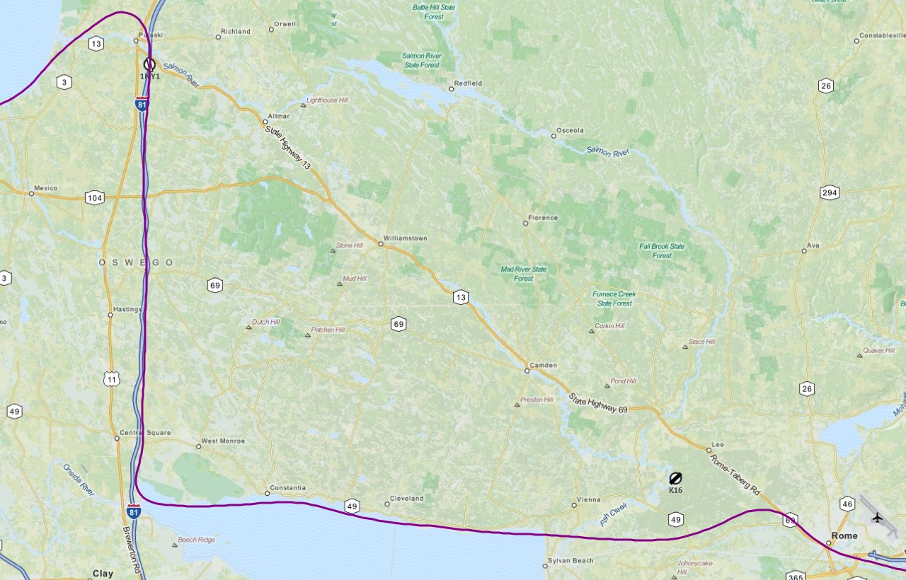
After spending several more weeks designing some new airports it was time to hop back in the cockpit and actually fly to them. I've been pretty productive since my last flight, and now have 37 airports up on AVSIM - that means I only have about 100 more to go, hahaha. Oh boy, I wish I were joking :P I spent the night of Thanksgiving plotting out the various airports I had added and ended up with 17 spread from south Jersey to north Jersey and ending back in central Jersey. This was going to be quite a trip! The majority of them were also turf airstrips which meant I got to practice soft-field landings. Although this time of year the ground is pretty solid thanks to the cold temperatures.


<object width="500" height="375" classid="clsid:d27cdb6e-ae6d-11cf-96b8-444553540000" codebase="http://download.macromedia.com/pub/shockwave/cabs/flash/swflash.cab#version=6,0,40,0"><param name="flashvars" value="offsite=true&lang=en-us&page_show_url=%2Fphotos%2Fgaiiden%2Fsets%2F72157625352979433%2Fshow%2F&page_show_back_url=%2Fphotos%2Fgaiiden%2Fsets%2F72157625352979433%2F&set_id=72157625352979433&jump_to=" /><param name="allowFullScreen" value="true" /><param name="src" value="http://www.flickr.com/apps/slideshow/show.swf?v=104087" /><param name="allowfullscreen" value="true" /><embed width="500" height="375" type="application/x-shockwave-flash" src="http://www.flickr.com/apps/slideshow/show.swf?v=104087" flashvars="offsite=true&lang=en-us&page_show_url=%2Fphotos%2Fgaiiden%2Fsets%2F72157625352979433%2Fshow%2F&page_show_back_url=%2Fphotos%2Fgaiiden%2Fsets%2F72157625352979433%2F&set_id=72157625352979433&jump_to=" allowFullScreen="true" allowfullscreen="true" /></object>


As with last time, I created a Flight Log to use as reference to get me from airport to airport. I also changed around a couple of things in the format of the log to get even more information included:


    I now list the frequencies of CTAF/ATC and ATIS/ASOS for the airport (although I still use AutoTune to set Com radios). "NA" is used for some CTAF/ATC because they are private airfields in real life, but do have CTAF in FSX. "NA" is also used for some ATIS/ASOS frequencies because the airfields either don't have one or are too close together to bother re-checking the weather.I now list the available runways for the airport, their length and width, and their surface type. The "L" and "R" after the runway number tell me the pattern direction for that runway.
  • I now list any fuel that is available.
  • I noticed that SkyVector lists in the airport's information page several nearby navaids you can use to get to an airport - it also lists the radial to travel on and the distance from the navaid. This I now include with my navaid info on the leg and has helped me determine distance from the airport.
  • I now say "To" or "From" a navaid to give me a better sense of direction and make sure I am setting to the proper radial when I tune my instruments. "Via" is used to indicate that I will first be tracking to the navaid on whichever radial I choose, and then tracking from the navaid on the radial given.


I might devise a spreadsheet to better format all this and actually start tracking my flight hours.


Leg 1: 26N - 28N


My first leg of the trip was from Ocean City Municipal Airport (26N), where I last left off, to Vineland-Downstown Airport (28N). I originally planned to take off at sunrise the day after Thanksgiving so I could get full use of the short daylight hours this time of year since the majority of the airports on this trip have inadequate or no night lighting - however weather did not cooperate and so I stayed on the ground and monitored. Finally at around 10am things cleared up enough for VFR conditions to return and I was able to depart 26N. However while the clouds lifted and the rain went away and the visibility increased, the wind stayed at around 15kts with gusts up to 20kts out of the WNW. Wicked!  Needless to say when I lined up for my approach to 28N Runway 20, I was coming in just a wee bit sideways! This was my first experience with crosswind landings in high wind, and I managed to get her down okay although staying on the runway was another matter. Luckily it's a grass field so plenty of room to muck around.


Looking at the flight log you'll notice a slightly different notation for the navaid listing: To VCN 115.2 > 330° - this means that I should track to the VCN VOR on a radial that is greater than 330°. This is so I stay out of KACY Class C airspace. The additional note "1000' until established on inbound VCN radial" is in case I had to depart to the north, staying at 1000 feet until I was sure I was out from under Class C airspace.


Leg 2: 28N - 29N


Taking off from 28N I chose to do so the way I came in, because having the crosswind coming at you from the right helps a lot when you're in a single-engine plane that by nature of its one propeller tends to want to yaw left on the takeoff roll, and at the same time a plane wants to yaw into a crosswind. So this effectively nullifies the left-yaw propeller tendency and helps reduce the right-yaw crosswind tendency - although the crosswind was strong enough that the airplane still wanted to yaw right. I was very very close to the maximum crosswind component for the Cessna.


The trip to Kroelinger Airport (29N) was only 4nm, so I didn't bother to switch off my fuel pump or turn off my landing lights after I cleaned up the aircraft. Since it's so close to 28N they share a CTAF, however I still need to dig through the ATC window to set the proper airport code for my traffic transmissions, so I'm doing that while trying to depart from 28N and almost immediately enter the pattern for 29N! Having destinations spaced so tightly together added yet another nice challenge to this flight. Coming down into 29N Runway 28 I was facing more into the wind and had an easier time setting down.


Leg 3: 29N - 00N


Another short hop, this time 7nm to Bucks Airfield (00N). The winds had picked up a bit more, flying over the airfield I spotted the windsock sticking straight out from its posts, which signals winds greater than 15kts. Coming down on final I found myself way too high and drifting towards some trees so I poured on the power, cleaned up the aircraft and called a go around. The second attempt was almost just as messy but I felt safe enough going for the landing and got her down in one piece. This is a public grass airfield that has a decent amount of traffic, but luckily the pattern remained clear as I shot my approaches.


Leg 4: 00N - 04NJ


I had some trouble finding my way to Emmanuel Airport (04NJ) for some reason, and had to track back to Bucks and try again, and finally found it. Wind continued to be a problem as I made my approach to Emmanuel Airport (04NJ). I had to call 2 go arounds and after the second one I just decided to continue on to the next airport, which was a decent 34nm away and hopefully had slightly better conditions.


Leg 5: 04NJ - 3NJ1


Turning east after aborting my landing attempt at Emmanuel I headed for McGuire airspace to put in at Pemberton Airport (3NJ1). I had down in the leg notes when I should contact McGuire Approach to let them know I was flying around their airspace. Conditions at Pemberton were indeed a bit better, and I was able to land without any problems. Still, en-route things were very bumpy, as they had been all morning.


Leg 6: 3NJ1 - 3NJ6


Next stop was a short hop west 7nm to Inductotherm Airport (3NJ6), where I was able to refuel, even though I was barely past 3/4 tank, it was the last fuel stop for a while. I did kind of get blown off the runway after landing, but thankfully didn't damage any gear since in this case I was getting blown off asphalt onto grass instead of just meandering about an open field. Going from hard surfaces to grass (soft) can really rip up your undercarriage. This isn't really simulated in FSX however. Still, it's not a good thing and if you have to do it, make sure you do it at an angle. Also having fixed gear helps and is less fragile.


Leg 7: 3NJ6 - 2N6


Departing Inductotherm (damn that's such a cool name) I immediately re-established communication with McGuire APP and traveled 7nm back west to land at Redwing Airport (2N6). Here I had a couple more options open to me in regards to runways and was able to choose one that was further into the wind than most I had been forced to land on so far.


Leg 8: 2N6 - 46NJ


Next leg kept me just within McGuire airspace and ended up with me at Perl Acres Airport (46NJ). Runway 34 was only slightly off the ~330° wind direction so landing was a cinch, without even any trees nearby the runway threshold to present a problem on final. Just set 'er down and taxi 'round.


Leg 9: 46NJ - 3N6


By now I was up in central Jersey and heading for Old Bridge Airport (3N6), which is right next to Raceway Park, where I take my car every now and then to drag race. Along the way I flew over the now-closed Marlboro Airport, and as I approached 3N6 a Maule called in he was 6 miles out. So I set up on downwind and just flew until I heard him announce he was only 2 miles out and then turned base and final to follow him down, although by this time I was about 11 miles out! The smarter thing probably would have been to calculate when the Maule would be past me and on final - but that takes math. In my head. Ouch.


Landing at 3N6 went so-so, it was perpendicular to the cross wind and I barely managed to stay on the runway after landing. Taking off was harrowing, however - I almost got blown into the trees along the left side of the runway!


Leg 10: 3N6 - 2NJ3


This airport was the one I was most worried about. Weidel (2NJ3) has a fence surrounding the runway that I modeled accurately, so although it's a grass strip I don't have the room to meander about upon landing that I had at pretty much all the other grass strips I had landed at so far. Plus the approach I had to fly, which was only about 45° into the wind, was over trees and power lines right at the runway threshold. And if I overshot the landing I would crash into a fence on the other end of the runway! So yea, no problem.


I was clenching my &amp;@(&#036;* as I came in over the trees, remembering my last attempt at clearing trees on final in a previous flight, but I made it over okay and dropped her on the runway with room to spare. Turning around to taxi back to the runway for take off would have been tough if I had rolled to the end, but I was able to turn off into the pasture area that had a lot more room.


Other than clearing the fence at the other end of the runway, take off was no problem although I was worried about yawing into the fence on either side.


I was also within Trenton-Mercer (KTTN) Class D airspace at this time but forgot to plan for that. Ooops!


Leg 11: 2NJ3 - 39N


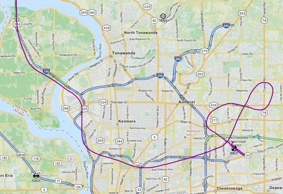
By now it was a little past 2pm as I departed Weidel and headed for my next stop, Princeton Airport (39N). After landing I taxied to a tie down spot and shut down the aircraft. Princeton is a helicopter field as well so I loaded up the Jet Ranger in the helicopter area and proceeded to practice a few landings and flying around the general area. I wasted a good half hour trying to manually start the Jet Ranger, and even Ctrl+E to have the simulator auto-start it for some reason refused to work. After shutting down FSX and reloading and still no luck, I just loaded the C172 back up, started it, and then switched to the Jet Ranger so it would be running.


After choppering about for only 30 minutes or so I grew tired and decided to call it a day and catch a nap before coaching early that evening.


Leg 12: 39N - 2NJ1


The next day (today) I once again woke up before dawn only this time the weather was perfect for flying - but I knew it was going to deteriorate fast as the morning went on in terms of wind conditions so I wanted to get up in the air ASAP. I took off from Princeton while it was still dark out and although I found Jugtown Mountain (2NJ1) okay, it was still too dark to really see the runway very well (it was unlit). So I continued on track but had to divert south to avoid Lehigh Valley Int'l (KABE) Class C airspace. I ended up just looping around in a wide arc to return to Jugtown when it was just light enough to make a safe approach. I had to clear some trees on final but I managed to do so okay and drop her down on the runway.


Leg 13: 2NJ1 - 2NJ5


The trip to Hartung (2NJ5) was another 7nm hop like several I had done the previous day. So while I cleaned up the aircraft after take off I left on my fuel pump and landing light. Hartung was a wide-open field so landing was easy, as was taking off again. It helped of course that the wind was still very light.


Leg 14: 2NJ5 - 2NJ6


This next leg was also 7nm and was flown pure VFR, all I had to do was follow the Deleware River north and the next airport, Markle (2NJ6), was right on it. While there were no trees on this approach, the end of the runway does sit on a pretty steep cliff, so coming in short wasn't an option. Also this was the only right-pattern I had to fly. In fact I almost didn't - I realized at this point I hadn't been paying full attention to my new "L"/"R" pattern notation. Luckily all the other runways where I just flew a left pattern out of habit actually were left-pattern runways.


Leg 15: 2NJ6 - 13N


After a longer 23nm trip to Trinca Airport (13N), I was descending over the mountains to land. The wind had started to pick up again and I had a slight crosswind component, but after the brutal breezes of yesterday this was a cakewalk.


Leg 16: 13N - 3N5


Newton Airport (3N5) was only 4nm from Trinca so it was a quick pattern entry pretty much right after take off. I was supposed to do a touch and go since this was an asphalt strip that was long enough (I didn't do it back at 3N6 because they do not allow TGO) but I was so used to calling out a full-stop landing when entering the pattern that's what I did. So I just did the full-stop landing. No biggie.


Leg 17: 3N5 - 47N


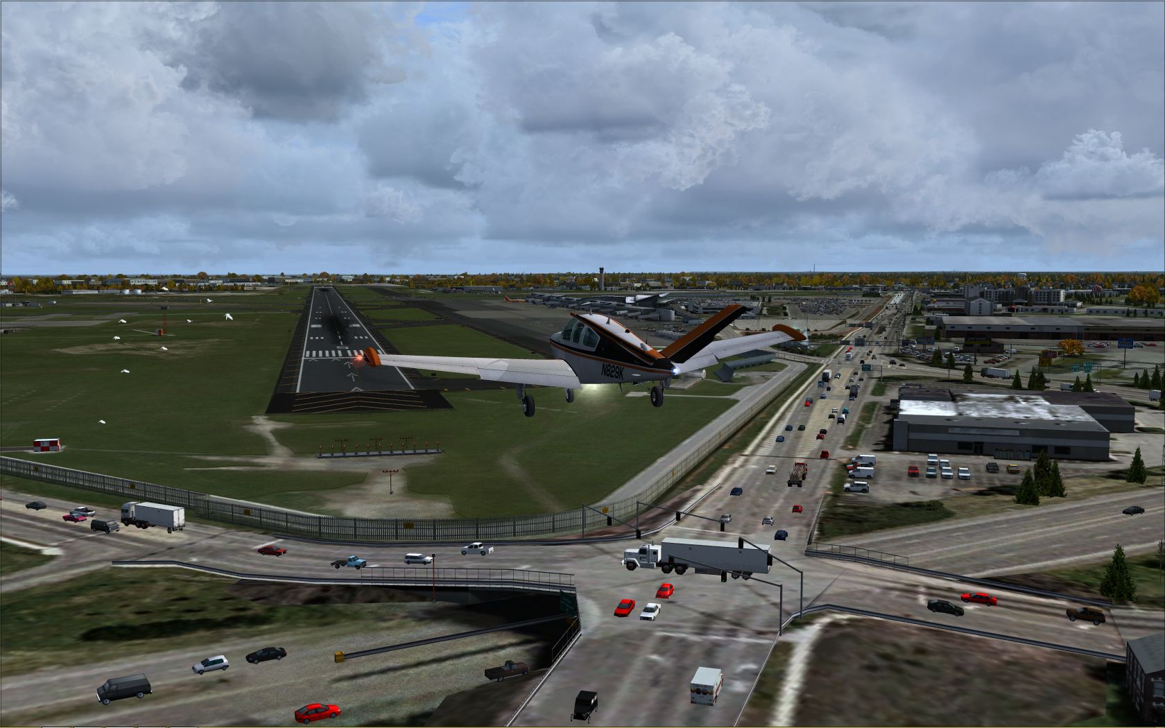
After taking back off, it was about 35nm back south to central Jersey and the aptly-named Central Jersey Regional Airport (47N). Unfortunately while I was on final for Runway 25 my anti virus popped up a status box saying it had been updated and then FSX hung up and crashed. I don't know if it was a direct result of the AV pop-up or not, but either way that was the end of my flight - so close to finishing!! At this point there was no real purpose behind reloading at the last airport and flying the leg over - I was practically on the ground when the sim crashed (better it than me!)


Back to airport design


Now that I've hit all the airports I've modeled, it's time to model some more! I'm glad this flight for the most part turned out okay. I got plenty of much-needed crosswind operations practice, having a lot of the airports so close to one another made things interesting as well, and I found myself getting better at remembering to carry out my pre- and post-landing checklist items.


This will most likely be my last flight of the year, but it was a good one!

Sign in to follow this  
×
×
  • Create New...