


=Hollywood=
-
Content Count
409 -
Donations
$0.00 -
Joined
-
Last visited
Everything posted by =Hollywood=
-
FSX BLURRIES ............ I can do no more!
=Hollywood= replied to =Hollywood='s topic in MS FSX | FSX-SE Forum
One thing that's interesting to note...For probably close to 2 years i had blurries in FSX on a Radeon 9800pro, especially after SP1 that couldn't be quantified...About 2 months back I installed the latest ATI drivers and suddenly all the MIPS started showing correctly as well as AA and all the issues were resolved...Some of these issues can be attributed to the video card driver software and not FSX itself...Just as an aside, I have an 8600GT right now with 512mb ram and 3GB DDR2 system ram, and also a Q6600 core 2 quad... No blurries but a few issues showing up with vector scenery and ground resolution set to higher than 60cm (where water tiles are showing up on the terrain)...Also I didn't get to read every reply in depth, but did the user have their settings on max global texture resolution and LOD radius max?The other thing is they may have been asking too much out of their system but having every slider set to the right, thereby pushing their system and GPU ram over the physical hardware in their computer and causing it all to go to Virtual Memory i.e. hard drive which of course would lead to blurring issues... -
I was going to say, which aircraft, they have quite a few out...
-
I'm waiting for the Piper Tomahawk to be upgraded to FSX status...The Just Flight offering was ok for FS2004 but poor fps on their FSX updated model...As for the 180HP 172SP, should be easy to upgrade here via the aircraft.cfg or .air files ;)
-
Need help to grab a massive screenshot...
=Hollywood= replied to =Hollywood='s topic in MS FSX | FSX-SE Forum
Thanks Jeff,The stitching approach worked after lots and lots of coaxing and breaking the program a few times just to get the right shot...I now have a most excellent 3600x3600 screenshot which is ready for print... ;-) It sure took some work though to achieve...I just had a request for a special sized image specifically for print of one of the products and it has turned out very very well...Now for that Quicktime VR I've dreamed of doing sometime, now that I have the right toys...Word to the wise, don't change the RAM settings on that program or you'll OOM... -
Need help to grab a massive screenshot...
=Hollywood= replied to =Hollywood='s topic in MS FSX | FSX-SE Forum
Oops I broke it lol...Will grab more screenies tomorrow... -
Need help to grab a massive screenshot...
=Hollywood= replied to =Hollywood='s topic in MS FSX | FSX-SE Forum
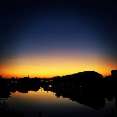
Ok, here's a test shot :-) Shrunk down of course...http://forums.avsim.net/user_files/191907.jpg -
Need help to grab a massive screenshot...
=Hollywood= replied to =Hollywood='s topic in MS FSX | FSX-SE Forum
Yeah I just took 180 pics of a mountain range in Oahu and am stitching it together, gotta give the proggie a bit more RAM access I think...Used Photoshop to batch covert to JPG...This is very very cool...Thanks for sharing the process, I couldn't wait to try it so I was already well on my way, now i'll need to clean up the scenery a bit before taking the master 'production' shot :-)Mahalo!Dean. -
Need help to grab a massive screenshot...
=Hollywood= replied to =Hollywood='s topic in MS FSX | FSX-SE Forum
You are my new hero...Very very very very very cool... :-) -
Need help to grab a massive screenshot...
=Hollywood= replied to =Hollywood='s topic in MS FSX | FSX-SE Forum
Sweet, that looks perfect!!!Oh that has just made my day... I've been searching all day for something that can do what this looks like it can achieve... :)I'll have a play around with it, oh that looks perfect for another thing i've been wanting to do...Did you move the aircraft and snap a bunch of pics? Or just change the aircraft views to achieve that shot?That looks incredible, I'm sure others will be making use of it as well :-)Dean. -
Hi guys,I'm hoping that posting here will get the best exposure for this question...I need to grab a massive 3600x3600 screenshot for a print article and I see a couple of possibilities in how to do it:1 - Somehow convince vista and FSX that a massive 3600x3600 monitor is attached2 - Force FSX to display a 'non-distorted at the edges' screenshot to create a series of shots that can be stitched together 360degree style3 - Take screenshots at 1 degree intervals and stitch them together in Photoshop (very time consuming)...Would anyone else have any ideas? I'm on a deadline for this project and need to complete this by Sep 10...Don't have money or access to get a TH2G at this point, that would help make life easier but I'm in the Philippines and wouldn't be able to obtain one before deadline...Anyone from ACES floating around?Dean.
-
Gosh you guys are great! Had similar thoughts, maybe FS4.0 can be ported over lol...Would love to use the iPhone as an iYoke or iRudder :D Maybe as an iThrottle...
-
there should be a fix available at www.fsinsider.com
-
FS Dreamscape: Blurries improved?
=Hollywood= replied to =Hollywood='s topic in MS FSX | FSX-SE Forum
Hi Tim,Blurries these days are caused primarily by out of date video card drivers under FSX or an underpowered system... For the longest time after installing SP1 I had blurries on my system until I recently upgraded to the latest ATI drivers and then everything came crystal clear again... I was running a Radeon 9800 Pro at the time...The NEXTMap ProMesh data improves the shape of the mountains but doesn't touch the flight simulator configuration settings as that is something best left up to individual users as each system differs...The way we've compiled the data is optimized for the best balance between high resolution fractional elevation sampling and performance and load on the videocard and CPU...We initially wanted to go for higher fraction bits settings in our datasets but found that it led to higher loads on the system and that in turn could exacerbate blurries causing the sim to load a lower level of detail within the scenery... Hence we've chosen the path of not taxing the system too much at this in time but providing a future free upgrade once computer systems can handle the load...Hope this info helps...Aloha,Dean. -
The solution to the autogen/photoscenery problem?
=Hollywood= replied to tasmanet's topic in Hangar Chat
Actually the 3m LIDAR data in the USA from the USGS is bald earth represention and wouldn't give that type of effect as it is way too coarse...I've already got the data for West Virginia sitting on my desk ready to render just have to find the time to do it, comes out as 2m terrain mesh for flight sim...I've already got 1m data for the grand canyon and by the end of 2009 we'll have 5m elevation data coverage for all of the United States and Europe based off IFSAR technology...We'll also have 1 and 2m lidar based dem data for our ProVFR series for Utah...Also the stuff we're working on doesn't require the illegal access to Google Earth, Virtual Earth and other servers... -
Engine Exhaust/Shimmer Effect for FSX
=Hollywood= replied to =Hollywood='s topic in MS FSX | FSX-SE Forum
the xyz values for FSX changed from FS9 so it won't work out of the box but depending on how it was implemened in FS9 it may be able to be ported to FSX -
3d experience now in vista-heads up...
=Hollywood= replied to simba_nl's topic in MS FSX | FSX-SE Forum
for polarizing you need either a projector or screen that is capable of polarizing the light, a standard monitor won't do that AFAIK -
3d experience now in vista-heads up...
=Hollywood= replied to simba_nl's topic in MS FSX | FSX-SE Forum
polarized glasses only work for polarized image projection, not for red/blue imagery -
3d experience now in vista-heads up...
=Hollywood= replied to simba_nl's topic in MS FSX | FSX-SE Forum
Just to give you guys a heads up, there's new polarized monitors that give full 3D color (no red/blue) from IZ3D...http://www.iz3d.com/t-22monitor.aspxBasically two LCD monitor screens stacked and polarized and the polarizing glasses give you the 3D effect...Not sure how they're doing on FS support at this point in time... -
Justin, that's a really good idea on distribution :-)
-
actually one of our recommendations is to obtain Ultimate Terrain for that very purpose, the only caveat is that the nightlighting for ground textures doesn't happen, but I have ideas on ways to automate that and tero you reminded me of something else that I am aware of but forgot about that could go towards helping with that...My dream is to see dynamic lighting in sim one day... Would save a lot of time rather than pre-rendering...There may be another solution in future as well but that may be 1-2 years away...
-
Dick thanks for that reply, yeah those are the challenges with scenery design today... And it's only going to be stretched further in future which is why I want to find a way to start streaming data...I know Christian B has done some groundbreaking work with TileProxy but FSX has some limitations as far as I understand to streaming scenery in, also the source data usage under tile proxy could be a violation of the server's TOS and put an end user at risk... I believe Christian gives a heads up about that in documentation...That's why we started down this road and hope to one day provide a way better option than Google Earth data or other imagery locations. Our code is native and designed specifically for FS. As it is GE imagery is based on satellites and images are taken at different times of days, seasons and years and really can look hokey in sim going from 15m imagery to 1m imagery and back etc... Don't get me wrong I am very supportive of Christian's groundbreaking work but the licensing issues need to be resolved...And we really need Fiber based internet connections and hosts to be able to see the whole streaming scenery aspect become a reality... It's probably a few years off infrastructure wise...I have an idea for one solution but would need a lot of programming done...Anyway we also offer extremely high resolution elevation data which beats all the streaming server hands down :-) More news on that very soon. :-)
-
>I have just purchased the pre-order of Oahu and was directed>to the download page on FSDreamscape. I am slightly confused !Hey jjaycee...I sent you an email regarding DVD (I can answer more specific questions at our forum and want to be sensitive to avsim here)... The files are each covering one part of the island, together they cover the whole island... Sorry for not throwing in an installer just I've had to move up the move to Hawaii from Mar 1, to Feb 24, then Feb 12 and now Feb 10 and only have a few days to get a month's worth of preparations done... :-SThe final version will be different though and I'll have an installer and I have a programmer who will be creating an autoinstall routine for us, I just wanted to get something into everyone's hands to play with while we continue work...I'll get more info together and a map showing each island's coverage... In the meantime, if you know how to locate your directory to Flight Simulator X, then the easiest way to install it is to drop it into your "Addon Scenery/Scenery" folder...Most users will have it in "C:Program FilesMicrosoft GamesMicrosoft Flight Simulator XAddon Sceneryscenery" or something like that...You can confirm your scenery library has the "Addon Scenery" folder enabled by selecting the 'scenery library' in the main FSX menu screen or in sim by hitting 'ALT' then 'W' then 'S'....Cheers,Dean.
-
Thanks SolarEagle for the info, I was wondering how the bandwidth was, will have to see what happens on 300 users downloading at once lol...Mike thanks for the well wishes, I'm almost ready to book the flight :-) I'm nervous and excited, am flying air china which is a worry but hopefully they've had their incidents for the year :-SOk gotta run and get some more paperwork organized... And hope that Sundays flight doesn't fill up...
-
>Erm... Wow! >>Even though I can now go fly almost everywhere at 1m>resolution (I developed that strange Tileproxy thing), I feel>inclined to buy this 0.30m scenery... just to see what else is>possible.>>Oahu was the first location I ever tried in with the TP>prototype. It is an amazing place to fly at (and I am sure to>live at as well). Also it makes me want to look into what will>happen if I generate 4096x4096 pixel BMPs in Tileproxy>(containing that very 0.30m/pixel resolution). Will FSX eat>them or will it refuse to load anything bigger than 1024x1024>textures? In fact I have never tried...>>Christian>Hi Christian,Any advancements on TP under Vista? We're going to need a solution in future as there's stuff future tech wise that will come down the pipeline and streaming data will be the only real practical option...Would beat the current streaming servers hands down...Dean.
-
Ok files 7-10 should be available now...The one plan with Oahu is to upgrade it for free, once we can cover the price of a commercially produced image that has a lot of the color issues resolved as this island is a beast for color correction, so this one will continue to get better...Am also planning on clouds and cloud shadow removals...Nils, I did the same thing, I snagged the autogen from my copy of Megascenery and used it when running it locally on my system, could probably do the same thing with night lighting... ;-)That way you get the best of both worlds...I did some tests on another thing tonight and to be honest was completely left in shock and wasn't expecting the test to work, but that will become apparent soon... :-)Am currently rendering the elevation data to go with the imagery and you'll be even more blown away. Last night I was flying in the island and I honestly 'felt' like I was really there...Will get these 4 Oahu demo files uploaded and then will start with the Utah San Juan County as well...Why doesn't avsim have a screenshot forum? lol... It's fun seeing what others can do and see in their rigs...Keep the screenies coming they look so cool, way better than my feeble efforts lol!!!
