


=Hollywood=
Members
-
Joined
-
Last visited
-
=Hollywood= changed their profile photo
-
Tom, love and prayers from Melanie and I. Your love, dedication and support of the entire flight simulator community has been above and beyond the call of duty. If there's anything we can do, please let us know. Sincerely, Dean & Melanie Mountford.
-
Hi Mike, I personally run with autogen on, and it's ok on my system. I have an old system as well, a Q8400 2.8GHz system for my personal computer and an ATI 5700 series videocard. The night lighting system has numerous density options for users to select what works best for their system. There's 100% realistic down to a lite version. I'll be also be re-working some code this month to make also make a super light version as well for low end systems like mine. I haven't had anyone say they've had performance issues, but most users have very recent hardware for FSX. The current version of the autogen is not as hard on performance as default FSX. Los Angeles will be a different matter though as there's over 5 million buildings in L.A. county. If there are any performance issues I'd love to know so I can help optimize the night lighting further for those systems. Cheers, Dean.
-
Hi Gregg, Arizona unfortunately didn't have a lot of public domain data available for buildings in the cities which is what I need to generate autogen buildings, unlike Colorado which had huge amounts of data from numerous sources that I was able to compile. Over time I will be providing free updates to help fill in the missing autogen building data as it becomes available. The thing to remember with this is if the U.S. Government with all it's money doesn't have it, it would cost tens of thousands of dollars to obtain from a commercial vendor. However I do undertake a huge amount of data mining to find building data and have significant tracts of data for Utah, Colorado, California, Washington State and other cities. For finding out which scenery is in a certain area, I use tmfviewer.exe which is included with the FSX SDK's which have installers that can be found on the FSX installation disks. All Ultimate VFR coverage is broken down into county and rows and segments. e.g. uvfr_v_az_coconino_01a, uvfr_v_az_coconino_01b, uvfr_v_az_coconino_01c <- indicative only) uvfr_v_az_coconino_02a, uvfr_v_az_coconino_02b, uvfr_v_az_coconino_02c <- indicative only) I'm a little unclear on your last question and would love to help. May I ask what you're trying to accomplish a little more specifically? I really want to provide you with an accurate answer Sincerely, Dean.
-
Hi Jim, There's actually a very good reason why the colors aren't oversaturated, and that is because of my professional film and television color correction background of over 24 years. I'm aiming for the type of realism color wise you see out the window whilst flying in the real world (I'm also a pilot and literally grew up on 727's and 767's not to mention many other types of aircraft) if the imagery is too oversaturated it can end up looking very game-ish which detracts from reality. The other issue with over processing imagery is that it can increase production time significantly. For each county there can be upwards of two thousand images at 10,000 x 10,000 pixel images, that's a massive 200,000,000,000 pixels that require editing and that's for one county alone (in other words 2000 files x 1-2 minutes to process). We already run about 10 different processes to the imagery improvement process. Adding any extra processing to each image could mean each state takes twice as long to render and twice as much cost in terms of electricity and computing power, which would then increase the cost of the product to be outside of the reach of any of us, including me. Also a lot can actually be done with shaders within the sim to tweak how everything looks, including increasing the terrain saturation at run time for those who prefer a more saturated look, however no one has yet tweaked the FSX terrain shaders to do this as yet. We discovered this when Lockheed Martin brought out Prepar3d v1. As time goes on imaging technology will continue to improve which lead to improved imagery on our part and if no one else comes up with a DX9/DX10 shader tweak to the terrain I will get to it when time permits. Also in terms of comparison, I'd say a better comparison is in looking outside at the real world. Remembering there are limitations also within FSX as it does not fully model color temperature like in the real world. Sunrise and Sunset are both around 3200 degrees Kelvin, and a bright summers noon day is about 6500 degrees Kelvin. For the night lighting we've actually matched the night light effects to real world color values for Sodium Vapor, Mercury Vapor, Metal Halide and High Pressure Sodium. The thing we need to share with the community is that I am working with Petabytes of data to process. I'm already using super computers to process this imagery and scenery and all on a cash basis. To generate all of the USA is going to end up costing me about $12,500+ and my wife is actually keeping us afloat at the moment. I'm operating the business on a measly grant of $250 per week which doesn't even cover the bills as yet. This is my full time job and this has all been done with 8 years of research and development and it's only the beginning. I'm actually considering taking on full time work to help speed things up. Thanks so much to everyone for the awesome feedback, what matters to you matters to me and if anyone has any questions or comments I'm here to help out. Aloha nui Loa, (with much Aloha), Dean.
-
Hi Gregg, autogen right now is only version 1, I do have plans to provide better coverage for autogen as well, but have some hurdles to overcome with roads and urban areas with vegetation. I have the process figured out, and the routines ready to start making that happen, but I need to upgrade my software to be able to make that happen. All being well in the next little while I should be able to provide a free update for the autogen that gives 100% coverage for vegetation and a handful of more buildings as well. The scenery addons are based on a continual improvement cycle with software as a service. Right now the goal is getting the imagery for all of the USA complete, followed by upgrades to the other layers such as water, autogen and much more. With the blend masks for the edges of the states, those are also on the radar moving forward. I've just been re-writing my software tools to be able to make that happen, however adding blend masks do add about 1/3 more time to processing of the imagery, but I did have a brainwave this morning that I'll be looking into today that may not increase production time. In terms of downloads, once I can afford the $600 to purchase new installer software I'm expecting to be able to simplify the download pulls that a) saves time and effort and B) runs MD5 checksums to ensure files don't break in the download process. In the meantime there's a great Firefox extension that is called DownloadThemAll which can help download all the files with one click. It's a free download available at https://addons.mozilla.org/en-US/firefox/addon/downthemall/
-
Hi Keith, try near two lovers point and at cocos island Hi Gregg, Colorado is approximately 62 GB, each product page has the file size and estimated download times listed on them Hi Regis, there have been a few orders, our files are hosted with a major CDN which has a Gigabit backbone. There were probably a lot of users using freedownloadmanager to accelerate the downloads, which is the method we highly recommend for download as it ensures the files are delivered 100% intact and as fast as your home/business internet connection is capable of. Thanks for the heads up about the brief slowdown and good to know it didn't last long. If you guys have any further questions or need any support please don't hesitate to ask. Kindest Regards, Dean.
-
-
Hi Scott, Ultimate VFR brings full water mapping, night lighting effects, autogen vegetation and autogen buildings and a whole lot more free upgrades as time goes on. Basically Megascenery pulls imagery off a tile server and renders it for FSX. We take the best high quality source data, process it professionally (my background is professional film & t.v. production and professional imaging), generate custom night lighting effects, custom autogen and highly detailed water maps including dams, small rivers, even large creeks and canals. Ultimate VFR actually started being developed back in 2006 during the FSX beta long before Megascenery Earth was even on the radar. We planned to be a complement to the MegsceneryX product line, however we quickly discovered users wanted more than just aerial imagery. So we started the long process to really exceed expectations. We have gone far beyond just providing flat imagery and we have a lot more planned. We have many more free upgrades planned for the future as well. Along with my Film/TV background I'm also a real world pilot. and father was flight crew on 727's and 767's and aviation and image correction has been my life. Please let me know if you have any further questions. I'll be happy to respond. Kindest Regards, Dean.
-
For EU customers the doors are now open for ordering the digital download products. We had turned it off temporarily due to the new VAT laws that came into effect on January 1, 2015. However we want to make the experience seamless for you as it has been before this year and will take care of the VAT.
-
For a limited time only Ultimate VFR Photoscenery for FSX and P3D has been reduced to $10 per title. http://www.ultimatevfr.com The sale is for: Ultimate VFR Arizona 2.0 Ultimate VFR Colorado 2.0 Ultimate VFR New Mexico 2.0 Ultimate VFR Utah 2.0 All titles usually $39.95. All photoscenery packages include: Latest Imagery (2012, 2013 or 2014) 1.2 High Resolution Aerial Imagery High Definition Water Mapping High Definition Autogen Vegetation High Definition Autogen Buildings *(subject to data availability) Street Night Lighting FX
-
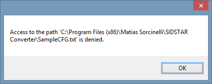
What happened was that I caused a problem by having several of the input files inadvertently open. This caused SIDSTAR converter to hang, not delete anything from the original files and caused it to not generate a SampleCFG.txt file. The issue is, if that happens and you need the SampleCFG.txt, you have to run the entire conversion process again just for it to generate the SampleCFG.txt file. Could you not separate the process to generate SampleCFG.txt to be able to run by itself? This would save hours of time and processing (and associated electricity costs) just to generate SampleCFG.txt without having to regenerate all the SID/STAR*.txt files from scratch again. In short: 1 - I ran SIDSTAR converter over my PMDG formatted Navigraph data 2 - Along the way I opened a file in the "original" subfolder: Australia\Queensland\Original\YBBN.txt as well as a few other airports and I forgot to close them as SIDSTAR Converter was doing the conversions 3 - All PMDG Airports' SIDSTARS were successfully converted and placed into the various region folders as normal (e.g. G:\AI\SIDsSTARs\Australia\Queensland\YBBN SID RNW 01 COODA2.txt etc etc etc) 4 - When SIDSTAR Converter got to the next stage of processing to delete the Australia\Queensland\Original\YBBN.txt file and Australia\Queensland\Original folder, the program threw up an error stating it couldn't delete YBBN.txt as it was currently open in another program and SIDSTAR Converter stopped at that point and did not delete any further subsequent AIRPORT.txt (eg KLAX.txt, RPLL.txt etc etc etc) files in the "original" folders 5 - Because of this SampleCFG.txt was not generated 6 - I needed to just be able to generate SampleCFG.txt by parsing over the final SIDSTARS data that had been successfully generated at item #3 above 7 - Because SIDSTAR Converter can't do that on it's own, I needed to go through the *entire* process from the start again which was a 2 hour process. I had another issue the 2nd time I processed the data which happened again after successfully finishing item #3 above, which again meant I couldn't just say "Generate SampleCFG.txt" over the final data, I had to go and re-compile the while thing again What this meant was that instead of a 2 hour process that could have been 2 hours + 1 min (to generate the SampleCFG.txt file separately), it took 6 hours just to be able to get the final SampleCFG.txt file. :( Even if you could just extract the code to generate SampleCFG.txt into it's own program separate from the other processes and then called it from within SIDSTAR converter it would be a huge help. i.e. SIDSTAR Converter Current Process (All-in-one-process) 1 - Copy PMDG data into folders based on regions/states (process = "SIDSTAR Converter.exe) 2 - Convert PMDG data into AIController Format (process = "SIDSTAR Converter.exe") 3 - Delete all PMDG original data that was copied (process = "SIDSTAR Converter.exe") 4 - Generate SampleCFG.txt (process = "SIDSTAR Converter.exe") What I'm suggesting means that if the process gets interrupted at Stage 3 (or any stage during stage 2, a user can run stage 4 manually. i.e. SIDSTAR Converter Proposed Process (2 Stage Process) 1 - Copy PMDG data into folders based on regions/states (process = "SIDSTAR Converter.exe) 2 - Convert PMDG data into AIController Format (process = "SIDSTAR Converter.exe") 3 - Delete all PMDG original data that was copied (process = "SIDSTAR Converter.exe") 4 - Generate SampleCFG.txt (process = "SIDSTAR Converter.exe" calls and runs "Generate SampleCFG.exe") End result: If Stage 3 gets interrupted, a user can run stage 4 manually in order to get the SampleCFG.txt file. This saves the user from having to run steps 1, 2 & 3 again before finally getting the file generated by stage 4. ----------------------- One final separate thought, an "if then" statement at stage 3 would also help eliminate a problem with stage 3 if a user inadvertently has an original airport file (such as YBBN.txt or YBCS.txt or KLAX.txt). If "error message, can't delete YBBN.txt is received by SIDSTAR Converter.exe then once user has closed the YBBN.txt file and clicked on "ok" then continue to delete original data files.
-
I just had to make the same decision and went with Navigraph, they support more aircraft FMC's and I'm used to Jeppesen Been wonderful for use with AI Controller. Navigraph also fixed 1 minor bug in the data that I found with Jan 8th's 1501 cycle release which I'm about to download and add to my system.
-
Oh I think I just found another bug with windows 8 64 bit. I'll try re-installing the program to a different folder than the "Program FIles (x86)" folder Here goes another 2 hour recompile
-
Hi Mathias, I think I may have caused a bug. I got cycle 1501 which was released last night and ran through SID/STAR Converter. All was well and good, except LFKJ and I can post the details to you if needed. However as I was new to all this and interested in all the airports I often fly in to I opened up the original, Australia/Queensland/Original/YBBN.txt file as well as others from different regions of the world. By that time it was about 5am and I headed to bed. When I woke up I noticed that because I had those files still open SID/STAR Converter had an error on screen saying the files couldn't be deleted because they were open in another process. I clicked okay but SID/STAR Converter appeared to have stopped all file processes and no further original files were deleted. This means I am having to run the entire process again which will take a couple of hours, as due to the hang the SampleCFG button didn't get highlighted. One suggestion I'd like to make. Is there a possibility to run the SampleCFG script on it's own separate from the AiConv.exe process. i.e. skip step 1 (aiconv.exe) and just run SampleCFG manually at a users whim. This would also have the benefit of allowing me to move any countries/region folders out of the main converted folder that I don't plan to use and only generate the sample.cfg based on the remaining folders I do want to use. This would be a lot easier than sifting through the SampleCFG fiie manually to grab only the regions I might want. Oh one more question, I'm wondering if it would be possible to have SID/STAR Converter convert the files to and from a KML/KMZ file format. This way we could easily edit our SID/STARs in Google Earth and add in our difficult or dangerous approach tweaks. Kindest Regards, and thanks so much for this amazing tool. Dean.
-
I've been seeing them a lot lately. Would love to replace the texture with something more realistic...

