


tonywob
Moderator
-
Joined
-
Last visited
Everything posted by tonywob
-
I wouldn't have super high expectations over this. It's unlikely to contain the detail MFS does, but it'll still be a big improvement. My take is that it'll be more accurate, better performing and follow real-world data better, including better art. It'll be far easier to author as well since mostly it's image masks and more modern 3D formats. Tools like Ortho4XP which build complicated meshes and try to smooth and flatten airports hopefully won't be needed, and far simpler tools just involving image manipulation can be used. Once I get my hands on the new tile format, I can work on updating my mesh tools to generate ortho tiles + DEM.
-
I'm looking forward to finally being able to use the tiling engine, it's so badly needed (we've been asking for this abilitly for years) :)
-
I'm looking forward to finally being able to use the tiling engine, it's so badly needed (we've been asking for this abilitly for years) :)
-
I gave it a go (I don't like just running random exes from the internet without any source-code, but I took one for the team) It's fairly hacky at best, but a decent proof of concept. The major problem is that it can't remove the mesh underneath, so it slightly raises the elevation essentially having one world floating on top of the other. It also converts in raw format, so the sceneries will be extremely heavy. This is not the fault of the tool, it's just a currently limitation of the X-Plane DSF format.
-
It's not streaming it in, it's downloading the data from Google beforehand and creates a scenery package. You need to select the area you want, generate it and drop it into the sim.
-
As someone who uses this airport several times a year in real-life, it looks really accurate and instantly brings back the pain of waiting in long queues at the Ryanair checkin desks
-
I have their Cessna 172s, and for such a basic aircraft, it's extremely heavy on the framerates (although very nice). I can't even begin to imagine how heavy a full-blown 737-Max is going to be.
-
Be careful with this script, it decompiles the mesh and recompiles it losing height accuracy and causes artifacts and issues at some payware airports. It also won't do much with this scenery since it uses the old style X-Plane 11 trees and water masks.
-
Sorry, but I'm not sure what you mean? You'll have to give examples. If you've lost any custom scenery it probably means your scenery order has reset and incorrect.
-
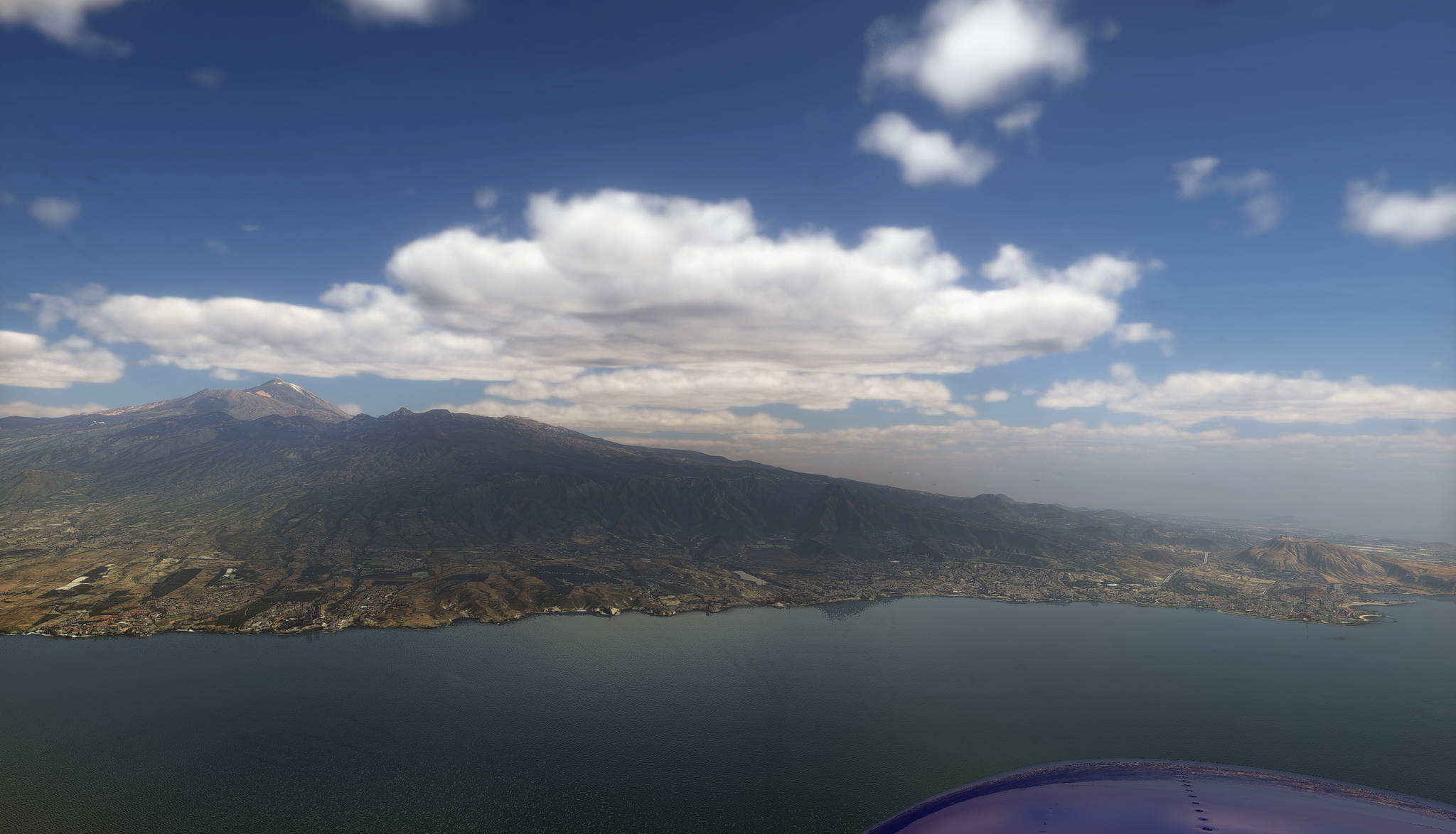
You can get them down to 1/4 the size if opting for 2m/px imagery (ZL16), which I found is absolutely fine above 1500ft or so. I have the Canaries at 60cm (ZL18), but honestly I don't see the benefit too much unless on approach/departure.
-
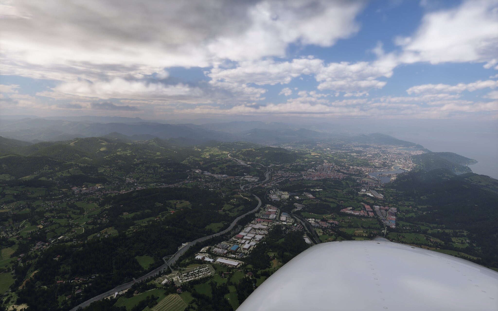
The northern coast looks really nice, one of the nicest areas to fly in
-
The issue is not just limited to disk space, it's to do with the slow loading times and memory requirements, since all that data has to be loaded in large areas due to the legacy 1x1 tile system. If anyone has used TE Florida as an example, then they'll have experienced the super slow loading times caused by this. Whilst it looks good, this scenery is even more detailed than that, so for most users it's just not practical at present, especially for those who just fly liners. There are also lots of hacks I have to do to make features that work in the other sim, e.g. Having matching roof colours and shapes, tree colours matching ortho, etc that X-Plane simply doesn't support easily. IMO, people would just end up disappointed, especially if they can't run the scenery smoothly, even if it does look good. I'm not a fan either, so it would have to support both for those that don't mind the storage requirements.
-
Since MFS was released a few years ago, interest for such products has hit a brick wall. Since such scenery is essentially free and worldwide in the other sim, it's difficult to compete with that and actually make any money despite some people still wanting to see new and updated regions. Either way, I have most of Europe and large chunks of the US generated, but I'm waiting for the new scenery system before deciding what to do next and how to release this for people to use. The most important factor is being able to reduce the size of the scenery downloads and the regions, i.e. Either by streaming it in or allowing users to only grab the areas they want.
-
I've been using Macs for years (Since 2003), but I was looking at finally replacing my Macbook with a laptop running Linux (Dual-booting for Windows games, and Linux for work and X-Plane) and this might be the push I need to go for it. I was looking at these custom build laptops that are well supported on Linux https://frame.work/pl/en/laptop16. Sadly, it seems 32GB is the max RAM I can top out at (I currently have 96GB which I make good use of in Photoshop), which considering the price of RAM these days might be a downgrade somewhat.
-
Yep, I remember needing to clean this up extensively when using the same MS building footprint data to make the TrueEarth US regions. Likely the same thing, i.e. OSM + MS Building data. The effort and bandwidth costs involved to generate and host these files inevitably led to them wanting to charge for it. So this doesn't surprise me, it was going to happen eventually
-
I've seen a substantial increase in FPS from the scenery changes in this, especially on large scenery areas.
-
It's been an interesting topic with some nice info, but time to close as it's been taken over by bickering
-
Yes, despite their limitations such as fixed seasons and baked-in shadows, I still think orthos combined with autogen are the best we currently have. While they can look rough at ground level, the scenery becomes quite convincing from a thousand feet up, especially with good lighting. The long-standing drawback of ortho imagery is that it’s not truly orthographic, building and bridge roofs are often displaced from their actual positions, and large shadows are permanently baked into mountainous terrain. You can suspend disbelief to a point, but the issues can become obvious, e.g., a mountainside covered with trees while the underlying ortho shows the ground completely black due to a shadow stands out like a sore thumb.
-
I had to Google this, but wow, they’ve clearly been busy (This would have been huge news a few years ago). It looks like they’re using the same autogen tech we see in MFS, just running inside Unreal Engine. Very cool stuff, though I doubt it’ll be in the hands of us normies anytime soon. As for next-gen scenery, the details are still pretty thin, but honestly I’m not expecting them to try going toe-to-toe with MS and their practically endless resources. What I am hoping for is a flexible, well-designed system that lets devs build efficient and good-looking scenery. Give us a default world that looks good, feels plausible, and doesn’t just default to "somewhere in the USA or Germany." If they nail that foundation I'm sure third-party devs and modders will happily take it the rest of the way.
-
They've already mentioned that the sim will continue to support DSF files as well because there is simply too much legacy stuff out there. Devs (those that still care) will be able to move their scenery over time to the new system.
-
Apart from just using a much older version (v10 or 11) your options are fairly limited if you don't want to upgrade your hardware. I see two options for you 1) Try AeroflyFS (https://www.aerofly.com/). It's a fairly basic sim compared to the others but has great performance and should run fairly well. It really depends on what sort of simming you want to do. 2) Sign up for XBox cloud https://www.xbox.com/en-us/play This lets you use your computer to play games (MSFS 2024) over the internet without actually needing to install the game (The game is ran on another system on the internet and streamed to you, and if you have a decent internet connection it could be worth a go, but of course there is a subscription to use it.
-
XRoads won't block the default autogen as it only replaces the road textures with transparent ones and leaves everything else as is. You're only real choice here is to use Simheaven to correctly place the buildings or completely block all autogen entirely by changing your scenery order
-
Funnily enough, I was thinking of buying this the other day as I like their products (C172 is my favourite). Good to know it's being updated
-
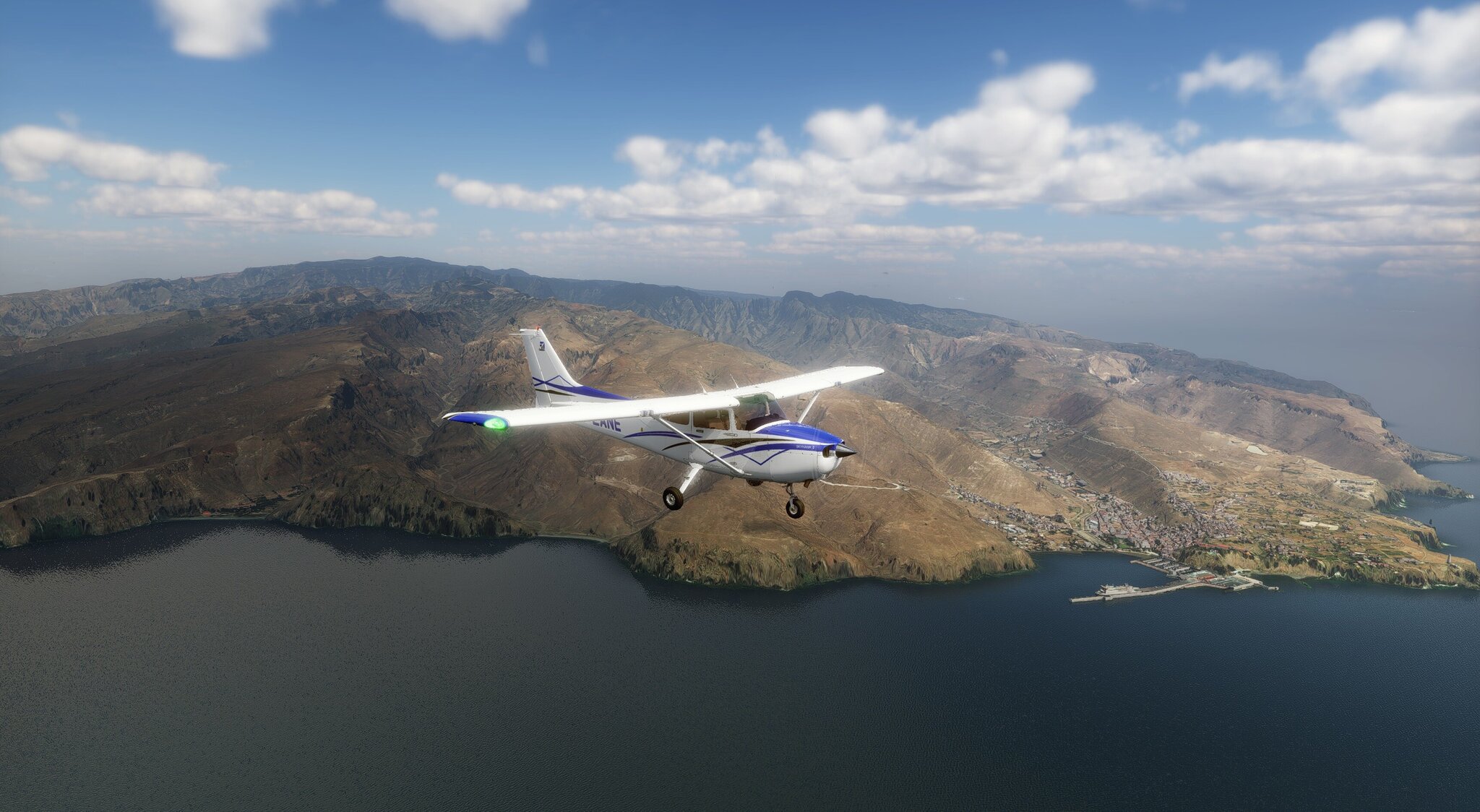
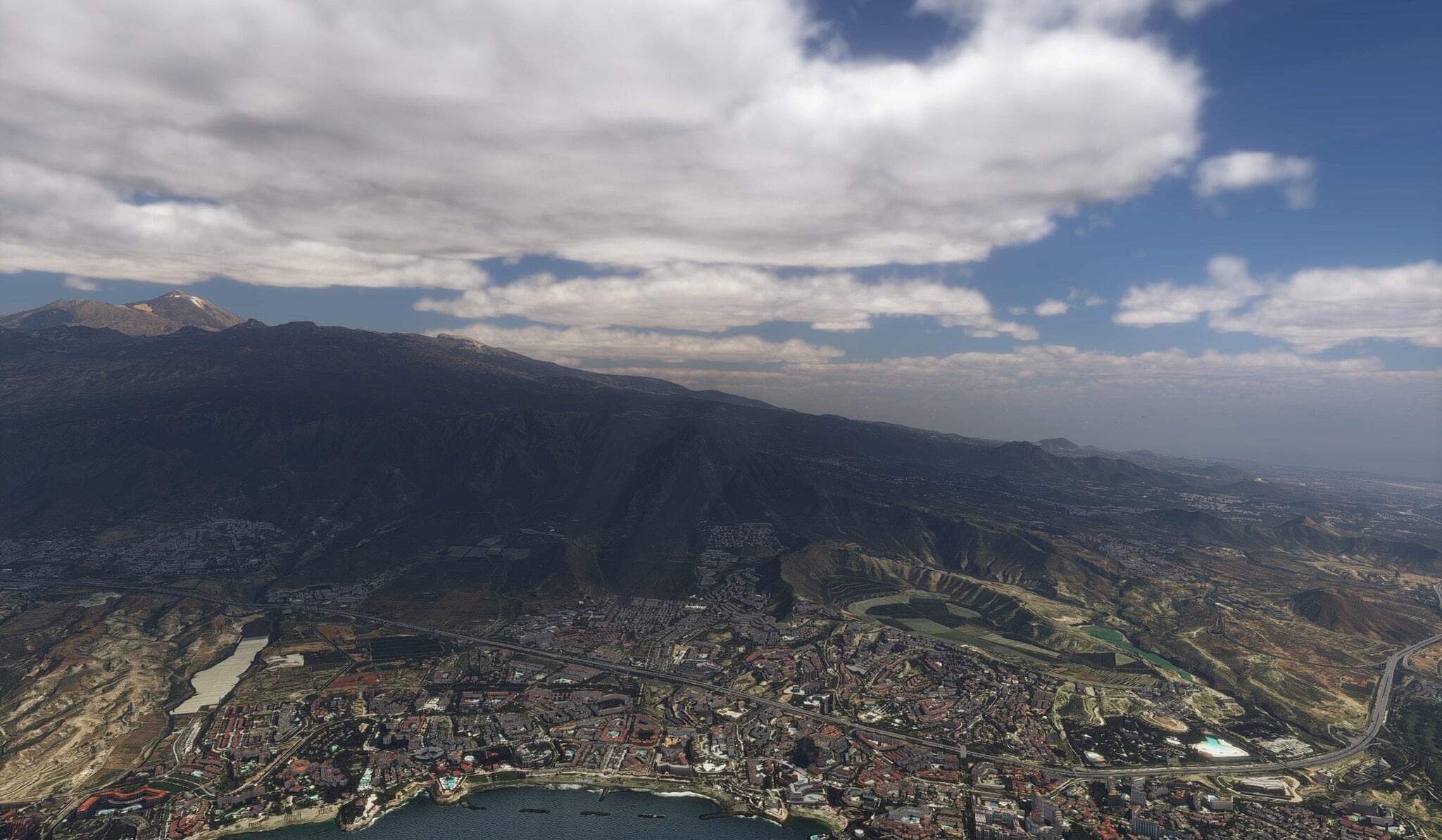
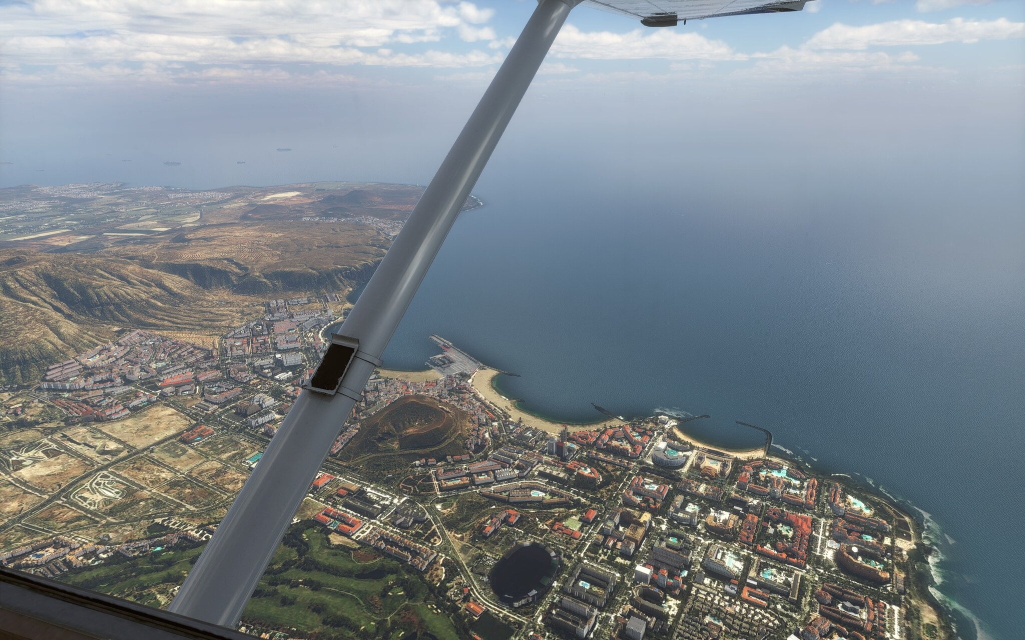
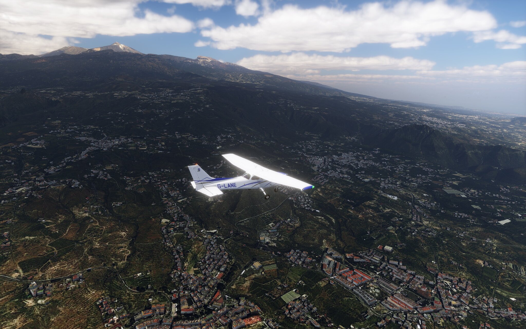
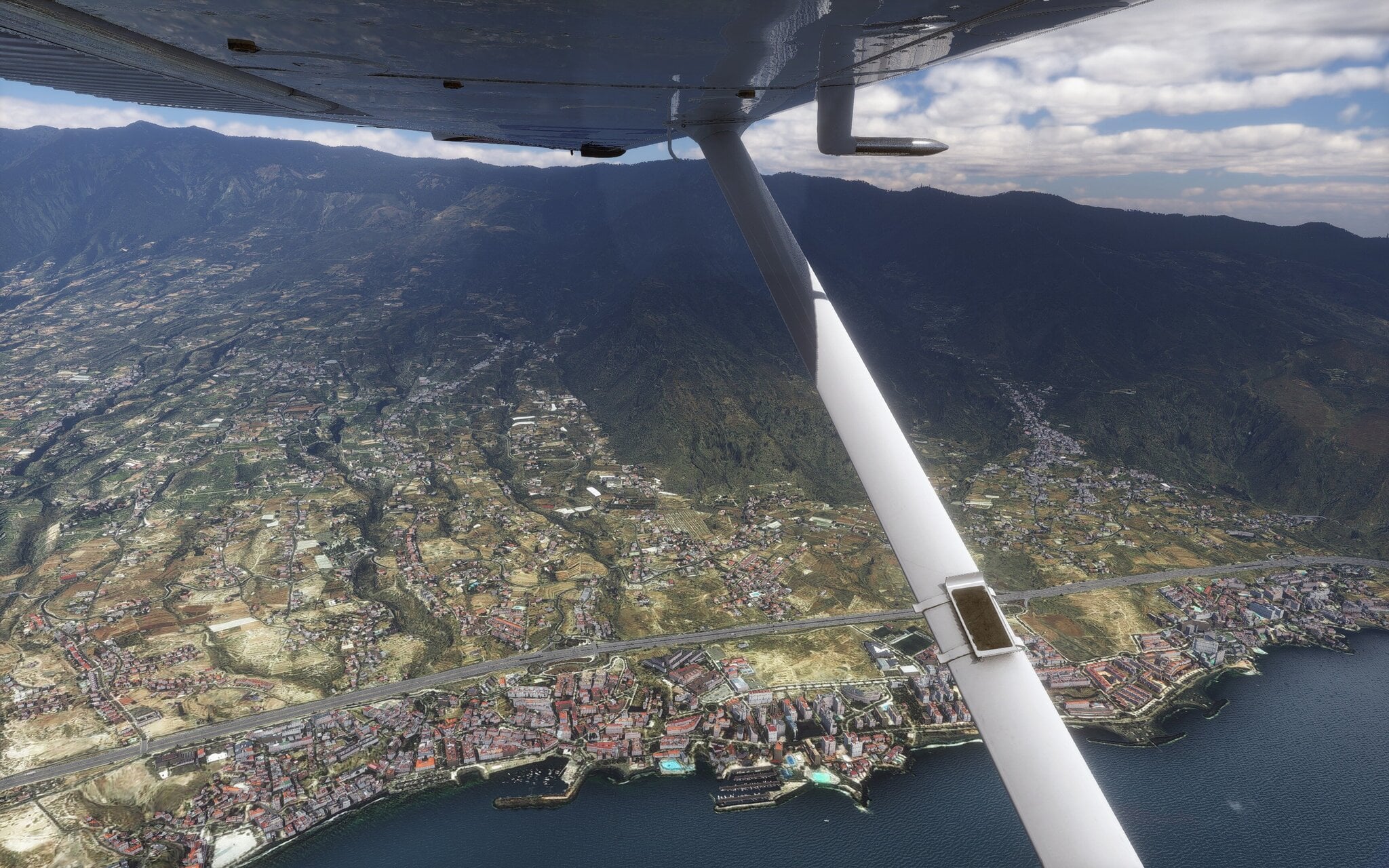
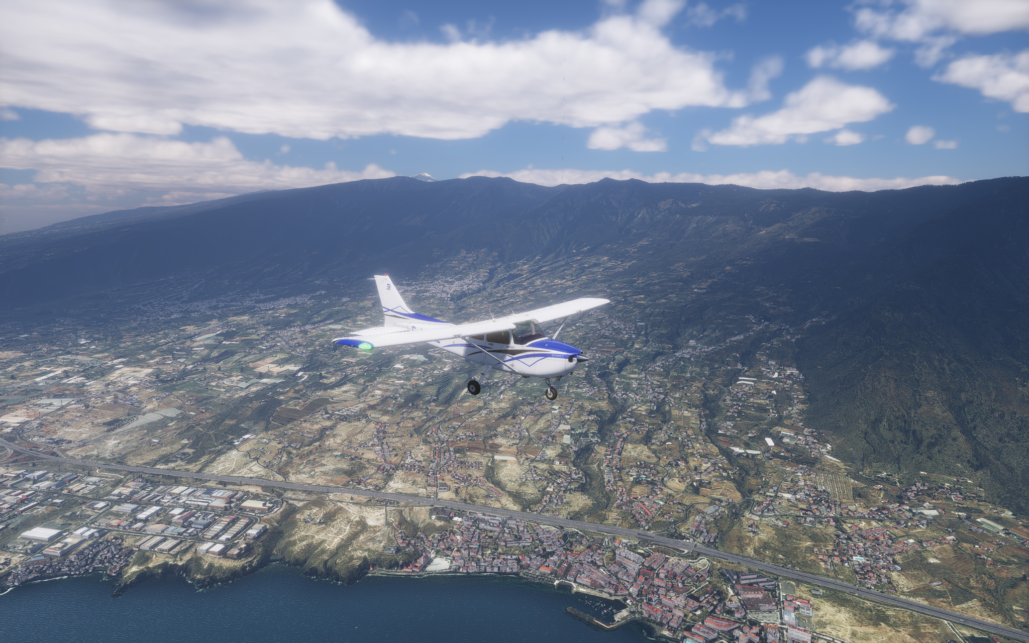
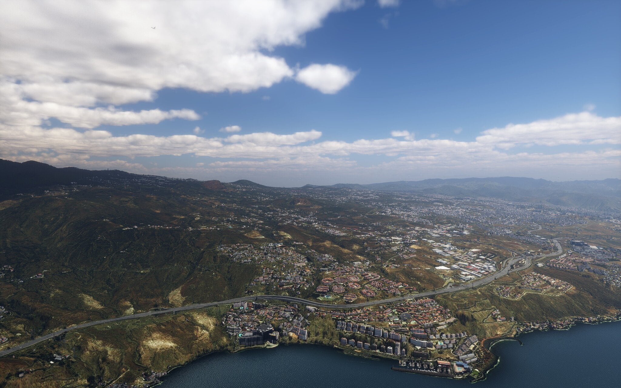
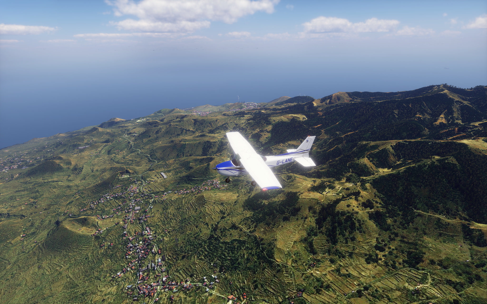
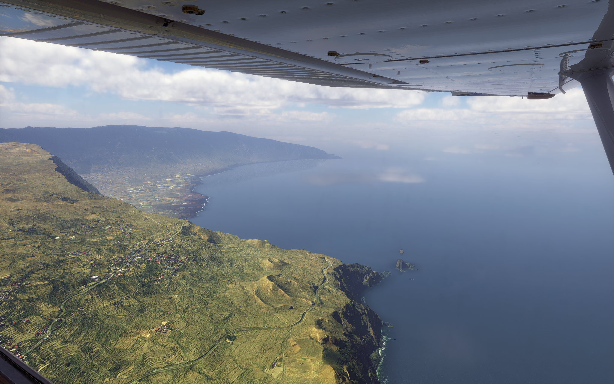
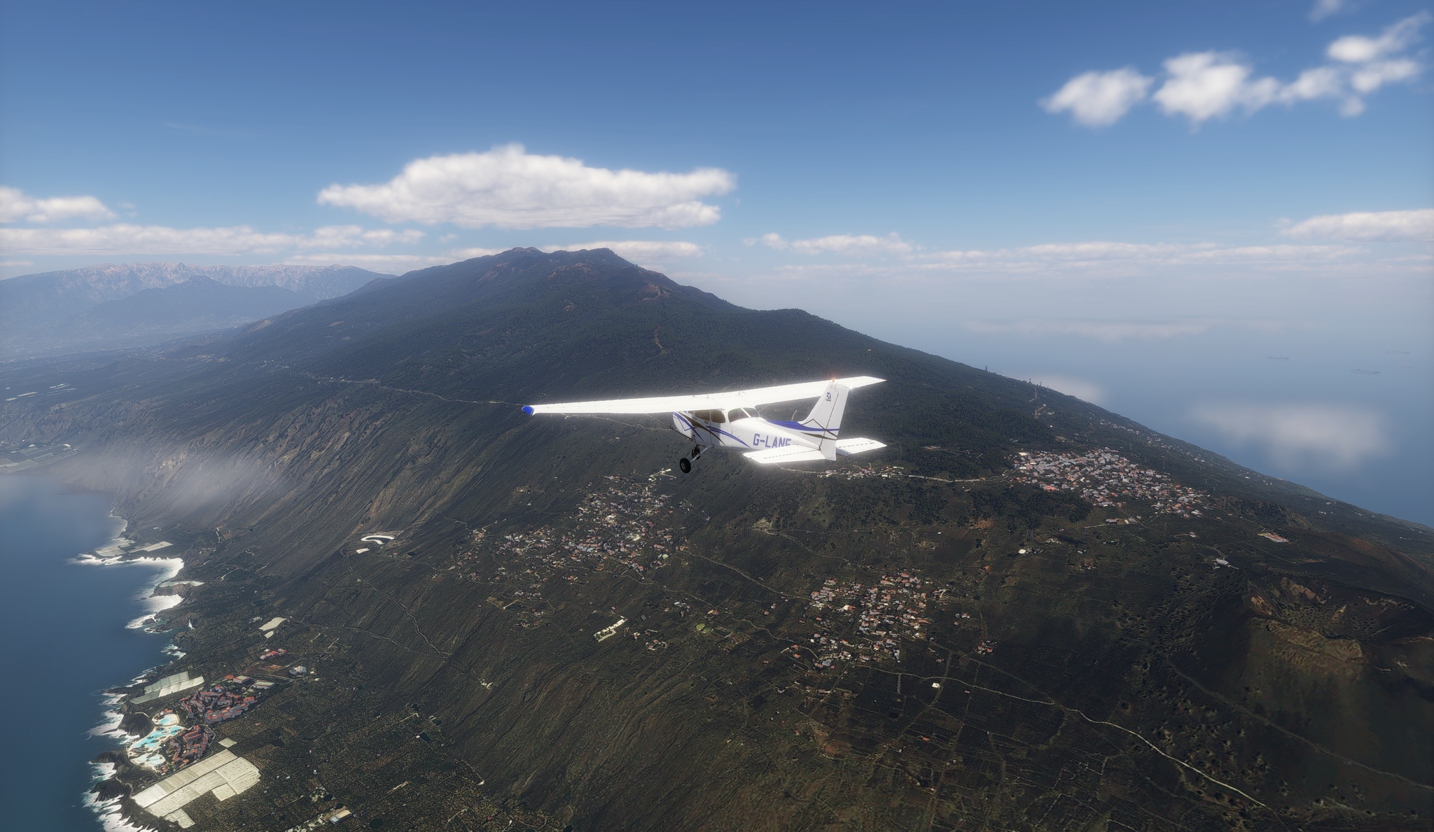
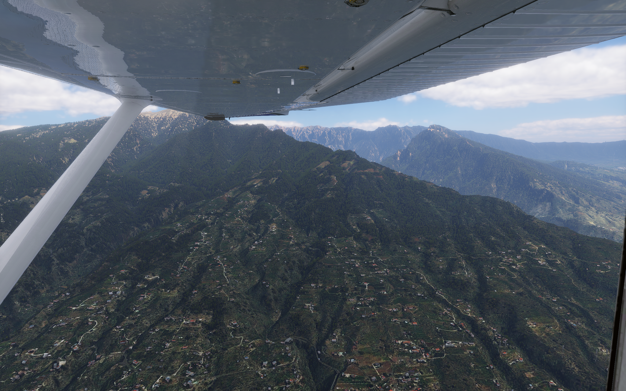
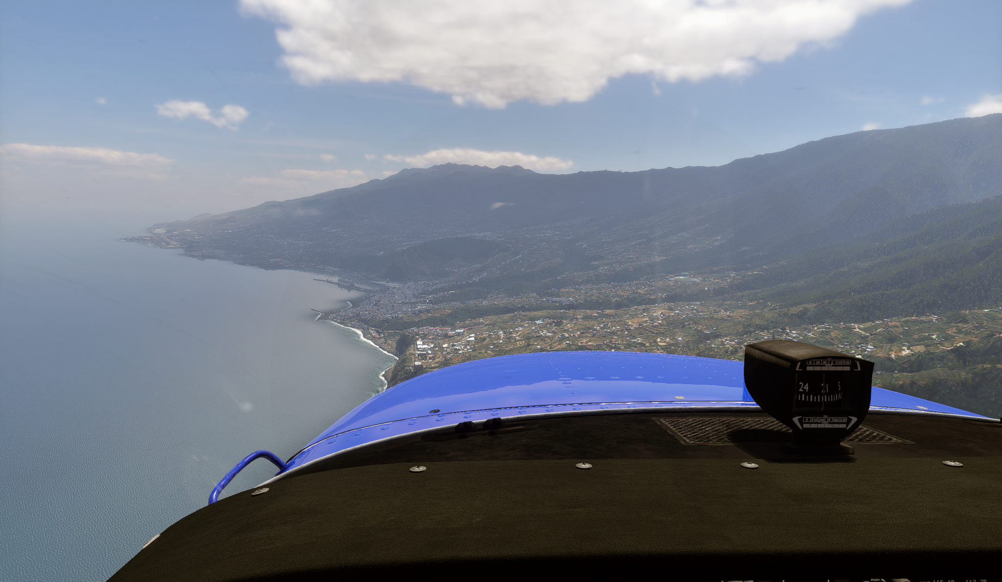
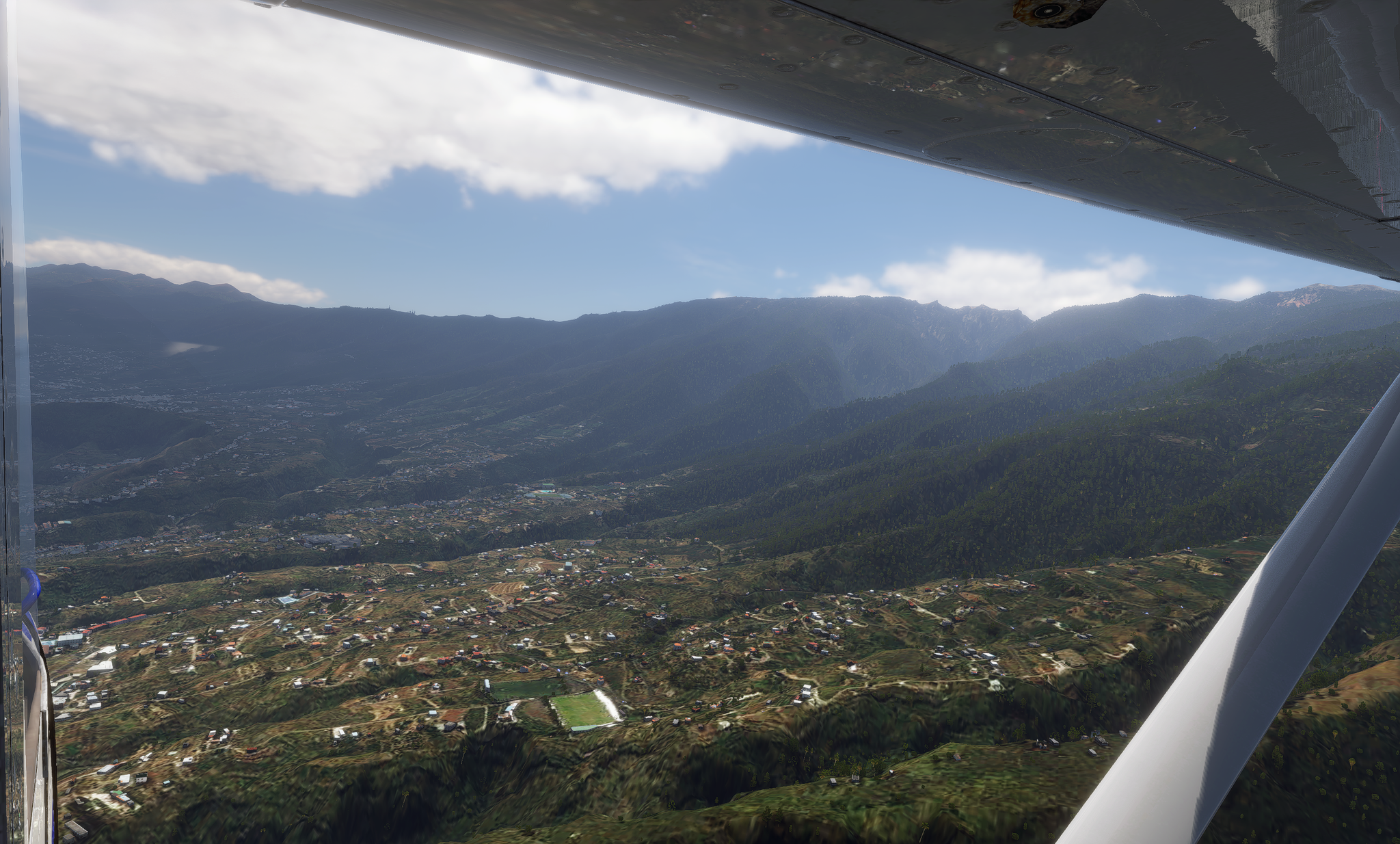
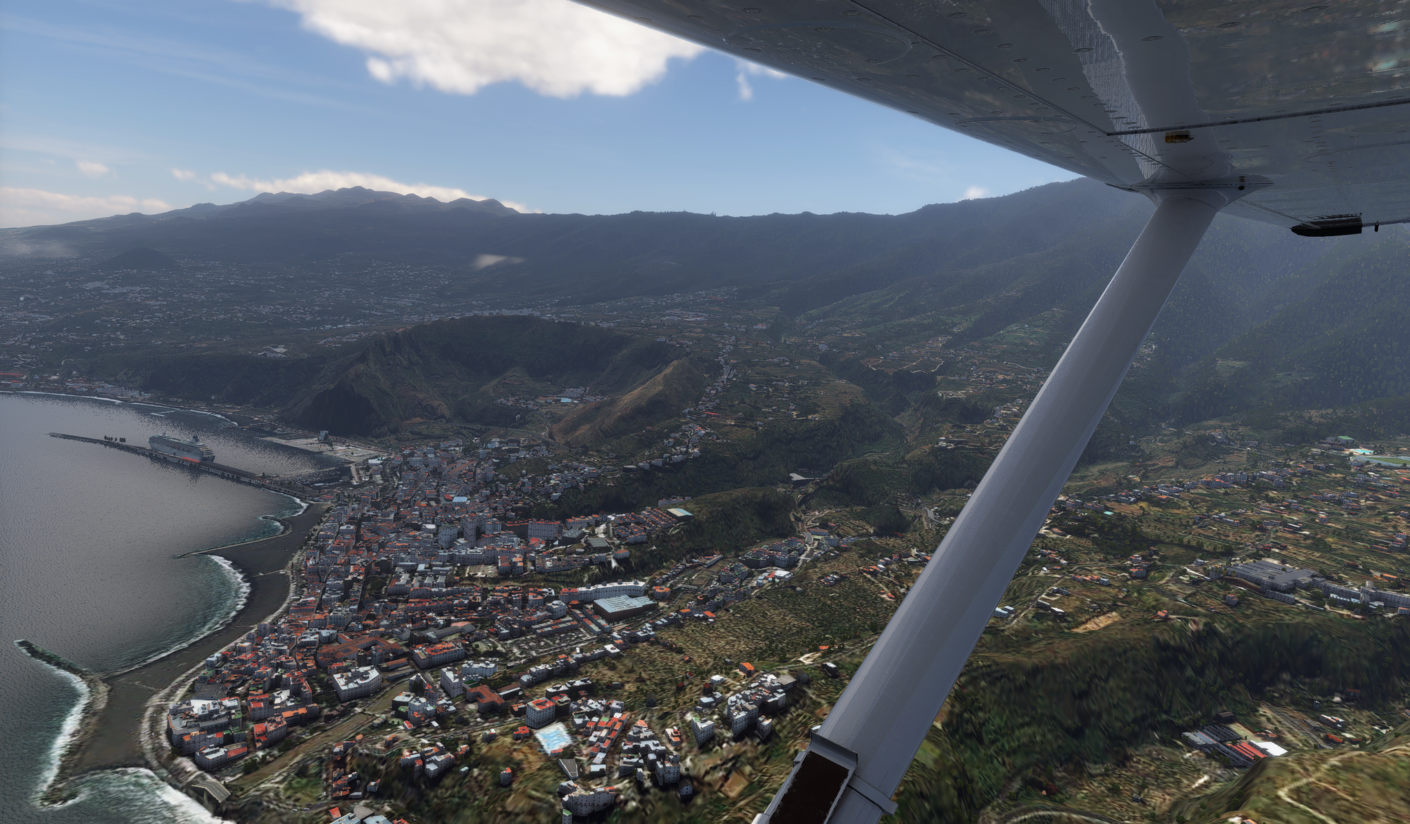
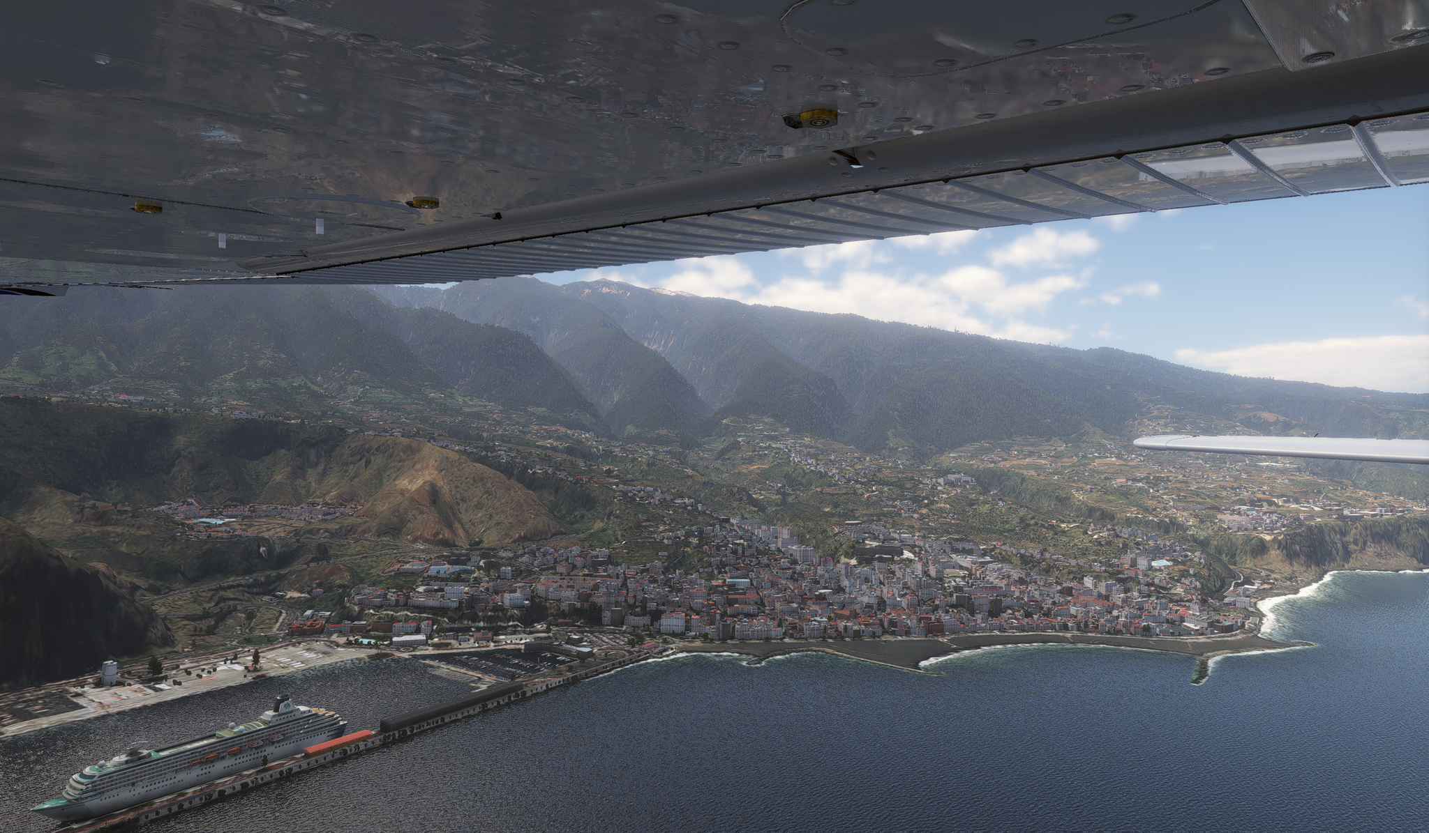
Having just come back from the Canary Islands, I had to revisit the places I've been in my trusty Cessna 172 using my WIP EU scenery. Leaving La Gomera El Hierro and then around La Palma to land at GCLA
-
It went further than that, it used AI to try and work out the style of roof as well, i.e. Flat, gabled etc. Blackshark.ai who made it eventually released the tech for other users, https://teamorlando.org/blackshark-ai-launches-globe-plugin-for-unreal-engine/


